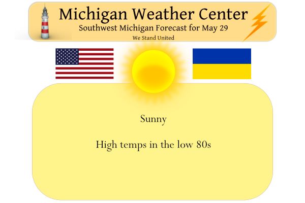
We had a high temp of 73° and a low of 48° yesterday with mostly sunny skies – doesn’t get much better than that unless you like the heat which you will get over the next three days. Today we should see high temps in the low 80s then the heat really kicks in on Monday and Tuesday when the temps rise to around 90° to usher in the unofficial start to summer. Our next chance of rain comes Tuesday night.
Friday we had 1.06 inches of rain which brought us to 4.87 inches for the month and 13.06 inches for the spring season. Below are the rainfall totals for around the area on Friday.
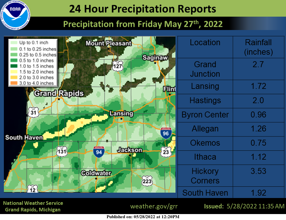
The main precipitation band was focused along a line from Lansing to South Haven. The largest amounts in Barry county which includes Hastings and Hickory corners
Forecast Discussion
--Dry and very warm through Tuesday afternoon--

Broad low-level warm advection is underway across the region in
response to a deepening surface low in the central plains. This warm
advection will contribute to mid/upper-level height rises today,
with global models remaining consistent in signaling the
amplification of a mid/upper ridge over eastern North America
through Tue.

Warm, dry, and somewhat breezy conditions are in store for today
through Tue. Surface dewpoints are expected to approach 60F
today, the low 60s on Mon, and perhaps the mid 60s on Tue. While
this is not particularly humid--and heat indices will likely
remain just a few degrees above ambient temps--Mon and Tue will
feel hot nonetheless. Highs in the mid 80s to near 90 are expected
away from Lake Michigan. For reference, normal highs for May 31
are 75F at Grand Rapids and Lansing and 74F at Muskegon.

--Next chance of showers/thunderstorms on Tue evening--

A second, more vigorous lee cyclone will emerge into the plains on
Mon. This low is expected to reach the vicinity of northern MN by
12z Tue, then evolve into a vertically stacked, post-mature
cyclone over Manitoba/Ontario by Wed night. Recent deterministic
and ensemble guidance has trended somewhat faster with the
progression of the associated surface cold front. By 00z Wed, the
ECMWF depicts this front extending from central Lake Superior, to
near Milwaukee, to near the Quad Cities.

Ahead of this front, forecast profiles indicate that moderate
instability (MLCAPE of 1500-2000 J/kg) should develop by late Tue
afternoon. Modest midlevel height falls may facilitate isolated
thunderstorm development ahead of the cold front by late Tue
afternoon into Tue evening. If this occurs, effective bulk shear
of 30-35 kts may support organized, surface-based convection.
However, it is plausible that convection may not arrive until
later Tue evening/night--coincident with the front itself--with
storms perhaps partially/fully elevated above a stabilizing
boundary later.

--Continued rain chances for Wed and Thu--

The frontal boundary is expected to stall over the OH Valley on Wed.
Rain coverage/amounts on Wed may be limited in the absence of
pronounced forcing for ascent, but will maintain chance PoPs, mainly
over the southern CWA.

On Wed night/Thu, EPS and GEFS means both depict a frontal wave
propagating along the baroclinic zone. The EPS mean exhibits a
higher amplitude shortwave impulse aloft and is correspondingly
wetter than the GEFS mean. Will maintain chance PoPs across the CWA
(highest south) for these periods.

--Drying Fri into Sat--

The aforementioned vertically stacked low is expected to meander
toward central Ontario by Sat night. Ensemble guidance suggests that
surface high pressure should build into the region on Fri, likely
providing drier, more settled, and seasonably cool conditions into
at least part of Sat. Another system may bring rain for Sat
afternoon and beyond.
Now while it very well could change the latest CFSv2 long range guess continues to show below average temperatures up to June 25th There is also a trend for it to become dryer so if that long range guess plays out then dryer and below average temperatures would be in play for most of June. So far this year at Grand Rapids January was -4.0. February was -2.0. March was +0.5. April was -4.0. May will end up above average. So the bottom line at Grand Rapids is 3 months below average one month near average and one above average.… Read more »
Considering the trend over the past few years, it will be surprising if this year ends up below average.
Enjoy the next three days of summer, because then we revert right back to
our long and persistent below normal temp pattern that we have been in all year! Absolutely incredible!
It will be very warm to hot the next 3 days and then it will cool down what the NWS has ” seasonably cool conditions” so it could be below average with highs in the upper 60’s to low 70’s low in the lower 50’s maybe some upper 40’s.
Slim
Here is the radar loop from May 29, 2011
https://m.youtube.com/watch?v=LkiUQLivBlw
11 years ago today we had severe storms roll through parts of the area. This complex of storms produced widespread straight line wind damage and 3 reported tornadoes. One in Shiawassee County and the others were down south of I-94. Battle Creek was hammered with some pretty significant damage. The wind damage continued northeast to the Lansing area. I remember watching Storm team 8 covering the severe thunderstorm warnings that day.
Thanks for the information. That line of storms must have been with a warm front as the temperatures jumped into the upper 80’s the next couple of days after.
Slim
The official H/L at Grand Rapids yesterday was 73/49. There was 74% of possible sunshine. There was no rain fall. The overnight low here at my house was 55 and the current temperature is 58 with a few clouds. The average H/L for today is 74/53. The record high for today is 94 set in 2018 and the record low is 32 set in 1966. Last year the H/L was 67/37. So it can get very warm and or very cold yet at this time of the year. Today will be the start of a expected 3 day warm up… Read more »
Just went for a walk with my dog. Feels like a July morning… I can already tell today is going to be very warm
Yesterday was my favorite weather (low 70s, strong May sun, no wind).
NWS shows highs around 70 Thursday through Saturday. Our local TV met shows mid 70s. Either way, it’s within several degrees of average.
My ideal temperature range is 82-89 degrees.
The 30 year average H/L at Grand Rapids for June 2nd is 75.6/54.6 and for June 4 it is 76.3/55.1 it is about the same for Lansing. How will the the week play out? It is easier to point out trends then to try pick a number say 72 for a high on next Saturday. Next week after Wednesday looks to be cooler than average but not cold. If your local TV people are correct than it would just above average.
Slim