Welcome to Super Bowl Sunday! Super Bowl LVII will feature the American football championship game of the National Football League for the 2022 season. It will be played between the American Football Conference champion Kansas City Chiefs and the National Football Conference champion Philadelphia Eagles, kickoff will be at 6:30. Who will win? For me, I believe it will be a close game with the Chiefs winning if Mahomes can stay healthy against the Eagle’s defense.
NWS Super Computers
The National Weather Service uses supercomputers around the clock to accurately produce forecasts, watches, warnings and a whole host of data for the public. These computers run sophisticated numerical models (computer programs) of the atmosphere, ocean, and even in space, which is used by NWS forecasters, the private sector, universities, and the public to help create accurate forecasts, support research and inform the public.

NWS supercomputers hold numerical modeling data for weather forecasting models.
These computers make use of virtually all observational data that the NWS collects. This data comes from satellites, weather balloons, buoys, radar, and more. From this data, the supercomputers are able to help predict every kind of weather hazard imaginable, including hurricanes, tornadoes, extreme heat, and even space weather.
In addition to helping the NWS forecast the weather, the computers’ data is also made available worldwide, which can help other countries predict their weather as well.
The NWS has been using supercomputers for decades. The latest major update to the computers was in 2018. Currently, the combined processing power of NWS supercomputers is 8.4 petaflops, which is more than 10,000 times faster than the average desktop computer. The supercomputers are housed in two primary centers, in Reston, Virginia, and Orlando, Florida. Each location features two rows of computers working in tandem, each 40 feet long.
The NWS supercomputers are one of the most powerful weather-predicting systems in the world. For more info: https://www.nco.ncep.noaa.gov/
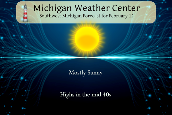
Grand Rapids Forecast
2 12 grrLansing Forecast
2 12 lanKalamazoo Forecast
2 12 kzoForecast Discussion
-- Dry and mild through early Tuesday --

We continue to expect dry conditions and mild temperatures to hold
through early Tuesday.

We expect today to be another day with a good deal of sunshine close
to Saturday. There will be some high clouds that float over the area
late in the day, but they will only filter out a little bit of the
sunshine. Today will also be a little less windy as the gradient
from yesterday has moved out.

There is still a fairly robust mid level short wave and associated
sfc front that is expected to move through on Monday. The chance for
a few sprinkles has trended down if anything over the last 24 hours.
This is because the models all continue to trend drier with the
moisture coming in.

The moisture initially will only be some high moisture, and then
just a little moisture pooling along the front as it moves through.
All of the mid level moisture is forecast to stay north of the area,
and come in and out before the low level moisture arrives. The front
looks to be mostly east of the forecast area by 18z Mon. After that,
we will only see some high clouds move back in on Tuesday morning
after some initial sunshine first thing Tuesday.

-- Rain likely Tuesday afternoon into Wednesday morning --

The Tuesday system looks fairly straightforward with little change
in the sensible weather and little impact expected. If anything has
changed with the Tuesday system, it is that the rain may come in a
tad earlier than previously expected. We should not have any p-type
issues with this system as there is good warm advection ahead of it
with a SSW flow over the entire area as the low tracks across the
MN/WI border.

No real worries with this regards to rainfall as it will be a fairly
progressive system. Thunder chances with this system are not zero,
but sfc based and elevated lifted indices do stay just positive
through the period. The best chance if thunder were to occur would
be toward and just after midnight Tuesday night. Rain will end early
Wednesday, with some potential for southern areas to clear out
Wednesday afternoon.

-- Mixed precipitation types Thursday changing to snow --

The break in the precipitation we see Wednesday afternoon will be
short lived, as the next wave and associated precipitation will lift
to the NE quickly toward the area Thursday morning.

The Thursday system continues to be quite a bit more complicated
than the Tuesday system as it looks like that precipitation type has
a good chance at being mixed for a part of the forecast area. This
is a factor as we continue to watch a frontal boundary stall out to
our North in the wake of the Tuesday system. On the other side of
this boundary will be sufficiently colder air to change
precipitation types to a mix from rain down South.

We see the southern stream system, which will be dominant. Then you
have a northern stream wave start to phase, and you have an old
frontal boundary present to complicate precipitation type. The trend
over the last 24 hours is for the colder air and old frontal
boundary to be a little further SE. This brings the zone of the
various precipitation types a little further SE. Right now, it looks
like all precipitation types will be in play from snow to the NW,
freezing rain and sleet possible just to the NW of GR, to rain near
GR and SE.

This is the scenario now, and we will be watching the latest trends
to see where the zone of mixed precipitation ends up. With all of
the aforementioned factors in play, the details will be in a state
of minor flux until all of the features are sampled accurately.

No matter how the precipitation ends up on the front end of the
system, the colder air will filter in and change any lingering
precipitation to snow as the low moves ENE of the state late
Thursday and Thursday night. Some snow showers will linger into
Friday as a brief bout of lake effect will be possible with 850 mb
temps dropping to the negative mid teens, and the upper trough has
to move through. Any snow showers lingering over the area on Friday
will taper off as ridging builds in and temperatures aloft moderate
by Saturday.
It would be 100%better, if it is was 20 degrees with a raging snowstorm and a pending forecast of cold and snow for weeks on end!
Clear skies, light winds, and 50 degrees in mid February. I don’t think it could get any better than this. Heading out to the pickle ball courts. Crazy.
Absolutely gorgeous today! Grilling outside on Super Bowl Sunday with 50 degree temps! Just a perfect day! Just WOW!!!
Just another perfect winter ski day up at Boyne! Wow just wow! Skiing and then the Super Bowl! Incredible!
https://www.boynemountain.com/current-conditions
Wasn’t there an upgrade to the computing power last year? Is this a different system? https://www.noaa.gov/news-release/us-supercomputers-for-weather-and-climate-forecasts-get-major-bump
Breaking Weather News! No winter is not over, no we are not done with accumulating snow! No we are not done with snowstorms and no we are not done with mid winter like cold! Mark it down and get prepared now!
Super Bowl – I believe that Philly is the better team, but my money is on KC to win the game!
Wow where did winter go? It seems to have been over for awhile now.
Yep this past winter turned out to be a pretty easy one. Some decent snows here and there, but melted a few days after the snow. About 90 percent of the winter has been snow free!
Good morning! The mild February weather just continues. Yesterday the official H/L at Grand Rapids was 45/19. So far this month there have only been 2 days that have not gotten above 32 for highs. There was no rain/snow yesterday and there was 100% of possible sunshine. It did get kind of cold overnight last night as it has now dropped down to 22 here in MBY with clear skies. For today the average high/low is now up to 33/19. The record high for today is just 55 set in 1984 and the record low of -23 was set way… Read more »
“ So far this month there have only been 2 days that have not gotten above 32 for highs.”
That’s not something you expect in February.
Nice information on the NWS supper computers.
Slim
I hate to bet against Mahomes and Coach Reid, but I think I’m going with Philly. They seem to be the hottest team in the playoffs. Every aspect of their game has been firing on all cylinders.
Sunny and near 50 today. The sunniest weekend we’ve had in months. Firing up the grill!