We have another morning where the temp has fallen below 40°. Yesterday we had a high of 62° with nearly 100% sunshine after a morning low of 38.5°. We currently have 38.8° at 5:30 am.
October so far has been cloudier and wetter than normal, we have seen only about 25% of possible sunshine over the past two weeks which we will make up the first half of this week… Still, no sign of widespread frost as we head into the second half of October.
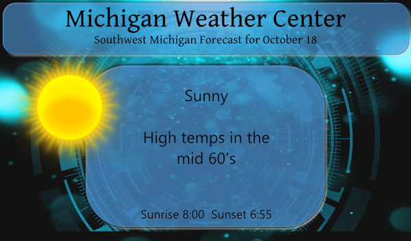
High pressure will continue to dominate today with a carbon copy of yesterday with temps rising into the mid-60s and near 70 on Tuesday and Wednesday. What more can I say? We have perfect fall weather in store…
Forecast Discussion
-Dry, sunny, warmer through Tuesday

The upper trough that provided the chilly, breezy weather over
the weekend is lifting out, with ridging now building in aloft and
at the surface. Expect lighter winds to prevail today as full
sunshine pushes temps into the upper 60s after a cold start to the
day. Continued sunny and even warmer for Tuesday with return flow
and H8 temps near 10C sending readings up to around 70.

-Showers Wednesday and Thursday

Our next weather maker is a strong Pacific system currently
coming onshore in CA which moves to the Central Plains by midweek
then across the srn GrtLks Rgn on Thursday. 35-40 kt low level
jet ahead of the approaching wave Wednesday send PWATs over one
inch into the region with showers breaking out in the afternoon.
Temps still well above normal near 70 on Wednesday in the
southerly flow.

Showers continuing Wednesday night and Thursday as the sfc low
tracks through, with highest PoPs and much of the system QPF
falling Wednesday night as the potent shortwave approaches. Can`t
rule out a few tstms on Wednesday night when MUCapes of 300-500
J/KG are progged ahead of the mid level dry slot and incoming sfc
cold front.

The deformation portion of the system impacts the area Thursday
morning with additional rain, before pulling away Thursday
afternoon and chillier air filtering in.

-Cool for the weekend

After the pacific system passes through on Thursday, another
upper low drops south from Hudson bay into the GrtLks Rgn for the
weekend. Associated H8 temps around -2C descend into the state,
leading to cooler but seasonal high in the mid 50s along with
clouds and a few lake effect rain showers.
I noticed more of the trees have started turning today. It feels like Fall.
The Lions are an embarrassment to pro sports! They should be forced to surrender and eliminate the franchise completely! Horrendous! The chance of the Lions ever making the Super Bowl is about .0001%!
I had a low of 37.0 here this morning. Frost is not far off.
Low of 39* this morning out in my area boy the 40’s went fast soon we will have highs only in the 30’s and look how short the days are getting shuuuu its the most wonderful time of the year ….INDY
Yes the pattern change has arrived! Get ready for frost and freezes this weekend! Incredible!
With clear skies the overnight low so far here has been 40. The overnight low so far at GRR is 41. Officially that is the coldest low so far this fall season the last time it has gotten this cold at GRR was on June 22 when the low was also 41. It is also the 1st time since June 21st to the 23rd that it has gotten into the 40’s 3 nights in a row. The current temperature here is that 40 with clear skies.
Slim
Our low this morning dropped to 37.9 here in the valley
It’s beginning to feel like autumn. Now, if only the grass would stop growing….