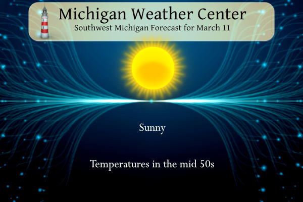
Yesterday we added .20 of an inch of snow to our meager snowfall total this year. After highs in the 30s yesterday we will return to warmer than normal temperatures today with plenty of sunshine in store. Clouds will increase starting Tuesday, eventually leading to showers and thunderstorms starting late Wednesday. Conditions will then remain wet and unsettled into the weekend.
NWS Forecast
Weather History
1948: Arctic air prevails with high temperatures in the teens and low temperatures near zero. Muskegon sets a record low of 2 degrees.
On March 11, 1946, the last snowfall of the 1946 season was recorded in Detroit and stands as the earliest date for the last snowfall in spring.
1888: The Great Blizzard of 1888 paralyzed the east coast from the Chesapeake Bay to Maine on March 11 through the 14th. The blizzard dumped as much as 55 inches of snow in some areas, and snowdrifts of 30 to 40 feet were reported. An estimated 400 people died from this blizzard. Click HERE for more information from History.com.
1917: At 3:02 pm on Sunday, March 11, 1917, many New Castle lives were changed forever. In just a few terrifying minutes, 22 people were killed, hundreds were injured, 500 homes were damaged or destroyed, and many of the city’s triumphant greenhouses were leveled in what would be part of $1 million suffered in property damage. Click HERE for more information from archive.org. Part of the same outbreak, a strong tornado caused extensive damage to the Hyde Park neighborhood in Cincinnati


1953: An F4 tornado cut an 18-mile path through Haskell and Knox counties in Texas. Seventeen people were killed, and an eight-block area of Knox City was leveled.


2011: On March 11, 2011, a 9.0 magnitude earthquake off the Pacific coast of Japan generated a tsunami. This series of ocean waves sped towards the island nation, with waves reaching 24 feet high. The result was devastation and utter destruction. Click HERE for more information from NOAA.
Forecast Discussion
- Dry and Warm through Mid-Week

Cold start to the day today following overnight radiational cooling
thanks to clear skies and low winds. Temperatures are already
into the low 20s near and north of US-10 and into the mid 20s to
low 30s southwards. Would expect temps to drop a few more degrees
prior to daybreak with lows in the 20s and even upper teens north
of US-10.

Temperatures will quickly rebound this afternoon as broad mid-
level ridging moves into the Great Lakes. Renewed southwest flow
carries warmer air in with afternoon highs reaching the mid to
upper 50s. Much of the day will be sunny but we could see some
high clouds creep in from the northwest with increasing 850mb RH.
Deepening southwest flow Tuesday and Wednesday increases moisture
and cloud cover. Temperatures jump in the 60s Tuesday and
Wednesday as the 850mb ridge with temps ranging from 5-8C moves
overhead.

- Showers and thunderstorms possible late Wednesday into Friday

It appears increasingly likely we will experience a warm front that
becomes quasistationary somewhere across our southern forecast area.
This will introduce a widespread coverage of precipitation to
southern Lower MI where the greatest threat for thunderstorms will
also be present. Ensemble guidance indicates a fairly compact spread
in QPF, generally ranging between one quarter and three quarters of
an inch through Friday. Given this limited precipitation and the
fact it will be dispensed over the course of days, we do not expect
any impacts of note with this event. Conditional instability and
shear do not look supportive of severe convection at this time, but
of course that could change as we get closer to the event. Upstream
upper flow over the western CONUS will be highly unphased during
this time thanks in part to a cutoff low over the southwest. This
will, for now, limit predictability of finer details such as the
position of the stationary front.

- Becoming colder Sunday with flurries possible

There is decent agreement among medium range ensemble guidance that
we will see broad northern stream troughing take shape and
approaching the western Great Lakes this weekend. This will produce
notably colder temperatures Sunday into Monday. Minor accumulations
of lake effect snow are not out of the question near the lakeshore
Monday morning; however, as noted previously, it is uncertain how
cold we will actually get. Ensemble 850 mb temperatures are
borderline as things stand now and a lot can change given this is a
day 7 forecast.
Get ready, we will see accumulating snow this month? You mean winter is not over? Rock n roll will never die! Bring it!
I’m in Scottsdale. No Daylight Savings here. So nice! Weather has been mid to upper 70’s and sunny everyday.
Enjoy your time there Mookie! And, CPC outlooks show near normal temps thru the end of March now! So the cold and snow wishcasts are down the tubes again! Who knew!!?!?
Note there are indications that it might turn rather cold for a while around spring equinox. So keep that in mind
Slim
What? You mean it is still winter and we may see some more cold and snow? How is that possible?
I was watching video on you tube talking about it. Looks like quite a cold snap. All the way to TX.
The official H/L yesterday at Grand Rapids was 39/29 there was a trace of snowfall. The sun was out 30% of the time the highest wind gust was 36 MPH out of the NW. For today the average H/L is 42/25 the record high of 71 was set in 1973 and 1971 the record low of 1 was set in 1895. The most rainfall of 0.80” fell in 2010 the most snowfall was 6.7” in 1950 the most on the ground was 13” in 2014. Last year the H/L was 38/22 and there was 2” of snow on the ground.
Slim
It is much colder here in MBY then the official reading at the airport. At GRR it is 31 while here in my yard I only have 22.
Slim