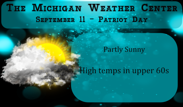
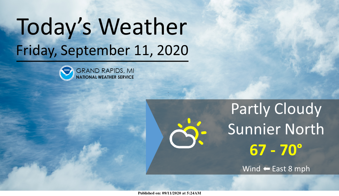
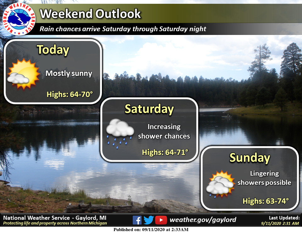
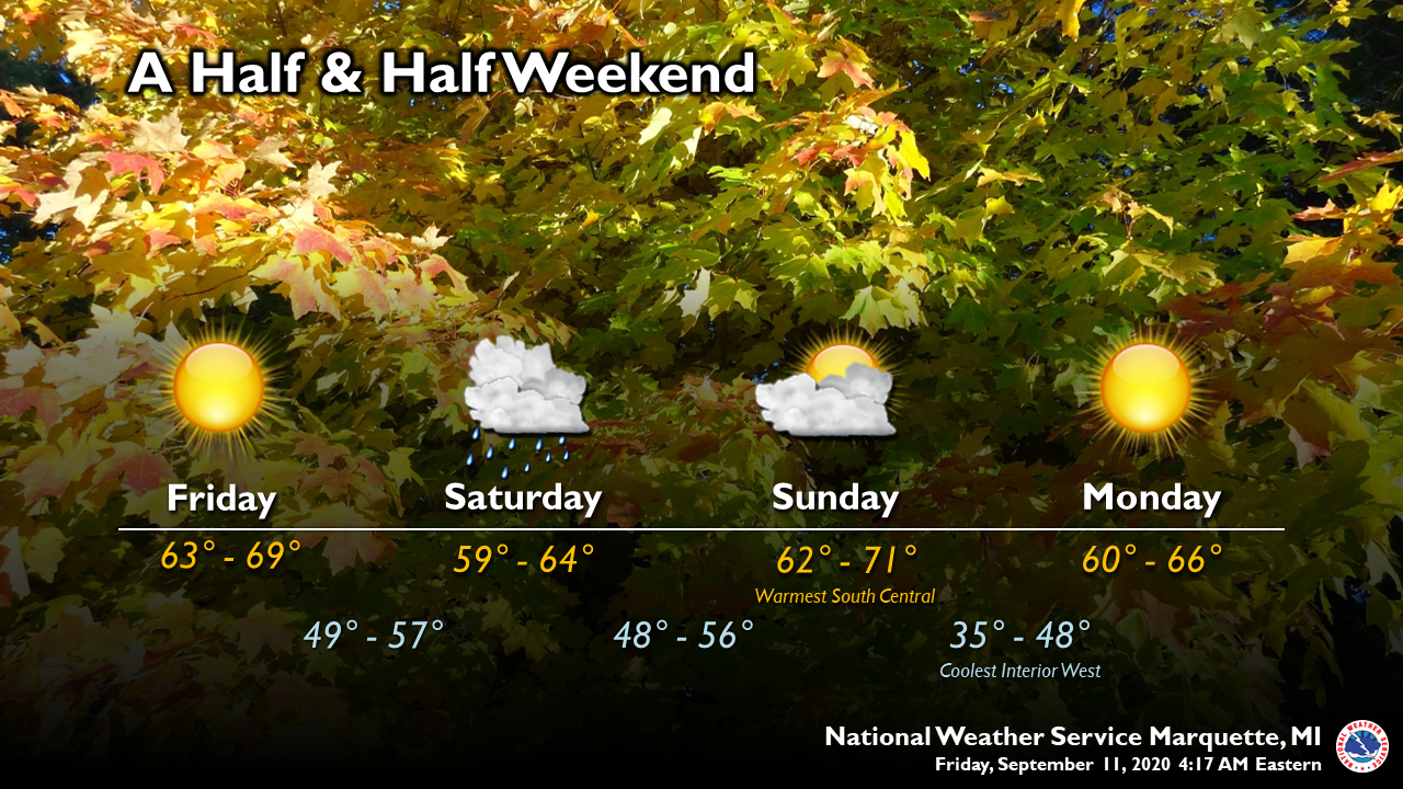
As the headline states the sun will make a brief return today before the clouds roll back in for tonight. This has been a grim reminder of the cloudy days we have during the winter rather than seeing the sun. We barely broke 60° once again yesterday which gave us three days in a row of 60 or below.
Today is the anniversary of the September 11th attacks on the world trade center and the Pentagon. My first grandchild was one year old. I remember the confusion, anger and sadness of that day; air travel was shut down for several days as the whole mess was sorted out. This year we have Covid-19, the Black Lives Matter movement, the fires out west which will also go down into the historical record as we question our mortality. Today we pause to consider we are each individuals in a large world of several billion other souls, many who suffer both in past and present issues. Many live in a bubble of their own condition without looking outwards to their fellow citizens who share the same space with them. Each person has issues great and small. Whenever I feel I am suffering I look outward to see there are people with greater issues than I and count myself as blessed.
[columns] [span6]
SW
[/span6][span6]
SE
[/span6][/columns]
[columns] [span6]
North
[/span6][span6]
U.P.
[/span6][/columns]
Forecast Discussion
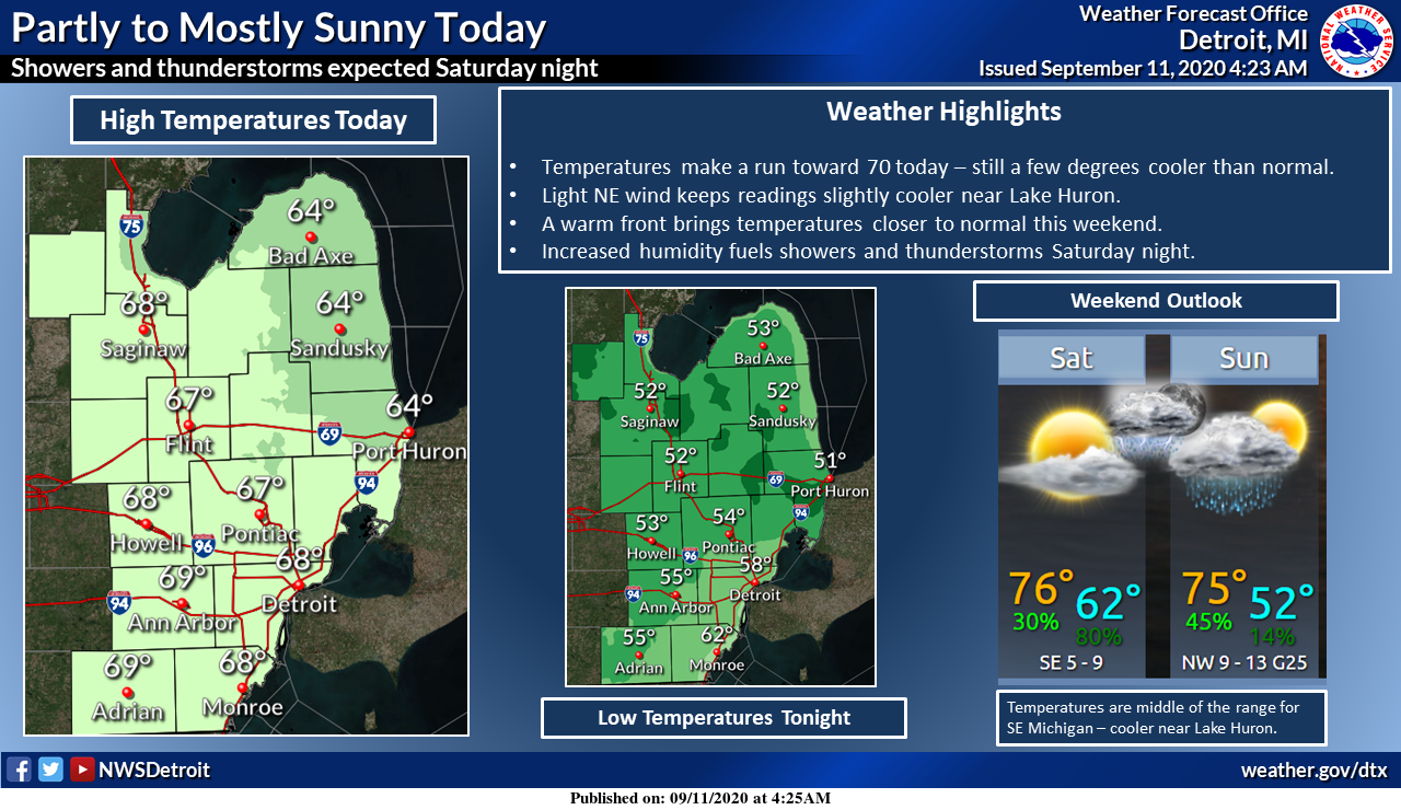
-- Chance for rain has increased tonight into Saturday --

Models have increased chances for rain tonight into Saturday
morning across portions of West Central Lower Michigan. A lead
shortwave will approach the area tonight and move into Southwest
Lower Michigan Saturday morning. There will still be some dry air
in the lower levels so we are not expecting significant rainfall.
Best chances for rainfall with this initial shortwave will be up
towards Ludington.

-- Chance for showers/thunderstorms Saturday night with front --

The main shortwave, which is currently an upper low over
Colorado/Wyoming, will move into the area Saturday night. The
upper system will drive a cold front through the region as well.
So, the deepest moisture and strongest forcing will occur Saturday
night. Instability has become a bit stronger in the latest model
runs as compared to last night. 850mb LI`s now dip to -2 to -3C
with MUCAPE values nosing to around 1,000 j/kg. The highest
instability occurs Saturday evening. Not expecting widespread
thunderstorms, but more of a general area of rain showers with
some embedded storms. The strongest winds seem to lag the front
just a bit so not sure we how much of a severe threat we have.

-- Dry early next week with rain chances again mid week --

High pressure builds into the area early next week which should
provide dry days on Monday and Tuesday. There is disparity between
the GFS and ECMWF with a system mid next week. The GFS is weaker
and quicker with a mid week wave, while the ECMWF is slower and
stronger. Would tend to side with the ECMWF here given a fairly
active pattern. Overall temperatures through the entire period
look to be near seasonal norms.
MV I like what you wrote – the last sentence.
Here is a video on 9/11. I had never seen this one before and it is worth taking the time to watch it.
https://www.youtube.com/watch?v=MDOrzF7B2Kg
Can’t believe it’s been 19 years. Seems like yesterday. 🙁
Not posting today but remembering
9/11/2001!!! God bless America…INDY
First off a moment of silence for 9/11……………………………………….Here at my house I recorded 0.03″ of rain since 7 AM yesterday. One of the difference of opinion I have with CoCoraHS is the timing of the reports. While the NWS has their daily reports take at midnight CoCoraHS has the daily reports starting at 7 AM and thus reports do not match up. I know may who report on CoCoraHS are farmers and they do not stay up to midnight but just a point I would like to make. At this time there is a strange fire ball rising to the… Read more »