We reached 52° yesterday after a morning low of 33°. A slow warm-up is expected through early next week with high temperatures reaching the 60s. Some rain is possible over the weekend, especially Saturday night. With dry air in place and breezy conditions today our fire risk increases especially in places like woodlots and forests with a lot of dry leaves and sticks on the ground. I am surrounded by woods so I can vouch for that. I have heard however that morel mushrooms have been found around the area so if you like that fungus (like I do) now is the time to look for them.
Hazardous Weather Outlook
.DAY ONE...Today and Tonight

Dry air will increase the risk for small fires to spread out of
control amid dry vegetation today and Saturday.

.DAYS TWO THROUGH SEVEN...Saturday through Thursday

Scattered thunderstorms will likely develop Saturday evening into
the night. There is a marginal (low but not zero) probability for
a thunderstorm to produce locally large hail or damaging wind
gusts in Southwest Michigan. Thunderstorms are also possible on
Tuesday.

.SPOTTER INFORMATION STATEMENT...

Spotter activation is possible Saturday evening. Spotters are
always encouraged to report local severe weather to the National
Weather Service via amateur radio networks, phone, or social
media.
Forecast Discussion
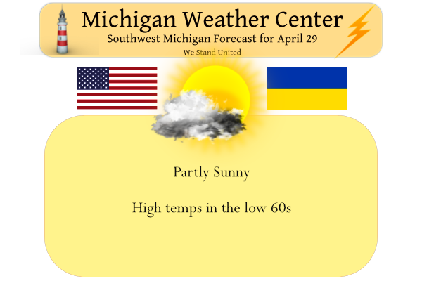
-- Dry Spring Day --

An amplifying upper level ridge and surface high will control our
weather today, providing us with dry low-level air and a light
east-southeast breeze. Slow-drifting mid-level cloud decks will
be present, though there are a fair number of areas with clearer
skies presently on satellite. Given enough sunshine, high
temperatures nudging into the lower 60s would be pretty close to
normal for this time of year. Given the very dry air in place,
fire weather concerns are increasing today and for some areas on
Saturday (described in further detail in the Fire Weather
section).

-- Weekend --

A large and occluding low over the central Missouri river basin on
Saturday will increasingly affect us on Saturday as the upper-
level ridge axis slowly translates through and east of Michigan.
Increasing mid-level moisture advecting in from the southwest will
make it increasingly cloudy, and rain showers from these mid-level
cloud decks may make it through the dry air beneath in areas more
south and west. The daytime probably won`t be a washout, though it
will be quite breezy with 25 to 35 mph gusts. By evening,
thunderstorms are possible beginning in southwest Lower Michigan
as the low-level jet ramps up. Depending mostly on the lapse
rates above the best moisture transport, enough instability may be
present for hail, though the threat presently seems marginal. If
the storms arrive early enough in the evening, the surface may
also be marginally unstable enough for locally strong wind gusts
to mix down with any storms. Rainfall amounts through the night will
likely be variable over the area due to the mode of convection,
though local amounts over 1 inch seem plausible.

-- Next Week --

Ensembles appear to be in good agreement regarding the shift
toward a more progressive wave pattern early next week, with a
shortwave trough and associated surface low moving through on
Tuesday. Rain is likely on Tuesday, though with some question
whether it will be from the deformation zone or in warm sector
via cold front. The temperature forecast for Tuesday would also
largely depend on the track of the low, as would the potential for
severe thunderstorms.

The evolution of the wave pattern mid to late week becomes more
uncertain, though may trend toward being quite meridional with
transient blocks in the flow developing. There is some ensemble
support for another chance of rain between late Thursday and
Saturday.
When will it ever hit 70 degrees again?
64 here with lots of sun. My kind of spring day. My son and I dusted off our clubs and we have a teetime tomorrow morning.
You actually like golfing when it is cloudy, 50 degrees and 20 to 30 mph winds? Wind chills well down into the 40’s! No thank you!
Yesterday was another of many double digit below normal temp days In West MI! Incredible cold pattern we are in!
I would Imagine a 3rd of the month of April will end up below average wow to the wow such a cold Spring we are having….Is it May yet?? InDY
Currently 48 degrees outside in my area chalk up yet another below average normal day in April we grown old to this over the years enjoy ..InDY
Actually, a pretty average day today
If clouds and cool weather upset you so much, move! Newsflash: Grand Rapids is one the cloudiest cities in the country and seems to be consistently colder than other major cities in Southern Lower Michigan lately. Grand Rapids is also windy because it’s so close to Lake Michigan. I think it’s funny how people expect April in West Michigan to be Florida now with nothing but consistent above average temps. We’re talking about a few degrees below average for the month after a warm March. We are still below average snow for April after a weak winter – and we’ve… Read more »
Not sure who you are talking about all the people? But this is a great post with the name Mookiee on it mr or mises blow torch in March remember? April in Michigan is such a transition month usually on the cool side nothing new I always consider real warmth happens in May but this year like previous years may not happen…. Thats fine wirh me I love the cool side of things and Im not moving anytime soon sorry …InDY
Once winter is over let’s see some sun and warm temps without 30mph winds! Incredible!
Lol what a load of crap!
In the state of Michigan Grand Rapids is the 2nd cloudiest location on average Grand Rapids has around 64 sunny days and around 96 partly cloudy days and around 205 cloudy days. The cloudiest location in Michigan is Sault Ste Marie with around 66 sunny days 90 partly cloudy days and 209 cloudy days. Detroit is the sunniest location in Michigan 75 sunny days 105 partly cloudy days and 185 cloudy days. As for the temperature Detroit is on average the warmest location in Michigan then Kalamazoo and in 3rd place is Grand Rapids in southern lower Michigan the coldest… Read more »
I have lots of yard work to do Im having a big party Saturday May 14th the fire will be burning hot in this cold Spring we are enjoying love it …..InDY
We are at the point of the season where even 10 degrees below average is pretty nice- mid 50s. With the strong sun a high of 55 is not too bad
On Rocky’s point below- yes wind makes things feel cooler. On a windy day increase my threshold to 60+ 😀
You’ve got it. On a windy day give me temps in the low to mid 70’s!
25 MPH wind gusts today and near 40 MPH tomorrow! Horrendous!
That wind will make it feel rather cold even if it makes it into the 60’s
Slim
It is almost May and we have only had one day with temps 70 degrees or higher! That is unheard of and no 70’s are even in sight! Wow, just wow!
Calling today sunny is a stretch! We will be seeing more clouds, than sun today and tomorrow will be worse! Saturday will feature colder temps, more clouds and more wind and then rain chances by evening! We are in a horrendous weather pattern, so get used to it! So if you are planning to golf yes today will be far better than Saturday! Then a lot of high temps in the 50’s next week, which is well below normal! So all in all horrible a weather pattern! Face the facts!
It’s been very sunny here all morning. We’re farther away from the big lake, though.
Right now we have PARTIAL sun!
Today looks like an even better day than yesterday. I went golfing yesterday and it was awesome. Very little wind and warmer temps.
It’s pretty nice going to the beach with 82 degrees and sunny on Saturday and seeing kids swim and then golfing Thursday evening. And it’s only April! Hoping to take advantage of sunny and 60’s today and do a sunset kayak tonight!
Yes so Summer like outside lol….InDY
Rock on Indy! He is delusional?
While yesterday was warmer then Tuesday and Wednesday with a official high/low of 54/28 it was still well below average. The average high is now 64 for today and tomorrow and then the mid to upper 61’s for the first week of May. After a brief warm up it now looks to fall below average for the start of May. In April 20 of the first 28 days have been below average. At the current time there are some broken clouds here and it is 45 the last reading at GRR was 43.
Slim
If you like clouds, wind and temps in the 50’s to maybe the lower 60’s, then you should be in Heaven over the next few weeks! Enjoy these below normal temps and clouds! Ridiculous!
Weather Channels May Outlook Blue for Michigan our cold Spring looks to continue according to the TWC! Wow InDY
Yes, May looks brutal! Not much sun and below normal temps most of the month! So much for thenblow torch and all of the above normal temps some on here have been promising since February! Wow and Absolutely incredible!