The SW Michian weather history has this for August 17.
August 17
1988: It is the last hot day of the hot and dry summer of 1988. Record highs were set at Grand Rapids with 98 degrees, Lansing with 95, and Muskegon with 93. Thirteen of the first seventeen days of August had highs over 90 degrees at Grand Rapids, but none after today. The transition to cooler weather is marked by severe thunderstorms that bring large hail and damaging winds during the late afternoon and evening.
Even though it was 25 years ago I still remember the early evening of August 17th 1988. The summer of 1988 was indeed a very hot one. While the mean temperatures for June 68.5° July 74.6° and August 73.4° were not the hottest for any of those months the highest readings of 98°for June, 100° for July and 98° for August were very hot. June was very dry with just 0.25” at Grand Rapids July and August were wetter. That summer had a total of 37 days of 90 or better. That 37 days of 90 or better is the record at Grand Rapids. With May having 1, June having 10 and July and August having 13 each. This year so far there have only been 8 so far at Grand Rapids. 1988 had 11 days when the temperature did not drop below 70° So far this year there has been 1 such day. While June and July had many days with highs in the 90’s or better with low dew points the lows fell into the 60’s, 50’s and even the 40’s. But it was the first 17 days of August that the heat poured on. From August 1st to the 17th there were 13 days of 90 or better. From the 11th to the 17th there were 7 day in a row of 90 or better. For the month there were 2 days of 98, 1 day of 97, 3 days of 95, 3 days of 93 and 4 days of 91. The month also had 9 days of lows of 70 or above with 1 at 76, 1 at 75, 1 at 74, 1 at 73. 4 at 72 and 1 at 70. Remember that was in the first 17 days.
The on August 17th the day was hot and humid. We only had a window air conditioning at that time. The official high for the day was 98. I had 101 at my house. During the day a line of storms formed over the UP. That line sank slowly south during the day. The was a east west line. It did not reach Grand Rapids in after sunset. We had a picnic table in the back yard and I watched the storms come in from the north they did not reach GR until after 9PM there was steady lightning for over 3 hours to the north. After the storms it did not get any warmer than 81 for the rest of August and the high was only 80 in September. For one of the biggest weather pattern changes we have seen. The big takeaway is that 1988 had a record number of days of 90 or better and that ended on August 17th
The official H/L yesterday at Grand Rapids was 74/54 there was no rain fall. There was 1 Heating Degree Day and for the month of August there have been 3 HDD’s average for August is 0 for a departure of +3. There were 0 Cooling Degree Days so far this month there have been 91 that is a departure of -37. There was 84% of possible sunshine yesterday. The highest wind speed of 28 MPH was out of the NW. For today the average H/L is 81/61 the record high of 98 was set in 1955 and the record low of 43 was set in 1977. The record rain fall amount of 4.22” fell in 1939 that is the record rain fall for any day at Grand Rapids. Last year the H/L was 83/58 and there was a trace of rain fall.
AREA FORECAST DISCUSSION
NATIONAL WEATHER SERVICE GRAND RAPIDS MI
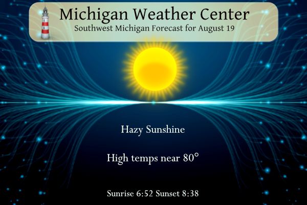
313 AM EDT SAT AUG 19 2023
LATEST UPDATE…
SHORT TERM/LONG TERM/MARINE
SHORT TERM
(TODAY THROUGH SUNDAY)
ISSUED AT 312 AM EDT SAT AUG 19 2023
FORECAST CONCERNS REMAIN MINIMAL THROUGH THE SHORT TERM. AFTER A
REFRESHINGLY COOL START TO THE MORNING WHERE TEMPERATURES ARE IN
THE 40S IN MANY SPOTS, WE’LL SEE HIGHS IN THE UPPER 70S. MOSTLY
SUNNY SKIES ARE EXPECTED TODAY. HOWEVER, LATER RAP SMOKE GUIDANCE
POINTS TOWARD HIGH LEVEL SMOKE OVER THE REGION THIS MORNING AND
MOVING EASTWARD DURING THE AFTERNOON. THERE APPEARS TO BE LITTLE
SUPPORT FOR SMOKE NEAR THE SURFACE.
WE’LL SEE A NOTICEABLE CHANGE IN HUMIDITY TONIGHT AND ESPECIALLY
SUNDAY AS DEWPOINTS ARE PROGD TO SURGE INTO THE LOWER TO MID 70S.
WHEN COMBINED WITH AMBIENT TEMPERATURES IN THE MID 80S, HEAT
INDICES WILL CLIMB INTO THE UPPER 90S.
LONG TERM
(SUNDAY NIGHT THROUGH FRIDAY)
ISSUED AT 312 AM EDT SAT AUG 19 2023
THERE CONTINUES TO BE FAIRLY HIGH CONFIDENCE REGARDING THE LARGE
SCALE PATTERN IN THE LONG TERM, THAT A LARGE RIDGE WILL DOMINATE
ACROSS MUCH OF THE COUNTRY. THERE IS EVEN GOOD CONFIDENCE THAT WE
WILL START OUT THE PERIOD DRY, AND GET INTO A MORE UNSETTLED PATTERN
BEGINNING AROUND TUESDAY. THE DEVIL IS IN THE DETAILS HOWEVER, AS
INDIVIDUAL WAVES START MOVING THROUGH THE AREA LATER TUESDAY, WITH
TIMING AND EXACT TRACK A BIT UNCERTAIN.
THE RIDGE WILL REMAIN INTACT OVER THE AREA FOR SUNDAY NIGHT INTO
EARLY TUESDAY. WE WILL SEE SOME SLIGHTLY COOLER AND MUCH DRIER AIR
MOVE INTO THE AREA BEHIND THE BACKDOOR FRONT DROPPING THROUGH IN THE
SHORT TERM. 850 MB TEMPS WILL STILL BE AROUND 20C, BUT THE FLOW FROM
THE EAST, AND THE SHALLOW COOLER AIR WILL PREVENT TEMPS FROM GETTING
TOO WARM. THE WARMER TEMPS ALOFT WILL CONTINUE TO CAP THE
ATMOSPHERE, ALONG WITH THE FACT THAT THE SHORT WAVE ENERGY WILL STAY
MAINLY NORTH OF THE AREA CLOSER TO THE UPPER JET CORE.
IT SEEMS THAT THERE IS GOOD AGREEMENT THAT HEIGHTS WILL START TO
SLOWLY DROP A BIT ON TUESDAY. THE IMPORTANCE THIS HAS ON THE
FORECAST IS THAT THE TEMPS ALOFT WILL NOT CAP THE ATMOSPHERE AS
MUCH, AND THE JET WILL DROP DOWN AND ALLOW SHORT WAVES TO BE A BIT
CLOSER TO THE AREA. AS MENTIONED IN THE PREVIOUS DISCUSSION, WE
COULD SEE MULTIPLE WAVES OF POTENTIAL SHOWERS/STORMS BEING ON THE
EDGE OF THE HEAT DOME UNDER THE “RING OF FIRE” FROM LATE TUE THROUGH
FRI. THIS IS WHERE THE UNCERTAINTY LIES.
IT DOES LOOK LIKE THAT ONE OF THE PACIFIC WAVES WILL BE STRONG
ENOUGH AND RIDE OVER THE RIDGE. IT DOES SO AS THE WHOLE PATTERN
RETROGRADES A BIT, AND WE SEE TROUGHING ALOFT RETURN OVER THE AREA.
THIS WILL BRING BACK MUCH COOLER WEATHER AROUND NEXT WEEKEND
Detailed Forecast for Grand Rapids
TodaySunny, with a high near 79. Light south wind becoming southwest 6 to 11 mph in the morning.
TonightMostly clear, with a low around 65. South wind 8 to 10 mph.
SundaySunny, with a high near 86. South southwest wind 6 to 10 mph.
Sunday NightPartly cloudy, with a low around 62. Northwest wind 7 to 10 mph becoming north northeast after midnight.
MondayPartly sunny, with a high near 82. East northeast wind around 10 mph.
Monday NightMostly cloudy, with a low around 62.
TuesdayPartly sunny, with a high near 79.
Tuesday NightPartly cloudy, with a low around 63.
Detailed Forecast For Lansing
TodaySunny, with a high near 79. Calm wind becoming southwest 5 to 9 mph in the afternoon.
TonightMostly clear, with a low around 64. South southwest wind 7 to 9 mph.
SundaySunny, with a high near 89. West southwest wind around 10 mph.
Sunday NightPartly cloudy, with a low around 64. West northwest wind 7 to 9 mph becoming north after midnight.
MondayPartly sunny, with a high near 82. Northeast wind 8 to 10 mph.
Monday NightMostly cloudy, with a low around 60.
TuesdayPartly sunny, with a high near 80.
Tuesday NightPartly cloudy, with a low around 63.
No heat waves in sight!! Rock n roll will never die!
The latest CPC is a thing of BEAUTY! After a few warm days next week, we revert right back to the near to below temp pattern that we have been in for months! I love cool summers! Incredible!
Quite the temp difference this weekend. Upper 40s this morning to near 90 tomorrow… looks like an amazing weekend
Just another nice typical below normal temp day on tap! I love cool summers! Keep it rocking baby!