This is the Consumers outage map as of 6 am this morning showing nearly 200000 people affected, mainly along the I 94 corridor and to the south due to icing.
The winter storm warning is still in effect for:
Mason-Lake-Osceola-Clare-Oceana-Newaygo-Mecosta and Isabella counties until 1 pm this afternoon.
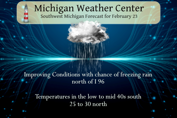
Our temperature in Otsego is 30° at 6 am. Hazardous travel conditions will continue into this morning due to snowy to icy road conditions. Winds will veer from the east to the southwest and increase this afternoon with some gusts reaching 30 to 45 mph at times. It will turn briefly milder by midday today mainly near to south of I-96 while a light wintry mix of precipitation will continue today north of I-96.
Weather History for SW Michigan
February 19
1978: Record lows of 21 below zero at Lansing and 15 below at Grand Rapids contribute to this being the coldest February on record at Grand Rapids and the coldest of the 20th century at Lansing. The temperature never gets above freezing during the entire month at Lansing. 2016: Winds gusts to 70 mph in Grand Rapids and 66 mph in Jackson as a strong low-pressure center moved across the Great Lakes. Lower Michigan was on the warm side of the storm with record highs around 60 degrees.
February 20
1898: A snowstorm dumps over a foot of snow on parts of Lower Michigan from the 20th to the 21st. Grand Rapids has 11 inches from this storm and almost 30 inches for the month of February. 1951: Ice jam flooding along the Grand River in Portland damages several buildings and forces the evacuation of some neighborhoods near the river. 2015: This is the coldest morning of one of the coldest months on record at Grand Rapids as the temperature falls to a record cold 13 degrees below zero. The monthly mean temperature of 13.3 degrees makes this the coldest February on record and the fourth coldest month ever.
February 21
1986: Lake Michigan water levels are near record highs. Coastal flooding and erosion is a concern during winter storms along the shore.
February 22
1930: Record warmth prevails with highs in the upper 60s across much of southern Lower Michigan. At Grand Rapids, highs are in the upper 50s or 60s every day from the 19th to the 25th.
February 23
2000: Warm air surges into Lower Michigan with temperatures reaching the 60s. Grand Rapids sets a record high of 63 degrees and Muskegon hits 60 degrees.
February 24
1989: Temperatures fall below zero as a late-season blast of arctic air moves in. Grand Rapids falls to a record 9 below and Muskegon hits 2 below, just missing the record of 3 below set in 1924.
February 25
1957: Mild and rainy weather prevails with lows in the 40s and highs in the 50s. The low of 47 degrees at Grand Rapids sets a record for the warmest low temperature for the date. Over an inch of rain falls as a cold front moves through.
Weather History for SE Michigan
February 19
On February 19, 1900, a snowstorm dropped 12.6 inches of snow at Detroit. This was the 7th heaviest snowstorm in Detroit history. It also started a remarkable run of snowstorms that included the 3rd and 4th heaviest snowstorms during the next two weeks in 1900.
February 20
On February 20, 2015, another calm and clear night during this frigid month allowed the temperature to fall to -25 in Flint, tying January 18, 1976, for the coldest temperature ever recorded there. The NWS office in White Lake also set a new all-time low of -25 degrees, albeit with a much shorter climate record. The temperature in Saginaw and Detroit reached -15 and -12 degrees respectively, also both records for the date. As temperatures struggled to rebound from cold early-morning lows, the average temperature for the day in Flint and Saginaw only reached -5 and -1, both records for the date. Also on February 20, 2014, A brief burst of heavy snow led to minor accumulations of 1 to 2 inches across the metro area. There were numerous reports of thunder accompanying the snowfall. Also on February 20, 2011, a winter storm impacted southeast Michigan, with 5 to 10 inches of snow falling across the majority of the area. Snow turned to ice near the Ohio border, where a major ice storm occurred. Downed trees and powerlines occurred over Lenawee and Monroe counties due to ice accumulations half an inch to one inch. Power outages lasted 4 to 5 days. Also on February 20, 2005, much of Southeast Michigan was hit with a snowstorm with generally 6 to 9 inches of snow. The Tri Cities area was the hardest hit with many locations reporting 12 inches of snow.
February 21
On February 21, 2018, a 3-day period of heavy rain came to a close. Total rainfall from the period ranged from 1 to 3 inches with a peak measurement of 3.36″ in Livingston County. Combined with melting snowpack, this caused the Clinton River near Mount Clemens to reach moderate flood stage while the Tittabawassee at Midland fell just short of reaching major flood. Also on February 21, 2014, the same storm that brought a round of thundersnow the day before moved off to the northeast. As this occurred, widespread wind gusts of 40 to 50 mph spread into Southeast Michigan with gusts up to 56 mph at Detroit Metro Airport and in Saginaw. Also on February 21, 1930, the temperature rose to a record high of 63 in Detroit. This day was one of a three-day record-high streak from the 20th with 61 degrees to the 22nd with 65 degrees. Saginaw also experienced this three-day streak with temperatures of 62 degrees on the 20th, 64 degrees on the 21st and 67 degrees on the 22nd.
February 22
On February 22, 2010, low pressure moved out of the Central Plains and tracked northeast through the Ohio River Valley. Snowfall totals were generally in the 2 to 8-inch range, with the higher totals occurring along and south of I-69. There were isolated totals up to 9 inches reported across Washtenaw county. Some of the higher snowfall totals across the area included Ann Arbor reporting 9.0 inches, Saline with 8.5 inches, West Bloomfield had 8.0 inches, Wyandotte with 7.7 inches, and Macomb Township receiving 7.5 inches. Also on February 22, 1930, the daytime temperature soared to 67 degrees in Saginaw, which is the record high for the month of February in this city. This day also marked the fourth day in a row (February 19-22) of daily record high temperatures in Saginaw!
February 23
On February 23, 2003, Port Huron received a foot of snow from a snowstorm that lasted from the 22nd – 23rd.
February 24
On February 24, 2016, a prolonged snowstorm that lasted into the 25th dumped heavy snow across most of the area. The rain-snow line was stark and aligned perfectly along the glacial ridge of SE Michigan. Detroit received nearly all rain. In fact, Royal Oak in Oakland County only measured 3 inches of snow while 12.4 inches fell just up the road in Lake Orion. A wide swath of 10 to 12 inches fell between the northern suburbs of Detroit and Flint. The highest total of 14.1 inches occurred in Peck in Sanilac County. At 9.9 inches, the storm ranks 16th on the all-time snowstorm list for Flint. Also on February 24, 1894, a temperature of -11.2 degrees set a record low for the day in Detroit.
February 25
On February 25, 1965, a snowstorm left all of Southeast Michigan covered under nearly a foot of snow. Saginaw received 17.9 inches, Flint had 12.9 inches, and Detroit had 11.0 inches.
Forecast Discussion
- Lingering light precipitation and windy this afternoon -

An overall short range guidance consensus including high res CAMs
continue to suggest that lighter precipitation will linger today
mainly north of I-96. Precipitation may increase a bit later this
morning into the afternoon north of the I-96 corridor as suggested
by latest runs of the HRRR with p-type as sleet and snow with light
additional accumulations.

Fortunately very little if any additional fzra accumulation is
expected early this morning across our southern two tiers of
counties which were impacted significantly by the ice storm.
Therefore we will allow the ice storm warning to expire at 4 am.
Winds will ramp up this afternoon and gust to around 35 to 40 mph at
times. Temps will also briefly moderate well into the 30s over
roughly the southern half of our fcst area by midday before
plummeting into the teens tonight.

Some lake effect flurries are expected Friday but with much lighter
winds as tranquil wx finally returns to our area. Some light snow
showers and flurries will linger over our northern fcst area Friday
night as a weak system traverses the northern great lakes region.

- Tranquil weather this weekend -

A high pressure ridge will build in this weekend and bring fair wx
with seasonable temperatures.

- Unsettled weather returns Monday -

A consensus blend of latest medium range guidance continues to
suggest another low pressure system will move through our region
Monday. Thermal profiles suggest that p-type with this system would
be rain for much of our area with mixed pcpn possible well north of
I-96. Precipitation may briefly transition to all snow on the back
side of this departing system Monday night with the deformation zone
as brisk north to nw flow caa occurs.

A high pressure ridge will build in for Tue/Wed. Beyond that there
is potential for a strengthening low pressure system over the
southern Plains to move ne and impact our area with potentially
significant mixed pcpn by Friday.
What more snow falling out in my hood currently in the end of February how could that be ??? INDY
What a winter! We are heading for at least 90 to 100 inches of snow! incredible!
GR is now over 86 inches of snow and counting and all the teleconnectors show cold and snow well into March! I love long winters!
The temps on the iPhone weather app keep fluctuating for next week. They showed all 30s this morning, now it is all 40s and even a 50. Hopefully the warm trend continues to melt all this ice
Back home at my house the ice has melted off the trees but still sleet in the yard and the road by my house still has quite a bit of sleet on it.
Along my delivery route down near Gobles in Van Buren County this morning I seen quite a bit of damage and got some pics. There was lots of ice down there.
We got about 7” of the heaviest snow I have ever shoveled. Top layer is ice pellets.
7 inches! Nice!
35 here. The ice has melted off the trees and landscaping. The roads are in good shape here.
Prayers to the Paw Paw firemen’s family, friends and fellow firefighters. UGH!! It just breaks my heart. We have a nephew who is a full time firefighter down south!!! It worries me all the time.
+1
ADA – Glad to have been in the “sleet” zone. Very lucky to receive minimal freezing rain. The sleet IS an icy problem today, but seeing all trees still standing…we’re ok.
After an extremely warm January with below average snowfall, we are about ready to close the books on another very warm and below average snowfall month. The trend of a warm January producing a warm February proved to be correct. And the worries of a cold and snowy February proved to be inaccurate.
A week from today I will be heading to some real warmth weather in Florida for Spring break as you call this warm here lol…. Its been a long Winter im reaady for Florida!! INDY
Commuting to Grand Rapids this morning was a mess. Hard compacted sleet and ice that couldn’t be scraped off by the plows. Should improve over the next couple hours.
There is over 700,000 customers with no power in Michigan this morning. Pretty significant ice event along and south of 94. At my house I’d say we picked up 0.20” of ice and lots of sleet as well
It looks like the Grand Rapids metro area dodged bullet. But that said there is around 1.5 to 2” of solid ice/snow on the ground and there is a good amount of ice on the car windows. The trees and wires do not look really all that bad. As sleet/ice storms go this was not all that bad. Most of the power outages are to the south along I94.
Slim
Yesterday’s official H/L at Grand Rapids was 31/26 there was 0.84” of precipitation of that 1.6” was reported as snow. Here in my yard I have just under 2” of snow/sleet/ice. There was no sunshine yesterday. For the season GR is now up to 86.1” of snow fall. At Lansing there was 0.82” of precipitation and at Muskegon there was less with just 0.44” there. The overnight low and current temperature here at my house is 27. For today the average H/L is now up to 36/21 the record high of 63 was set in 1984 and again in 2000.… Read more »
More sleet and freezing rain than snow. So much for the predictions of a big snow storm. Looks warm again for at least the next 1-2 weeks!
probably about one quarter inch of ice on our tree limbs, but we never lost power in Hamilton, although it did flicker a few times. Took my dog out this morning, and the driveway is like an ice rink! I cancelled my meeting with one of my customers for 8:30 this morning. No reason to risk my life to sharpen knives…wondering if this ice will melt off before the afternoon winds kick in?
I saw the video clip on the news of your superintendent announcing the snow day following the basketball game two nights ago and the subsequent jubilation by all the kids. You can’t help but smile ear-to-ear. That was fantastic.
Wow, that Consumer’s map is incredible!
We received a significant amount ice overnight, but we really dodged a bullet. There are three layers of frozen precipitation out there: ice-sleet-ice. The Christmas ice storm nine years ago was much more impactful for this area. That was all ice, no sleet. We lost power for five (?) days and ended up temporarily moving in with my sis in law and her family and spent Christmas there with them.
How it’s looking over there, westsiders?
Have a great day and make someone smile.
Certainly not as bad as the 2013 ice storm here. The ground is coated in compacted ice pellets, but the trees and power lines are ice-free.
I took that first picture on page 7 of the summary: https://www.weather.gov/media/grr/21and22DecIceStorm.pdf
Yeah, nothing like that this time around, thank God. I am interested, however, in seeing some photos of the I-94 corridor and southward.