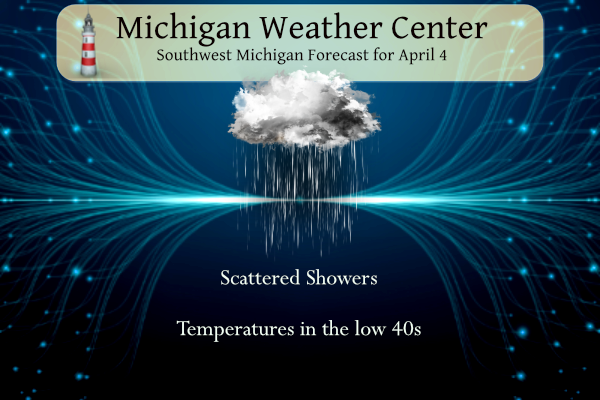
We expect another day much like yesterday and the persistent low hanging out will finally make its exit out of the state tomorrow. Showers will taper off by early Friday, leaving dry and sunny conditions for most of the weekend. Temperatures will be cool through Friday, and will then gradually warm up through early next week as more springlike weather moves in.
NWS Forecast
Weather History
2003: A devastating ice storm strikes central Lower Michigan. Heavy rain from thunderstorms falls into a layer of cold air near the ground and freezes on contact, creating sheaths of ice up to 3 inches thick that bring down thousands of tree limbs. It was estimated that 450,000 homes and businesses lost power during the storm and that nearly 50,000 people were without power for a week as persistent cold temperatures kept the heavy ice on the trees for 4 days after the storm. Crews came from four different states to help local utility companies restore power.
On April 4, 2003, a severe two-day ice storm ended over southeast Michigan. The storm was responsible for up to an inch of accumulated ice in Oakland County, which caused 500,000 people to be without power and $50 million in damage.
1804: A group of tornadoes slashed a 120-mile path across seven counties in Georgia and one county in South Carolina killing 11 people near Augusta, GA. The tornado’s path through heavy timber was still visible some 71 years later as noted in an Army Signal Corps survey.
1923: An estimated F4 tornado killed 15 people and injured 150 at Alexandria and Pineville, LA. 142 homes and businesses in Pineville were destroyed.
1966: One of the strongest tornadoes in Florida’s history moved in from the Gulf of Mexico and ripped through Pinellas, Hillsborough, Polk, and Osceola County. Damage was very severe in the towns of Gibsonia and Galloway in Polk County. 11 people were killed, and 350 were injured. The tornado was classified as F4.
1977: A Southern Airways DC-9 jet crashed near New Hope, Georgia, after being struck by large hail. The hail and associated heavy precipitation caused the engines to flame out. Seventy-two people (including nine on the ground) died.
1977: A massive F5 tornado moved across northern Birmingham, Alabama, killing 22 people and injuring 130. The tornado cut a 15-mile path from just northwest of Birmingham to the town of Tarrant. 167 homes were destroyed, primarily in the Smithfield Estates subdivision. Daniel Payne College sustained substantial damage. At one point, the tornado was three-quarters of a mile wide. The tornado crossed busy I-65, tossing cars and trucks like they were toys. Other tornadoes killed one other person in Alabama and one person in Georgia that day.
Forecast Discussion
- Lingering precipitation and cool air through Friday

The surface low in the vicinity of the southern state border will
gradually fill and weaken today, though the effects of the large
upper-level low over the region will linger through Friday. Today,
both troughing at the surface and upper-level shortwave
troughing/vorticity revolving around the center of the low will make
precipitation likely. Stratiform precipitation from deeper moisture
in the mid levels will move south-southwestward from Northern
Michigan this morning, then a transition to shallow s1urface-
based convective showers is expected during the afternoon.

Initially a wet snow is favored this morning, particularly in the
highlands of Central Michigan where a minor coating of accumulation
is possible. By mid day, any precipitation would more likely become
rain. Forecast soundings for this afternoon indicate a shallower
diurnal convective mixing layer than yesterday, with convective tops
around -10 C and 7,000 ft. Graupel is still possible but may be less
prevalent than yesterday.

Friday, the chance of precip is quite a bit less, though can`t rule
out some morning snow showers around Lansing/Jackson as a mid level
shortwave trough swings through on the back side of the upper-level
low, with lake-enhanced moisture from Lake Huron.

- Period of dry weather from Friday night into Sunday morning

High confidence in dry weather from Friday night into Sunday morning
as the models have been consistent in moving surface ridging through
the region during this time frame. Some cyclonic curvature hangs on
aloft much of this time, but RH vertical cross sections show only
moisture being shallow and diurnal cumulus related. Highs both
Saturday and Sunday look to be in the 50s which is close to normals
for this time of year.

- Weakening low brings some rain Sunday into Monday

A weakening upper low moves our direction in the Sunday and Monday
time frame. It is being shunted to the north and west of us however
as the downstream low over the Atlantic has the pattern a bit
blocked. A warm front lifts our direction and we should see some
rain showers Sunday into Monday. We have mainly chance pops in the
forecast (30-50 pct) to cover the nearby upper low/surface warm
frontal precipitation. Overall it looks to be on the lighter side
with amounts generally less than 0.20 of an inch.

As far as the eclipse forecast off to our south goes, it still looks
to be decent prospects down in Indiana, but conditions will need to
be monitored as we get close. Monday afternoon down there looks to
have a warm front pushing north and east of the area with 500mb
ridging building. Both are good for clearing skies, but way too
early to tell what upstream clouds may be pushing in.

- Some chances for rain continue into mid next week

The upper low that early in the week moves off to our west is
handled differently by the ECWMF and GFS. The GFS brings a stronger
upper low into our region, while the ECWMF has more in the way of
ridging persisting. At this point like the ECMWF solution a bit
more, but confidence is low in the pattern evolution at this range.
We have low pops (20-50 pct) in the forecast for rain showers
Wednesday into Thursday. Temperatures hit the 60s Tuesday, Wednesday
and Thursday within the GRR forecast area.
I see yesterday was yet another below normal temp day! I see today is yet another cold, wet Spring day! Incredible cold pattern we are locked into right now! Wow, just wow, WOW!!!!! Great golf weather?
Yep, Saturday and Sunday are going to be great golf weather! How has the snowshoeing been this week??
I will be switching to golf once it actually turns to some decent golf weather! Sunny and 60 degrees is a good start!
Wind chill in 30’s and low 40’s on Saturday! Incredible!
Sunny and 55 Saturday afternoon with a 6 mph wind. Fine golf weather for me!
I’m really hoping that the clouds cooperate on Monday for the eclipse. Anyone driving south to experience the totality?
Not weather-related, but our son and I went to DeVos last night to see Brit Floyd, whom is arguably the best Pink Floyd cover band. They were fantastic – audibly and visually. Our nearly 17-year old really enjoyed the show too. I think we now have another Pink Floyd fan. 🙂
Have a great day, friends!
I have been listening to Pink Floyd since the late 60s. Give their Meddle album a listen.
Speaking of Meddle – they played One of These Days last night. It was awesome.
INDY is heading to Indianapolis! Elclips 24.. 350% up tick in people heading to Indianapolis should be crazy…INDY
That’s cool!
There was a brief period of heavy snowfall here yesterday and I had 0.4” of precipitation with that trace of snowfall. The overnight low here was 33 and the current temperature here is 36 with cloudy skies.
Slim
What, heavy snowfall? You mean we are still seeing winter like weather? How is that possible?
The official H/L yesterday was 45/35 there was 0.06” of precipitation of that there was a trace of snowfall. The highest wind gust was 30 MPH out of the SW there was just 11% of possible sunshine. For today the average H/L is 53/33 the record high of 77 was set in 1921 the record low of 13 was set in 1971 the most rainfall of 1.27” fell in 2003 the most snowfall of 2.5” fell in 1920. The most snow on the ground was 8” in 1975. Last year the H/L was 52/46 and there was 0.50” of rainfall.
Slim