We have had some light snow falling in Otsego off and on overnight. We currently have some snow and 32° at 7 am this morning. Snow amounts still remain meager across the state as shown in the graphic below.

The CPC continues to change its guesses daily as to where cooler than normal air will set up in the US over the next couple of weeks; Michigan continues to be in the mostly normal area as the rest of the US seems to be thought to fall into a cooler than normal pattern.
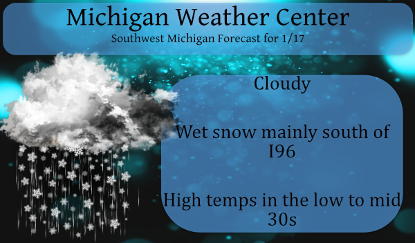
Here is the NWS Discussion:
--Increase in snow shower intensity south this afternoon--

Expect an uptick in snow shower coverage and intensity this
afternoon and evening as a shortwave tracks just south of
Michigan. Deeper moisture and better forcing north of this feature
combined with lake enhancement should result in some locally
heavier snow showers for a time mainly near and south of I-96.

1000-850 mb wind convergence and 850 mb omega progs from the
NAMNest and RAP/HRRR models are highlighting the I-94 corridor as
an area of locally heavier/more intense snow showers this
afternoon and early evening. This signal isn`t just near lk MI; it
carries well inland toward Jackson and Ann Arbor.

Typically the mesoscale models have a good clue with these
signals but will oftentimes misplace the location a bit, so it`s
possible the enhanced low level convergence zone later today sets
up slightly farther north... between I-96 and I-94.

These locally heavier snow showers could result in some travel
impacts this afternoon and evening due to highly variable,
fluctuating visibilities that may go down near 1/2 mile briefly
at times. Sfc temps today remain slightly above freezing (33-34)
which should limit accums to 1-2" so will not issue a Winter Wx
Advisory at this time, but it will need to watched especially
since temps fall below freezing after dark and some roads may ice
over.

--Lake effect snow showers continue through Tuesday--

After the shortwave passes later tonight, snow showers become
mainly pure lake effect (NW flow) and limited to areas mainly
west of Highway 131. Then on Monday the snow showers spread back
inland in increased westerly flow, with some hint in the guidance
of enhanced low level convergence along the I-96 corridor. Highs
Monday look to be a degree or two above freezing again which may
limit impacts.

Additional lake effect persisting into Monday night and Tuesday
as well as brisk cyclonic WNW persists, although generally light
accumulations expected. However colder sfc temps in the mid to
upper 20s during this period may result in more road impacts than
on Sunday and Monday.
We have another inch of snow to add to our season – creeping up towards a foot of snow so far for Otsego – we are now just a bit above 9 inches since December 1st. We still need another 31 inches to break last year’s total.
Only 3 tenths of an inch from the record lowest snow fall ever, that’s impressive! Trying to measure a tenth or two of snow is rather difficult as some snowflakes are larger than that. Light snow here this morning, but melting with the current temp of 35.
Looking back at the winter of 1905/06 November had .1″ December had 5.3″ in January the 4th had 1.6″ with .1 reported on the 5th and again on the 6th for a total of 7.2″ On January 16th .2″ was reported for a seasonal total of 7.4″ On the 17th today 1.8″ was reported and on the 17th 1.6″ was reported and on the 19th .2″ was reported. Yesterday I reported 1906/07 in the mix but I missed October of 1906 that had 2.6″ of snow fall. So bottom line is that this winter at this time is still on… Read more »