This is the time of year many hope for some snow on the ground for Christmas. I am beginning to wonder if we will see that this year looking at the medium-range forecasts. The problem with forecasts more than a few days out is they are subject to change on a daily basis. At this time the guesses are for rain and temps in the low 40s for next weekend which isn’t indicative of a white Christmas. As with any other year, Santa has workarounds for this.
We had an inch of snow yesterday which brings us to 10.5 inches since November which is well above what we had last year at this time. We had 10 inches in 2019 for the same period. I am still thinking we should exceed the 40 inches we had last winter. Yesterday’s high was 35° with a low of 26°.
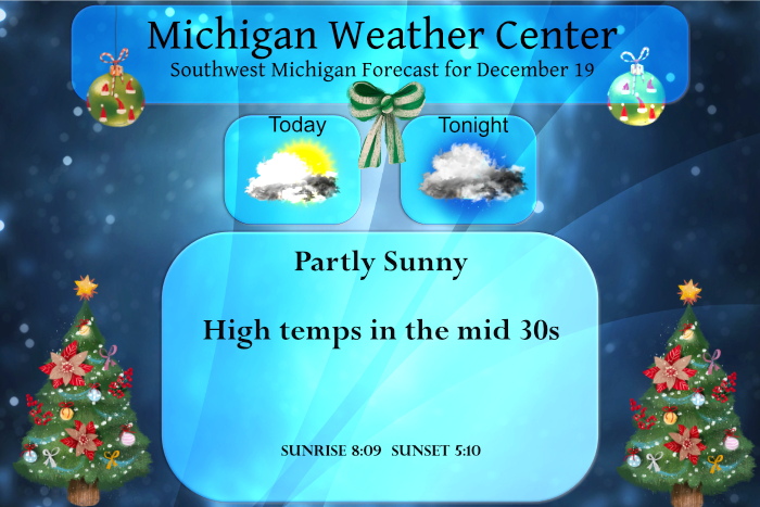
We are expecting a fairly quiet weather pattern through most of the week with rain coming Friday and Saturday.
Forecast Discussion
The trickiest part of today`s forecast is the cloud cover. Most
models show at least a period of unsaturated low levels and weak
subsidence which makes sense given the ridge moving through,
however clouds across the Lower Peninsula redeveloped overnight,
perhaps via some moisture contribution from northern Lake Michigan
but there is a patchwork of stratus in the states to our south
and west without help from the Great Lakes. On the other hand,
there is some clearing in central Wisconsin and the U.P., and that
drier air drifting toward Lower Michigan may provide us with some
sun. On the other other hand, it usually pays to lean toward
clouds this time of year whenever the low levels are expected to
be fairly moist without strong subsidence. Will go mostly cloudy
today near Lake Michigan where there could be some occasional
flurries, and partly cloudy farther east.

Monday will have breezy southwest winds with gusts over 30 mph
given the tight pressure gradient between the high to our east and
the low to our north. Precipitation should stay in northern
Michigan and the cold front should pass through dry Monday evening
in our part of the state.

Another shortwave trough and low passes through northern Michigan
Tuesday evening, and some light snow is possible down to the
central lower peninsula.

Late in the week, the pattern across the CONUS will feature a high
degree of baroclinicity (colder than normal in the northwest and
warmer than normal in the south) and a strong upper-level jet
streak will consolidate and extend coast to coast from WSW to ENE.
This is a recipe for unsettled and potentially volatile weather
for Michigan from Christmas and into the following week. Most
ECMWF and an increasing number of GFS ensemble members are
bringing warm advection and temperatures in the 40s for Friday and
a pretty good chance of rain by evening. The spread in temperature
guidance for Christmas is still very high and depends on the
evolution of the developing low in the region and if/when a cold
front passes through. Some impacts to travel conditions are
possible around Christmas, more likely for those heading up
north but details at this point are far from resolved.
Since 1893 there have been 105 years when there has been 1” of more of snow on the ground on Christmas morning. There have been 22 years with no snow and a additional 18 years with just a trace of snow. In the last 10 years there has only been 4 years with 1” or more on the ground at Christmas and 6 years without. If there is no snow this year on Christmas morning that will be 7 out of 11
Slim
Wow! The numbers certainly suggest things are changing from the way it was in the past. And of the 4 years that had snow recently, last year barely qualified because by noon the little snow we had on the ground was gone already.
At 16 inches of snow now in my hood for the young Wimter season looking out to January its starting to look very cold snowy around here I definitely will be adding to my snow total if thats the case especially with a warmer lake Michigan look out get prepared now!!!! InDY
In the snow fall department so far this December Grand Rapids has had just 4.2″ that is -6.9″ below where we should be by this date. For the season GR now has had 13.9″ and that is a departure of -4.6″ At Muskegon they have only had 0.9″ so far this month and that is a departure of -11.9″ and for the season their total is now at 6.5″ and that is a departure of -12.1″ Over at Lansing they have had 4.5″ so far this month and that is a departure of -1.7″ and for the season they now… Read more »
Once again this year like the past several we just don’t seem to be getting much lake effect snow for whatever reason. Lake snow usually makes up a good chunk of our season snowfall total, but without it the totals fall below average pretty quickly. Doesn’t look like much of anything coming this week either so the deficit continues to grow.
There was around a half inch of snow on the ground here yesterday, of course that it now all gone. Even though the official high at Grand Rapids was just 33 with the warm ground that was enough to melt the little bit of snow on the ground. The overnight low and current temperature here was 29.
Slim