We will once again see the oddity which is snow in the state today. We have had 2.5 inches in Otsego so far for January and 8.2 inches since December 1st. I thought last year was bad as we failed to reach 40 inches for the winter season. Like last year we are getting inched to death with mediocre amounts from synoptic events and lack of lake effect due to lack of Arctic air. We had a high temp of 43° yesterday. We currently have rain and 34° at 7 am.
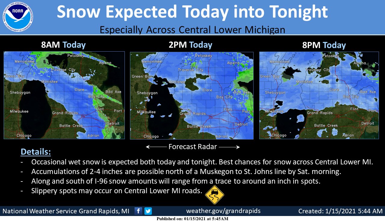
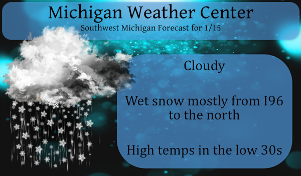
A low-pressure system slowly moving through the Southern Great Lakes will bring snow to Lower Michigan both today and tonight. The most sustained snow will occur across Central Lower Michigan. An inch or two of wet snow is possible today and again tonight. Totals by Saturday morning will be on the order of 2 to 4 inches north of M46. From I-96 to the south accumulations will be much less on the order of trace amounts to around an inch. Temperatures will be near the freezing mark so roads will be either slushy or wet. A few slippery spots are certainly possible though across Central Lower Michigan along U.S. 10.
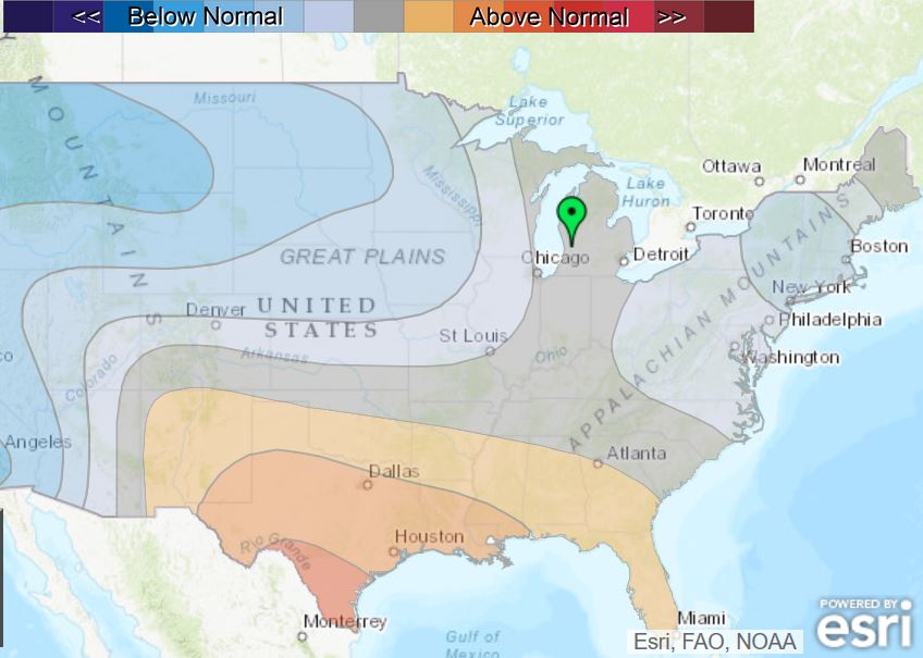
The CPC isn’t guessing any frigid air through most of the rest of the month through the trend has been seeing the tongue of below normal temps creeping ever closer to the state. Keep in mind these have been changing daily and the blue on the map is more of a tease than not.
The winter storm track is headed right at us! Get ready for the backloaded winter with tons of snow!
Lol!! Good one!
This is the best snow, as soon as it hits the ground it melts!
Agree !!
We have seen some steady snow today and it a beautiful sight! Keep it rocking!
Off and on rain all day, 39 degrees. Let’s keep this streak going right into Spring!
Like I said, I have been skiing and snowshoeing for weeks on end. It is a different world if you travel an hour or 2 north of here! I love it!
It has been snowing here for about the past 90 minutes. The ground is covered again. The street is just a little slushy.
I just looked out the window as lo and behold what do I see? Some light snow falling with a temp of 35.
Slim
We are now at the halfway point of meteorological winter. At this point much of the area is on track for a historical winter season. Of course we will not know for sure what the seasons snow fall total will end up at but it is a safe bet to place that we will not reach “average” for the season. But keep in mind that there still could be some big snow falls in the next 3 months. Of note the longest standing monthly snow fall records at Grand Rapids are for March 36.0” in 1965. April 15.6” in 1961… Read more »
First day of the second half of Winter today, looks the same as the first half. A mild 35 degrees out and received 0.14” of rain overnight. Always great reporting “rain” in mid January!
As I stated while we can not say what the seasons snow fall will end up at. But at this time we are on track for a “historical” winter season. I still think that March and April could see some very cold weather and snow.
Slim
Snow country is still looking great for my weekend ski trip! Accumulating fresh snow and nice temps for skiing! Who would have thought! The great outdoor sports weather continues to rock just North of us! Keep it rocking!
LOL Hundreds of miles north and it’s still been a quiet winter for them.
5-day snow map (spoiler alert: very little snow):
http://wxcaster.com/gis-gfs-snow-overlays2.php?STATIONID=GRR