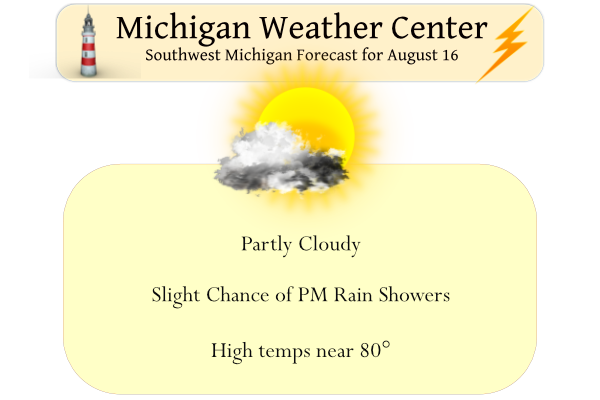
Yesterday was as near to perfection as we get in Michigan with low dewpoints and comfortable temps. Our high in Otsego was 77° after a morning low of 60°. Most places will remain dry today with plenty of sunshine, but a few showers and perhaps a thunderstorm cannot be ruled out this afternoon.
Our Hazardous Weather Outlook
Isolated thunderstorms are expected over parts of Lower Michigan this afternoon and evening, mainly along and east of US-131. Any storms that develop will move toward the southwest at 10-15 mph. Severe thunderstorms are not expected.
Forecast Discussion
-- Mainly dry through Fri --

A broad mid/upper-level cutoff low will remain situated east of the
region through Wed, reinforced by modest height falls accompanying
New England coastal cyclogenesis. This cutoff low is associated
with moderately cold temps aloft (e.g., -14 to -12C at 500 mb)
over much of Lower Michigan. RAP forecast soundings at LAN suggest
that boundary-layer heating should yield modest instability
(MLCAPE of 400-800 J/kg) over the eastern CWA by late afternoon.
Expect cumulus development inland today as convective temps (in
the mid 70s F) are reached, with a few vigorous cumulus congestus
yielding widely scattered showers or perhaps isolated TS. This
expectation is supported by latest CAM guidance, indicating that
showers should initiate over the interior of Lower Michigan today.
This activity will likely drift SW--approximately with the 0-6 km
mean flow--and should make inroads into the CWA before
dissipating this evening. However, most locations will remain dry
today. Diurnal showers should similarly develop on Wed afternoon
as the NE CONUS cutoff low remains in place and boundary-layer
moisture persists over the forecast area.

-- Chances of rain this weekend --

A vigorous shortwave impulse / vort max evident in water-vapor
imagery over BC this morning will crest the western ridge today and
tonight. This feature will then dig southeastward on Wed/Thu,
facilitating the gradual ejection of the NE CONUS cutoff low.
Meanwhile, the mean longwave trough will undergo discontinuous
retrogression, becoming reestablished west of its original longitude
via the height falls accompanying the digging shortwave trough. This
shortwave may subsequently evolve into a closed low on Fri.

EPS and GEFS means differ on the details/timing of this process, and
each has exhibited recent run-to-run adjustments. Nevertheless, some
agreement exists suggesting that a modest surface low will
consolidate over the Upper Mississippi Valley on Thu night, then
slowly meander southeastward through Sun. PW will increase with the
approach of this system, nearing 1.4 inches (~80th percentile of
climo distribution) by Sat night.

Some showers may arrive as early as Fri afternoon/evening across the
northern counties, but greatest coverage of precip is currently
expected for the Sat-Sun timeframe as the deep-layer low traverses
the region. Still, precip timing/placement/amounts are fairly
uncertain at this time, owing to the aforementioned ensemble
uncertainty in the evolution of the digging shortwave trough/low.
The GR NWS rocks and they use state of the art equipment that results in very accurate temperature and precipitation reports! Keep up the good work!
Breaking news>>>>>the latest CPC gives us near normal temps well into September! The facts always get in the way of the warm weather hype! Rock n roll will never die!
This Summer has been a decent one in the temperature department nothing hot at all .. INDY
We had a brief shower yesterday afternoon when one gray cloud passed overhead.
It was another great summer day yesterday with the official H/L at Grand Rapids of 80/59 there was no rain fall and the sun was out 68% of the time. The over night low both in MBY and at GRR was 55. For today the record high of 99 was set in 1913 and the record low of a cool 40 was set in 1979. The next several days look to contiune to be near average with a chance of a few showers.
Slim
Hey Slim, about half way through August – where does the GR August temp compare to average?
Right now for Grand Rapids we are almost at average for August. The current mean of 72.1 is +0.1 from average. It should be pointed out that while Grand Rapids and Holland are near average so far this month Lansing and Muskegon are warmer than average but that has been the case this year. At Grand Rapids and Holland this summer will end up very close to average.
Slim
Another month where GR is colder relative to average than the major reporting stations? What a joke!
You can’t tell me that all this can still be “explained away” can you?
And the remaining month of August is supposed to be warmer then normal that being said mskes me laugh….INDY
Wow, another near to below average temp month! What a summer!