Hard to believe we have only two weeks left of Met summer. I am four years into retirement from the workforce and the time just flies by – seems the older I get the faster it goes…
Sunrise today is 6:53 and sunset is 8:43 pm which gives us13 hours and 50 minutes of daylight. Our temp at 5:30 am is 56°. Yesterday’s high was 79° and the low was 55°. Our lowest temp for the year was -3.5° back in February and the highest was 94° last month.
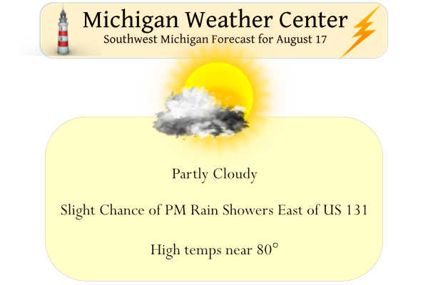
Expect another day of isolated rain showers this afternoon and evening, mainly in areas east of US-131. Otherwise, the skies will be mostly sunny. Isolated showers are again possible on Thursday, but most areas will remain dry through Friday. A system will bring renewed chances for rain on Saturday, with showers and thunderstorms becoming likely on Sunday, especially across southern Lower Michigan.
Weather History for SW Michigan
August 14
1987: A total of 3.61 inches of rain falls at Grand Rapids, making this the second wettest August day on record and contributing to a record monthly total of 8.46 inches.
1988: A tornado struck East Lansing and then proceeded southeast, leaving an intermittent damage path south of Okemos to Gregory. A man camping near Stockbridge was killed when a tree fell on him.
1995: Lightning struck and killed a 33-year-old man walking through his campsite in Coldbrook Park in Kalamazoo County.
August 15
1951: Tornadoes hit near Grand Ledge in Eaton County, Fowlerville in Livingston County and Kings Mill in Lapeer County. Several barns were destroyed.
1978: A waterspout moved inland off Lake Michigan just south of Little Sable Point, about 8 miles west of Shelby in Oceana County. Several cottages were damaged and Scenic Drive was blocked by falling trees. One person was injured when a picture window was blown in.
August 16
1938: A tornado struck between Oil City and Mount Pleasant in Isabella County. No one was injured but a home was torn apart with the roof carried about 100 yards.
1979: High pressure from Canada brings record cold temperatures with Muskegon falling to 36 degrees, the coldest ever recorded there in August. At Grand Rapids, it falls to 40 degrees and at Lansing 39.
August 17
1988: It is the last hot day of the hot and dry summer of 1988. Record highs were set at Grand Rapids with 98 degrees, Lansing with 95, and Muskegon with 93. Thirteen of the first seventeen days of August had highs over 90 degrees at Grand Rapids, but none after today. The transition to cooler weather is marked by severe thunderstorms that bring large hail and damaging winds during the late afternoon and evening.
August 18
1943: Autumn is in the air with record cool temperatures of 41 degrees at Grand Rapids and 43 degrees at Muskegon.
1955: West Michigan is in the midst of another heat wave with Grand Rapids setting a record high of 97 degrees, helping this become the second hottest August on record there.
August 19
1939: A total of 4.22 inches of rain falls for the wettest August day on record at Grand Rapids.
1977: Cool air from Canada brings record lows of 37 degrees at Lansing and 43 degrees at Grand Rapids.
1996: Severe thunderstorms produce damaging winds from Cadillac to Ionia. Montcalm County is one of the hardest hit places. Numerous trees are blown down from Greenville to Sheridan. In the town of Sheridan, there are several reports of building damage mostly to roofs. A school in Greenville had a large plate glass window blown out.
August 20
1992: Temperatures fall into the 30s in some rural areas during the coldest August on record at Grand Rapids. Record lows for the day include 42 degrees at Muskegon and 43 degrees at Grand Rapids.
2007: Heavy rain falls across southern Lower Michigan for the second consecutive day. Grand Rapids and Lansing both set daily rainfall records and some places see over 4 inches of rain for the two day total on the 19th and 20th.
2016: Tornadoes strike from Bangor to Grand Rapids and east of Belding. There were no injuries, despite damage to several buildings and hundreds of trees being down.
Weather History for SE Michigan
August 14
On August 14, 1964, the overnight temperature dropped to 41 degrees in Flint, which is the record low temperature for the day. Curiously enough, the very next year, in 1965, the daytime temperature rose to 97 degrees, setting the record high temperature for this day.
August 15
On August 15, 1951, an F1 tornado developed from a severe thunderstorm at 3 pm and hit Lapeer county.
August 16
On August 16, 1968, 4.45 inches of rainfall fell in Flint. This is the record for the greatest precipitation recorded in Flint in the month of August and is actually greater than the normal amount of precipitation for the entire month (3.43 inches).
August 17
On August 17, 1988, the high temperature reached 100 degrees in Detroit, 96 in Flint and 91 in Saginaw. This was the last 90-degree day of the very hot summer of 1988. A significant cold front moved through Michigan on the 17th. High temperatures ranged from 65 to 80 degrees for the rest of the month of August 1988.
Also on August 17, 1926, 4.51 inches of rainfall fell in Detroit. This is the third greatest daily rainfall amount ever recorded in Detroit. The greatest was on July 31, 1925, when 4.74 inches was recorded.
August 18
On August 18, 1914, 3.73 inches of rain fell in Saginaw. This is the second highest daily total to be recorded in Saginaw in the month of August. The highest is 6.93 inches, which fell on August 10, 2012.
August 19
On August 19, 2010, a supercell developed over far northern Saginaw late in the afternoon, then tracked southeast along a frontal boundary. This storm produced a swath of wind damage with winds up to 80 mph, large hail up to golf ball size, and eventually two tornadoes as it moved through Macomb County. The first tornado touched down near the intersection of 22 Mile and Hayes Road, tracking south-southeast before lifting just east of Hayes Road on M-59. Maximum winds were estimated to be up to 90 mph with this EF1 tornado. Damage included multiple homes with roof damage, along with downed trees and power lines. The second tornado touched down just east of Romeo Plank and north of Canal Road. The tornado tracked southeast before lifting just west of the intersection of 14 Mile Road and Harper Avenue. Maximum winds were estimated up to 85 mph with this EF0 tornado. A few homes sustained window, garage, and shingle damage. Numerous trees were blown down.
Also on August 19, 1998, Flint experienced a record cold temperature of 41 degrees for that day.
August 20
On August 20, 2011, severe thunderstorms were concentrated mostly along the M-59 corridor, causing the Dream Cruise along Woodward Avenue to be cut short, as minor damage was reported. The other notable item from this event was a weak tornado reported near Chesaning in Saginaw County.
Also on August 20, 1996, 0.29 inches of rain fell in Detroit. This would account for over half of the 0.43 inches that would ultimately fall that month. August 1996 ended up being the driest August of the 20th century for Detroit.
Forecast Discussion
-- Mainly dry through Fri --

A broad mid/upper-level cutoff low will remain situated over the NE
CONUS today. Similar to Tue, the combination of cool temps aloft
(-14 to -12C at 500 mb) and daytime boundary-layer heating should
yield MLCAPE of 300-600 J/kg with weak inhibition. This should
again be sufficient for showers and perhaps isolated TS this
afternoon and evening. CAM guidance suggests that coverage will
be more limited than yesterday, with isolated showers generally
confined to the eastern half of the CWA. This CAM signal of more
limited coverage today seems reasonable, given the closer
proximity of the low-level ridge axis today. Any showers that
develop will move toward the SSW at 10-15 mph, with activity
dissipating in the evening as surface-based instability wanes.

For Thu, some deterministic CAMs suggest that lake-breeze
convergence may help to initiate isolated showers in the
afternoon. Slight chance PoPs on Thu will be introduced with this
update for the SW and NE portions of the CWA.

-- Rain chances for Sat into Tue --

Global ensemble (EPS and GEFS) means exhibit good agreement
regarding the evolution of a vigorous shortwave trough / vort max,
currently over Alberta/Saskatchewan. This feature will dig
southeastward through Thu, likely evolving into a compact closed low
on Thu night. An associated surface low is expected to consolidate
in the vicinity of central MN on Thu night, with the system possibly
becoming vertically stacked as early as Fri night. This post-mature
system should subsequently drift southeastward, with the EPS and
GEFS means indicating a weak/diffuse surface low passing just south
of Michigan during the Sun-Mon timeframe.

Both the EPS and GEFS means have recently trended drier with precip
coverage on Sat. Chance PoPs (highest south) will be maintained for
Sat with this update. Greater precip coverage/amounts is expected on
Sun as the deep-layer low approaches the region and PW increases to
near 1.5 inches. Some surface-based instability may be present, with
MLCAPE possibly reaching 500-1500 J/kg if breaks in cloud cover
develop. Effective bulk shear of 15-25 kts should limit storm
organization and the overall risk of severe TS. Nevertheless, deep
moisture, tall/skinny CAPE profiles, and somewhat slow storm motion
in the vicinity of the low may support locally heavy rainfall on Sun.

Farther ahead, chance PoPs will be carried for Mon and Tue as the
upper low/trough slowly meanders eastward. Precip coverage on both
days may exhibit an afternoon uptick as daytime instability
develops.
On a side note. There has been not only a thunderstorm drought in parts of Michigan there has also been a tornado drought as well. So far this year there have been only two reported tornadoes in the state of Michigan (the EF3 storm in Gaylord on May 20th and a small EF0 south of Flint)
Slim
I keep seeing things about the the northern lights? Any chance for us down here or with that moon at this stage it would be difficult? How about up by the Soo Locks?
Many years ago the best display of the “northern lights” that I ever seen was up by the Soo. Not sure how they will play out around here as there is way too much ground light. But yes in the UP near Lake Superior on a clear night would be a good spot.
Slim
Thanks Slim…
I have only seen a few late one July after Ottawa County fair about 30 yrs ago.
The official H/L at Grand Rapids yesterday was 82/55 officially there was no rain fall reported. Here in MBY there was a cloud that came overhead and from that cloud there was a brief shower so I ended up with 0.01″ of rain fall. There was 79% of sunshine reported at GRR. The overnight low here in MBY was 57 the overnight low at GRR was 58 at the current time with clear skies it is 68 here. For today the average H/L remains at 81/61 the record high of 98 was recorded in 1988 the record low of 45… Read more »