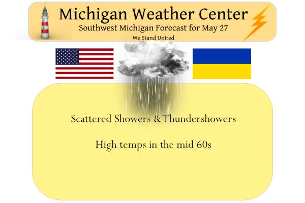
Yesterday we had a few sprinkles around the area which only amounted to a trace of precipitation in the Otsego/Plainwell area. Our high temp was 77° and the low was 60°. A low moving east through Illinois, Indiana, and Ohio today will bring showers and a few thunderstorms to southern portions of the Lower Peninsula. Rainfall will be most concentrated south of a line from Muskegon to Mt. Pleasant to Saginaw. High temperatures in most areas will be between 65 and 70. Rainfall amounts south of Grand Rapids could be .50 or more.
Looking forward, after today, rain chances diminish with a slight chance tomorrow evening. We will see sunny skies prevail with rising temps into the 80s Sunday to near 90 by Monday. If you are heading to the big lake take care as water temps are still in the 40s.
Dangerous swimming conditions are expected today between St. Joseph and Manistee. Winds will be from the north so the north sides of the north piers will be the most dangerous areas. We are not expecting many swimmers today given that cold water is a threat all its own. Water temperatures at the buoys this morning range from 48F at Ludington to 53F at South Haven.
Forecast Discussion
-- Showers and a few storms today --

We will see one more day of shower/storm chances with this upper low
complex that has been affecting the region the last couple of days.
There is a little bit of a change with the forecast, and that is
there is a little more of a threat of a few storms than it looked
like the last couple of days with the sfc front and mid level
deformation zone moving overhead today.

This better chance of thunder is likely due to the limited cloud
cover and precipitation to start off the day. This is allowing a
little more destabilization to occur with some breaks/thin spots in
the clouds. Even though there is thunder in the forecast, the deep
layer shear is pretty anemic with the light flow aloft up through
most of the column under the low. CAPE profiles will be rather thin,
limiting updraft strength. Some small hail can not be ruled out, and
maybe a cold air funnel cloud, but the threat for anything severe is
quite low.

We will see the entire low complex begin to open up and accelerate
to the East tonight. This will bring the rain chances to an end, and
allow skies to clear out tonight.

-- Mostly dry and warm holiday weekend with rain chances Sat night --

The majority of the daylight hours on Saturday should be mild and
dry for most of the area with high pressure in place. There is a
small chance of rain late in the day toward Ludington. Most of the
rain chances will come centered around Saturday night for Central
Lower. As the ridge of high pressure moves East of the state, strong
return flow from the SW will develop to our West. The nose of a low
level jet centered across the Central Plains will be touching off
some showers and storms.

We are not looking at a lot of rain with this scenario taking place.
The upper pattern becomes somewhat stagnant as the flow amplifies
and the long wave features across the country slow down for a couple
of days. What this means is that we will not see the best axis of
forcing and moisture/instability move over the area. What we see
Saturday night will be the leftovers from convection to our West,
that outruns its better support.

So after the rain chances Saturday night, Sunday will see drier
conditions return with temperatures warming up as the heat from out
West starts to move over the area. The upper ridge axis will build
overhead, and will cap any kind of potential shower/storm chances
with strong subsidence over the area. The higher heights and warmer
temps aloft will translate to temperatures approaching 90 for
inland areas by Monday.

-- Very warm next week with limited rain chances --

The ridge and warmer air will hold in place through at least early
Wednesday with the ridge in place through then. What helps to break
this pattern down a bit is strong jet energy/upper trough to the
West, that will break the ridge down a bit.

This trough coming in will support a cold front pushing through the
area around the Wednesday time frame. This cold front is a decent
front with a noticeable temperature change behind it. What it looks
like it won`t have is a lot of precipitation with it. The front will
not have much moisture with it, since the Gulf is not really open
for business. The only thing that will support the rain chances will
be limited diurnal instability during the peak heating part of the
day, combined with the convergence along the front.

Some cooler and better chances for rain now look to come in around
the Thursday time frame. The front is expected to slow down coming
through the area as it becomes closer to parallel with the upper
flow. As the front slows down, it will have waves of low pressure
embedded in the flow to ride along the front. Eventually, the low
level flow will advect enough moisture into the area to help with
rain chances.
The cpc hammers us with cool air in June! Incredible!
Heading to Indianapolis for the weekend should be epic weather for the race Sunday over 3 hundred thousand people fast cars and sprites happy memorial weekend my friends…INDY
After a brief two or three days of some very warm temperatures it still looks to drop down below average for maybe up to two weeks.
Slim
How is that possible! Certain people keep saying how warm it will be? Incredible!
At least no rain here! I am ready for the sun! Bring it!
Now getting a little thunder
Picked up 0.4” of rain so far. Still pouring outside.
The rain shield is to the SE of Grand Rapids and here at my house it has just been a few sprinkles. Of course it is very cloudy with a cool temperature of 67 here.
Slim
It’s been raining pretty hard here for the past half hour. Lots of urban flooding.
Yeah the rain isn’t making much northward progress just keeps sitting and developing over the same areas. I’m fine with the rain because it looks like we may be entering a little bit of a dry spell coming up.
1128 AM EDT Fri May 27 2022 …FLOOD ADVISORY IN EFFECT UNTIL 730 PM EDT THIS EVENING… * WHAT…Flooding caused by excessive rainfall is expected. * WHERE…Portions of south central Michigan and southwest Michigan, including the following counties, in south central Michigan, Calhoun, Clinton, Eaton and Ingham. In southwest Michigan, Allegan, Barry, Kalamazoo and Van Buren. * WHEN…Until 730 PM EDT Friday. * IMPACTS…Minor flooding in low-lying and poor drainage areas. * ADDITIONAL DETAILS… – At 1128 AM EDT, Radar and automated rain gauges indicated heavy rain. Minor flooding is ongoing or expected to begin shortly in the advisory area.… Read more »
Just keeps on raining at my house!
The last 3 days have cumulatively been very average. This pattern of very warm temps, a few day cooldown, and then repeat has made for a great May. And the timing of rain during the week and sunny weekends has been perfect too.
The last 9 days have also been cloudy. The last time Grand Rapids had more then 50% of sunshine was on May 17th. In that time there have been 3 days with less then 10% of possible sunshine. The sunny days have had just under 50% of possible sunshine. As for the warm up cool down cycle that is what is how the weather in Michigan (and much of the northern Midwest) is year round.
Slim
Thanks for the Facts!!! Very cloudy dreary week! Those are the facts!
What does the “north side of north piers” mean? Does this mean the break walls that are running from a southwest (where it starts at the shoreline) to northwest?
I believe this is what it means:
Picture the two piers/breakwalls at the mouth of a river. One extends from the south side (south pier) of the river, and the other extends from the north side (north pier) of the river. I think they’re talking about the north side of the north pier. The south side of the north pier would actually be the water in between the two piers.
I have not had coffee yet and I live in a land-locked center part of the state, so don’t quote me.
Thanks Mark. That makes sense to me!
You bet. Have a great holiday weekend.
While next week looks to be very warm to maybe hot the CPC’s long range guess is hinting that the warmth may not last long.
https://www.cpc.ncep.noaa.gov/products/predictions/814day/
and todays CFSw2 backs that up
https://www.cpc.ncep.noaa.gov/products/people/mchen/CFSv2FCST/weekly/
Slim
The average high is now up to 73 so even if we get below average temps, it wouldn’t be too cold.
Hey, if we get 70s and 80s for the majority of the summer, I would not complain.
We are at the point where I enjoy cooler CPC forecasts than warmer ones. Until October, then I like them above average again 😀
I tend to agree. It seems when we have the cooler temps, there is less humidity.
When “cool” temps still mean 70+ degrees = heaven!
I was surprised to see a record rain fall at Grand Rapids for yesterday. The official rain fall at GRR was a record amount of 1.32″ from a thunderstorm that passed to the SE of my house. Here at my house just 0.02″ of rain fell. The official H/L at Grand Rapids yesterday was 76/62. The overnight low at GRR was 58. Here at my house the low was 59 and the current temperature is 61 with a few clouds.
Slim