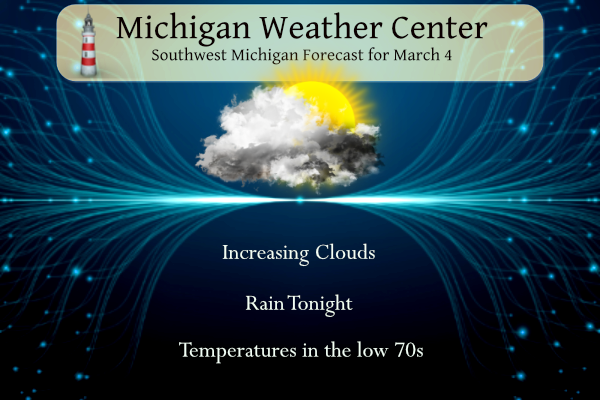
Yesterday we reached 66° in Otsego. We are currently at 45° at 6 am this morning. Today we will be making a run at record temperatures in the low 70s. Clouds will be on the increase today. An approaching cold front will bring showers and thunderstorms tonight and Tuesday along with cooler weather for the rest of the week. We are in the general outlook for thunderstorms tonight.
NWS Forecast
Weather History
1912: Subzero cold continues during one of the coldest months of March on record across Lower Michigan. Muskegon sets a record low of 2 below zero on this morning, during a spell of five straight days below zero.
March 4 has seen many snowstorms across Southeast Michigan. Snowstorms have occurred in 1895, 1899, 1900, 1985, 1999, 2003, and 2008. Many of these storms rated in the top 25 heaviest snowstorms including:
Detroit in 1900 received 16.1 inches of snow for 3rd heaviest snowstorm
Detroit 1895 12.3 10th
Detroit 1899 11.4 15th
Flint 1999 9.1 14th
Saginaw 1985 12.0 16th
1841: President William Henry Harrison was sworn into office on a cloudy, cold, and blustery day. His speech lasted one hour and 40 minutes, and he rode a horse to and from the Capitol without a hat or overcoat. Unfortunately, he died from pneumonia a month later, or did he? Click HERE for more information from the Smithsonian Magazine.
1873: The second inauguration of Ulysses S. Grant remains Washington, DC’s record-cold March day. The low was 4 degrees, and by noon with the sunshine, the temperature was 16 degrees. Wind chills were around 30 degrees below zero. The 40 mph winds made his inaugural address inaudible to most on the platform with him. Click HERE for more information from the Library of Congress.
1899: Cyclone Mahina, aka “The Bathurst Bay Hurricane” in Australia, was credited with producing the highest storm surge on record worldwide. The cyclone, with an estimated central pressure of 911 millibars or 26.90 inches of mercury, caused a 42.6-foot surge when it came ashore on the coast of northern Australia. The storm killed as many as 400 people and is Australia’s deadliest cyclone.
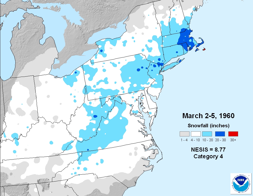
1960: Eastern Massachusetts’ most significant March snowstorm occurred on March 4-5th, 1960. The storm produced record 24-hour snowfall totals of 27.2 inches at Blue Hill Observatory, 17.7 inches at Worcester, and 16.6 inches at Boston. Winds gusted to 70 mph.
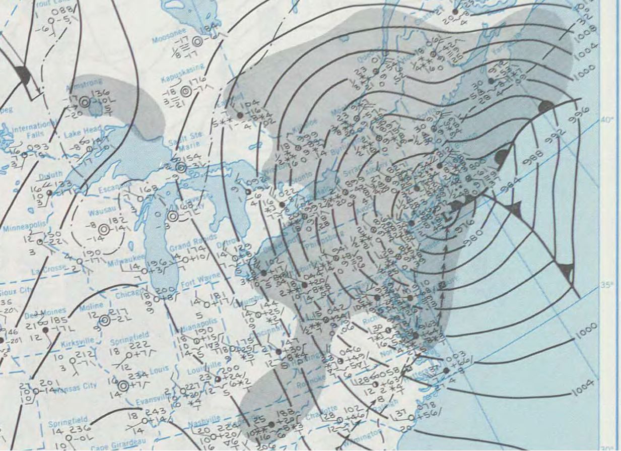
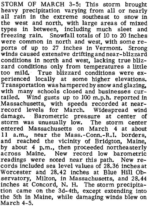
1971: A potent storm system blasted the northeastern U.S. on March 3-5th, 1971. The barometric pressure dropped to 28.36 inches at Worcester, MA, for the lowest pressure recorded at that location.
1983: Brownsville, Texas, recorded a high of 100 degrees, the earliest the city has ever hit the century mark.
Forecast Discussion
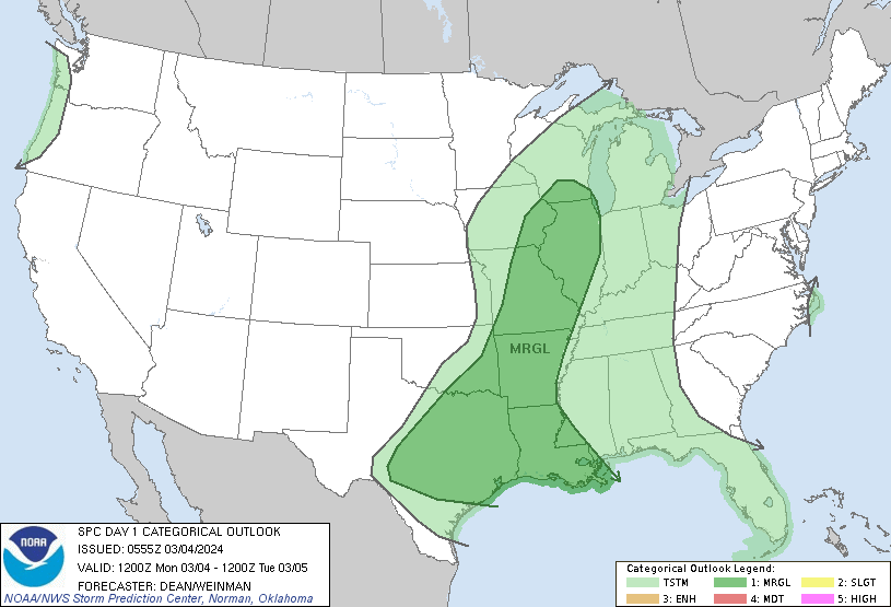
-Unusually Warm Monday, Broken Records Possible

One more day of unusually warm conditions is expected Monday as
robust warm air advection and moisture transport continues.
Temperatures are already in the upper 40s to mid 50s, and look to
climb to near 70 today. One question however is cloud cover. As
dewpoints climb this morning, the surge of moisture will cause an
area of low stratus to develop. There is some uncertainty as to how
fast, and if for our northwestern areas, the stratus mixes out. The
longer clouds linger, the more our highs are tempered. With most
record highs in the mid 60s giving some buffer, breaking records
remains on the table even if clouds linger into the afternoon.

-Showers and Storms Monday Night into Tuesday

A cold front then approaches the points after 00z and then moves
southeast through the night and into the day Tuesday. Widespread
rain showers are expected along the front with generally 0.5-0.8
inches of rain expected, highest north and west of Grand Rapids. The
HREF LPMM continues to suggest that areas of over 1 inch are
possible, particularly under any thunderstorms that develop. As for
thunder, while SBCAPE remains limited, MUCAPE values in the 400-800
J/kg range and mid level lapse rates of 6.5-7C/km do support a
chance of thunderstorms near and after midnight. Given the lower
instability values and weaker deep layer shear severe weather is not
expected with these storms. Showers are slow to depart, especially
for areas south and east of Grand Rapids, with cloud cover expected
to persist through the day.

-A little cooler, then rain late in the week

Showers will be ending Tuesday evening in the far southeast cwa and
then we`ll see a couple of dry days high pressure over northern
Ontario noses into the Great Lakes. Colder air behind the departing
front will send h8 temperatures closer to 0C by Wednesday. This will
produce surface highs around 50s Wednesday and Thursday, which is
still above normal for this time of year.

The next chance of rain will arrive Friday as a southern stream and
northern stream trough attempt to phase over the Great Lakes. The
models continue to show an inverted trough over the Mississippi
Valley with abundant moisture transport toward Lower Michigan as a
surface low rides northeast toward the region along a cold front.
This could be another decent rain producer with at least a half inch
QPF.

As colder air wraps into the system from the northern stream short
wave Saturday, h8 temps are progd to fall to -6c or lower, which
means we could see some wet snow mix in. Some lake effect show could
develop Saturday night as h8 temps fall to around -12c.

After highs mostly in the 50s Wednesday through Friday, temperatures
will fall into the 40s over the weekend; Sunday will be the coldest
day with highs around 40.
New record highs set today at Grand Rapids 70, Lansing 69 and Muskegon 67. A record was tied at Kalamazoo with 72. The 71 at Holland is just short of the record of 72.
Slim
Maybe some stormy wx this evening?
Don’t count on it! The GGR area will not see any severe thunderstorms tonight! Mark it down!
Hopefully it cools down soon! These temperatures are outrageous! Way too hot! Let’s see some more cold and SNOW!!
“along with cooler weather for the rest of the week.”
Cooler than today but still like 10 or so degrees above average. Crazy temps during the past seven weeks.
Yes even the “cool” days in the low 50s are still early April conditions on average
New record highs were set at Muskegon 71 and Holland 68 yesterday. The high at Grand Rapids was the 3rd warmest for any March 2nd
Slim
The official H/L yesterday at Grand Rapids was 66/38 there was no rain/snowfall. The highest wind was 33 MPH out of the SE. The sun was out 85% of the possible time. For today the average H/L is 39/24 the record high of 66 was set in 1983 and the record low of -3 was set in 1948. The wettest was 1.36” in 1985 there was 4.6” of snowfall that day. The most snowfall is 8.0” in 1900. The most on the ground is 19” in 2014. Last year the H/L was 47/26.
Slim
2014 has had nearly continuous snow cover records the past couple weeks of posting (and some cold records). A crazy winter for sure!