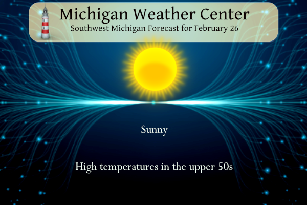
Today will be a peaceful day weather-wise with lots of sun and temperatures in the upper 50s. Tomorrow we will see near-record min/max temperatures. The chance of storms increases early tomorrow morning and again tomorrow afternoon. Below are the SPC forecasts for these periods.


NWS Forecast
Weather History
2000: Record-warm weather continues during a week-long spell of balmy weather across Lower Michigan. The temperature hits 66 degrees at Muskegon for a record high. The low temperature at Grand Rapids is 53 degrees, setting a record for the warmest low temperature for the month of February.
On February 26, 2020, a long-duration snowstorm occurred with widespread reports of 3 to 6 inches of snow over much of the county warning area.
On February 26, 2019, a snowstorm brought about 2 to 4 inches across areas along and north of I-69, while areas to the south saw 2 inches or less.
On February 26, 1944, the temperature rose to 68 degrees at Detroit Metro Airport. This is a record maximum temperature for the month of February in Detroit.
1910: Parts of Washington State were amid a storm that produced 129 inches of snow at Laconia between the 24th and the 26th, a single storm record for the state. A series of storms began on the 23rd and led to a deadly avalanche on March 1. Late on the 28th, the snow had changed to rain, setting the stage for disaster.
1972: The Buffalo Creek disaster occurred in the Buffalo Creek Hollow of Logan County in West Virginia. A coal slag dam on the Middle Fork of Buffalo Creek burst, sending a fifty-foot wall of water down a narrow valley killing 125 persons and causing 51 million dollars in damage. Three days of rain atop a six-inch snow cover caused the dam to break.
2011: The tallest tree in Wales falls after a wind storm. Located on the Lake Vyrnwy Estate, this 124-year-old Douglas fir stood at 63.7 m (208.9 feet). The tree reportedly was leaning over and had two substantial cracks in the main trunk. This tree would be carved into a giant hand. Click HERE for more information from the BBC.
Forecast Discussion
- Possible strong storms tonight and late Tuesday.

Although we`re expected some sunshine today, medium/high
confidence exists showers and thunderstorms will develop
tonight.

Initially, soundings are showing dry air in place through this
afternoon. However, an approaching short wave will result in a
45kt LLJ during the evening which will help to draw moisture
northward into the cwa resulting in MUCAPE values around 1200
j/kg by midnight. Additionally, steep mid level lapse rates
around 8c will create an environment conducive for convective
development. Shear values increasing to 35-40 knots may result
in a few storms producing large hail; SPC has placed much of the
southern half of the cwa in a Marginal Risk tonight. HREF
reflectivity shows the most favored location for storms will be
southeast of an Allegan to Alma line after midnight, including
Lansing.

Strong southwesterly flow will continue Tuesday and confidence
is high we`ll see thunderstorms develop and confidence is
increasing that a few of the storms will be strong to severe.

SPC has maintained the Slight Risk area and even nudged it a bit
farther northeast...but still generally south of a Grand Haven
to Lansing line. A strong cold front will approach Lake - Record
high minimums and maximums possible Tuesday.Michigan Tuesday
afternoon. Ahead of it, moderately strong instability with LI`s
near -4c, 1100 j/kg MUCAPE and a 50kt LLJ approach. HREF max
reflectivity shows a strong uptick in convective development
during the peak heating part of the afternoon with
showers/storms beginning cross the MI/IN boarder after 22z. The
most likely time for stronger/severe storms will be after 00z.

- Record high minimums and maximums possible Tuesday.

The strong southwest winds will push h8 temperatures up to 12c
Tuesday. The warmer air will result in mild weather tonight and
much above normal temperatures in the mid to upper 60s Tuesday.
See the Climate section for record high max/min information.

- Severe Weather Risk Tuesday Night

The approaching mid to upper level trough will generate increasing
lift through the evening.  A low level jet will be strengthening as
it lifts up through IN and into the MI/IN border region by 06z Wed.
SB CAPE values are likely to exceed 500 J/kg generally south of a
Grand Rapids to Lansing line during the evening. Deep layer shear is
expected to be over 40 kts.  A deepening surface low is forecast to
track eastward through Lower MI with a warm front over/near Southern
Lower MI. This is a favorable setup for organized severe weather,
especially for Southern Lower MI where the best CAPE, instability and
deep layer shear is forecasted.  The main severe weather risk will
likely shift east of the region roughly 06z to 09z based on various
model solutions. SPC`s severe weather risk highlights the potential
for the region.

- Rain to snow showers for the morning commute Wednesday

It will turn sharply colder late Tuesday night and into the
Wednesday morning commute.  It does look like a window for snow
exists in the wrap around moisture of this departing storm system,
mainly for the area near and west of a Kalamazoo to Grand Rapids to
Mount Pleasant line.  Model ensemble snowfall accumulations for most
locations are forecast to remain under an inch.  The temperature
will be falling into the 20`s though.  This could support some icy
roads, which may impact the morning commute.  Bridges and overpasses
would be first to turn slick.  The DGZ becomes unsaturated by noon
so any potential for accumulating snow will be over by then.
Who wouldn’t want snow in Feb. in MI?
Wednesday will be nice from my 70 degree computer desk! Then maybe some golf this weekend at Moss Ridge! LETS GOOOO!!!
Facts – for the last decade Feb has been the snowiest month! WOW!
This has been one of the worst Februarys ever! Too warm and low snowfall totals! Bring on a snowstorm!!!
Get ready for single digit wind chills on Wednesday! Now that is some incredible late Feb wind chills! Holly cow!
More beautiful sunny 50’s and 60’s coming this weekend! Glad I’m working INSIDE on Wednesday so I don’t have to deal with that one day abnormality. After that one day, right back to spring as usual around here!
Don’t let anyone tell you how great February is! But this year it has been fantastic! Over the last 30 years January is the snowiest month!
With El Niño coming to an end in early April, this beautiful spring weather we are enjoying looks to keep going all the way into a nice hot summer! It’s going to be spectacular!!!
I love snowy Springs and cold Summers! Let’s all hope these events rock our area this year! That would be awesome! Bring it!
For this past decade FEB has been the snowiest month! More snow is coming on Wednesday! WOW, just wow, WOW!
https://www.currentresults.com/Weather/Michigan/Places/grand-rapids-snowfall-totals-snow-accumulation-averages.php
Well that’s misinformation as usual from you, per the chart you posted, give us the last 30 years, January has been the snowiest at a little over 22 inches and February comes in at a little over 17 inches.
Don’t let anyone spew a bunch of BS about February! We all know the last 10 years Feb has averaged tons of snow! In fact the snowiest month on record the last 10 years! Incredible facts!
3 of the past 8 Februarys were extremely mild with very little snow. That’s 38% of the time. Just the facts.
Present day February has been heaven on earth! Virtually no snow and plenty of 50s and 60s! If this is gonna be a regular thing with climate change, I say keep it coming!
I’m old enough to remember many on here (WOOD and Bill Steffen too) predicting a cold and snowy back half of February. If anything, we’ve gotten even warmer LOL
Don’t let anyone tell you that February is a big winter month in the GR area! We have barely seen any snow and with temps in the 40’s and 50’s all month, February has been a nice spring month this year!
Exactly right! How about February 2023? We barely saw snow and were very mild too.
February 2017 was snowless and featured a month long blowtorch. I love short winters!
Hail outlook:
Wind outlook:
Tornado outlook:
Don’t let anyone tell you that February is not a big winter month in the GR area! Obviously they are either ignorant or spewing warm weather hype! Over the last 10 years January and February are big months for snowfall – both with about 22 inches per month! Obviously not this February but usually cold and almost 2 feet of SNOW! Those are the facts!! Incredible! Rock n Roll will never die!
On average February is the 2nd coldest month and at Grand Rapids there a on average around 17″ of snowfall. The mean for the month has ranged from 13.3 in 2013 to 34.7 in 2017. The record coldest low of -24 was in February and there has been as much as 41.6″ of snowfall. So yes in a typical winter February is very much a winter month in Michigan.
Slim
Meanwhile, the facts are we’ve only gotten one day of snow this February and we will probably have 10 days in the 50’s and 60’s. There have been more quality golf days in February than any winter weather activity – wow!
Thanks for the facts Mookie!
Some interesting tidbits in this piece:
https://www.cnn.com/2024/02/23/weather/warm-weather-winter-climate/index.html
Hundreds of record highs about to be broken. Weather more like May or June than February. Warmest winter ever recorded for dozens of cities. Record low Great Lakes ice. Huge snowfall deficits. Wow!
Just an absolutely terrific winter! And guess what, winter is almost over too!!
Remember when people laughed when I said a month ago winter was dying?
You definitely called it Mookie! Who knew?!?!!
If the HRRR has its way, tomorrow could be a bumpy ride for some. The parameters are enough to raise eyebrows. Could be overdone but something to watch.
50’s and sunny and then record high temps in the 60’s and severe storms… in February!
Don’t let anyone tell you February is a big winter month in Southern Lower Michigan.
This February will be the warmest on record at Muskegon and depending on how Wednesday and Thursday turn out could be also the warmest at Lansing and Grand Rapids.
Slim
The overnight low here in MBY was 27 and the current temperature is 33. The forecast low of 48 for tonight would be a new record warmest minimum for the date the current record is 37 set in 2018. The forecast high on Tuesday is 67 and if it makes it to 67 that would tie the current record for the date set in 1976.
Slim
The official H/L yesterday at Grand Rapids was 50/27 there was no rain/snowfall. The highest wind was 29MPH out of the SW. There was 56% of possible sunshine. For today the average H/L is 37/22 the record high of 64 was set in 1944 the record low of -9 was set in 1963. The most rainfall of 1.33” fell in 2009 and the most snowfall of 4.5” was in 1912. The most snow on the ground was 18” in 2014. Last year the H/L was 40/24.
Slim
2014 has had the record snow cover on most of your posts for quite a while now. That was definitely a much different winter than this year, the total opposite
Get ready for snow and wind chills in the teens on Wednesday! Incredible weather!