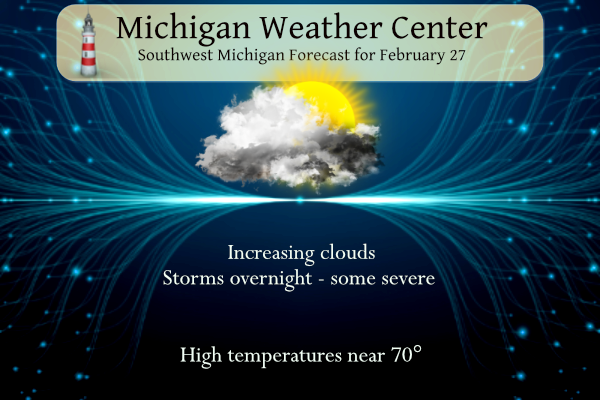
It is 56° at 5 am this morning with mainly clear skies. Our high temperature reached 64° yesterday. We expect warmer temperatures today with near to record warmth in southern Michigan near or above 70°. We expect a strong cold front to pass through tonight with strong storms, wind, and hail being the main threats. Temperatures will plummet behind the front dropping into the 20s Wednesday morning bringing in some snow showers. Temperatures will rise once again into the 60s by the weekend.
Hazardous Weather Outlook
Thunderstorms will be possible today and tonight, some of which
could become locally strong to severe. The best chance for severe
weather will be south of Interstate 96 during the mid-evening
hours this evening into the early overnight hours. Large hail and
gusty winds will be the main threats.

The rain showers will change over to snow showers toward daybreak
on Wednesday. Temperatures will fall quickly below freezing,
potentially causing wet roads to flash freeze for the Wednesday
morning commute. Some light snow accumulations will be likely west
of U.S.-131.
SPC Outlook

NWS Forecast
Weather History
1976: Temperatures soar to the upper 60s during a spell of spring-like weather during the last week of February. Record highs include 62 degrees at Muskegon and 67 at Lansing.
On February 27, 2023, a winter storm brought a quick burst of heavy snow – exceeding an inch per hour – across Midland, Bay, and Huron Counties which ended up with snowfall totals of 4 to 8 inches.
On February 27, 1994, the overnight temperature dropped to a frigid -14 degrees in Flint.
1986: It was 99 degrees in Palm Springs, California, the highest temperature on record for February. Palm Springs also reached 99 degrees on February 26, 1986.
2010: A magnitude 8.8 earthquake occurred off the coast of central Chili at 3:34 local time. The quake triggered a tsunami that devastated several coastal towns in south-central Chile. Tsunami warnings were issued in 53 countries. In addition, waves caused minor damage in the San Diego area and the Tohoku region of Japan.
Forecast Discussion
- Severe thunderstorms possible this evening/tonight after near
record temperatures today

We are seeing the few showers and storms that developed over the
eastern half of the area earlier being pushed east of the area as of
0730z this morning. These showers and storms are at the leading edge
of the low level jet and theta e ridge. They were well behaved over
our area, before growing a bit as they moved east.

It seems that most of the day now should be rather quiet with
additional rain chances likely holding off until after 00z tonight.
We are already sitting with temperatures in the 50s and 60s. The big
warm up may be delayed until this afternoon with some low clouds and
fog expected for a few hours this morning. Once the sun comes out,
we will see temps rise to the 60s to near 70 degrees across the far
South with 850 mb temps in the lower teens C and good diurnal
mixing.

The latest trends are coming into better agreement with the vast
majority of convection with this system coming this evening into the
overnight hours. This is when we see a short wave approach the area,
and the nose of another low level jet brushes by to our South. This
will bring another surge of instability with some moisture pooling
associated just ahead of it.

There are definitely some favorable ingredients that are expected to
be there to support the going Marginal/Slight Risk for this evening.
Models are in good agreement in bringing up over 2,000 J/kg of MU
CAPE by late evening. To go with this is a good deal of deep layer
shear. The best shear is over the south where 50+ knots will be
present, tapering off to 35-40 knots across the north. Mid level
lapse rates will be favorable for large hail also with rates of over
7.0C/km in the mid levels. The shear vectors will be favorable for
some strong winds in some bowing segments parallel to the storm
motion.

One can not also rule out a tornado late in the evening to early
overnight hours. With the upper wave driving the convection, there
is an associated weak sfc low that forms over southern Lake
Michigan, and moves to the ENE over the two southern rows of our
counties. There is almost a weak warm front that extends from the
low with some directional wind changes. To go along with the deep
layer shear, 0-1 SRH and shear values become somewhat favorable for
a spin up. The factor not favorable is weakly stable sfc boundary
layer. Plenty here though to potentially cause an active period for
the area, especially by late February standards.

- Much colder weather rushes in Wednesday morning with snow chances

As the convection from Tuesday evening and night moves out with the
wave, we will see a very strong cold front pass through the area
overnight, and be east of the forecast area by 12z Wednesday. We
will see temperatures ahead of the front likely still in the 60s,
with temperatures then dropping to the 20s by 12z at Grand Rapids.
Additional showers will be present with the front, and will change
over quickly to snow showers with the arrival of the cold air.

The snow amounts with this front, and some of the lingering lake
effect behind it will not be all that problematic by itself. What
could be problematic will be the potential of a flash freeze taking
place with the temps dropping so quickly well below freezing. The
warm temps today will delay ice from forming a little, but it is
still likely to happen. This also could happen right during the
morning commute, which could pose some problems. We will continue to
monitor this potential, and the need for an advisory if it looks to
be too impactful.

Lake effect snow showers will quickly taper off Wednesday afternoon
after going decent in the morning. The upper wave moves by after
18z, and the upper flow goes anti-cyclonic quickly thereafter.
Inversion heights will crash, and moisture will dry up quite a bit.

- Warming Trend over the Weekend

Models are in decent agreement in showing deep warm air advection
through the weekend.  Strong mid level riding occurs, especially
over the eastern Great Lakes Region into Sunday. Temps at 925 mb
rise steadily Saturday through Sunday with the thermal ridge
forecast to arrive on Monday.  Based on projected 925 temps and
assuming we can mix to that levels, daytime highs in the 50s are
likely on Saturday and 60s for Sunday and Monday.  These values are
supported by the ensemble forecasts as well.


- Watching Friday Aftn/Eve for possible showers

For now we will keep the area generally dry but a mid level
shortwave will be lifting out of the Southern Rockies and toward the
OH Valley or Southern Lower MI on Friday.  The deterministic GFS is
showing measurable qpf for much of the CWA however the other models
are dry and ensemble values support keeping a dry forecast going.
That`s how we will keep the forecast for now but we will need to
monitor trends.
Severe thunderstorms? What thunderstorms. Snow, what snow?
Seeing lightning coming from the south this way and lots of thunder.
Oh my goodness…just had an airliner make a hard left turn over the house, heading away from the airport. Waved off?
It looks like a watch has been issued soon. Mostly for hail and wind. It is 62 here in MBY at this time with a DP of 54.
Slim
Seeing lightning to the south.. a few strikes.
Several tornados already on the ground outside Chicago. Incredible storm.
Today’s high was 36 degrees above average. I don’t remember a temp 30 or more degrees above average. Historic day, for sure.
very rare. It happened in March of 2012. On the cold side it happened in November of 1950.
Slim
For anyone interested, Ryan Hall is going live at 6:45.
https://www.youtube.com/live/jbCQtLqxAvo?si=mgz4-HN-_f8h78sz
Forget about Thunderstorms and bring on the SNOW!! Incredible!
Reached 77 in my car… obviously out in the sun on the pavement, but that’s crazy! It is only February, where the average high should be 40 degrees colder
Too funny – all of this cold weather hype and after tomorrow we will be expecting a 40 degree plus rise in temps Saturday! Incredible!!!!!!
Snow and cold warning! Amazing temp drop warning! Possible black ice warning! Wow!
70 degrees today Winter weather advisory tomorrow Love it!! Bring it onnnn!! INDY ..
What? You mean winter is not over? Who knew?
Mason-Lake-Oceana-Newaygo-Muskegon-Ottawa-Kent-Allegan-Barry- Van Buren-Kalamazoo- Including the cities of Ludington, Baldwin, Hart, Fremont, Muskegon, Grand Haven, Jenison, Grand Rapids, Holland, Hastings, South Haven, and Kalamazoo 343 PM EST Tue Feb 27 2024 …WINTER WEATHER ADVISORY IN EFFECT FROM 4 AM TO 4 PM EST WEDNESDAY… * WHAT…Snow expected. Total snow accumulations of up to two inches. Plummeting temperatures expected with rapid onset black ice possible. Winds gusting as high as 40 mph. * WHERE…Portions of southwest and west central Michigan. * WHEN…From 4 AM to 4 PM EST Wednesday. * IMPACTS…Plan on slippery road conditions. The hazardous conditions could impact the morning… Read more »
This is just crazy…. will be interesting for schools too.
It will be interesting to see how cold it gets tomorrow. We have only had five days this entire winter that were -10 or more from average. For comparison purposes, there have been 30 days that were +10 or more from average.
We will be in the upper 50s at midnight, so the high will still end up 20 degrees above average
Ran the mower to clean out the front yard…just because 🙂
Certainly was not expecting to be running the ac for our new restaurant building this early! Absolutely unbelievable having to turn it on in February.
My 6 year old just asked if I can turn on the AC in the house! Haha
Too funny – all of this warm weather hype and we are in a WWA and expecting a 50 plus drop in temps! Incredible!!!!!!
NWS Grand Rapids think all severe modes are possible. Large hail is a big threat, some damaging winds as well. Highest tornado threat would be further south you travel in the state. “REGARDING THE TORNADO THREAT A SECONDARY SURFACE LOW LOOKS TO BE DEVELOPING IN THE NORTHEAST MISSOURI VICINITY. THIS LOW IS FORECAST TO LIFT NORTHEAST ACROSS LAKE MICHIGAN THIS EVENING WHICH MAY TEND TO LIFT A WARM FRONT INTO THE SOUTHERN CWA NEAR I-94. THE WARM FRONT MAY BECOME A FOCUS FOR CONVECTION AND THE POSSIBILITY OF ACQUIRING STRONGER LOW LEVEL SHEAR. STORM MODES WILL BE MIXED WITH LINES… Read more »
Anyone else check out Michigan Storm Chasers page? Looks like they will have a lot of people chasing tonight.
Voted today. Enjoying this temporary “anomaly”
A new record high for meteorological winter is insane! This day will be remembered for decades. 70’s in February…
Several new record highs for both February and meteorological winter. The 2PM temperature of 72 at Grand Rapids and Lansing have set new record highs for February and meteorological winter. The reading of 66 at Muskegon set a new record for the date but is just shy of the record for February. Will see how that plays out the rest of the day. Here in MBY I now have a reading of 74.
Slim
That is just incredible.
72 degrees is the highest I’ve seen in MBY today.
On this date just last year areas along and north of I-96 had significant amounts of freezing rain and power outages. What a difference a year makes.
On my way to work this morning I noticed the large trees were budding out. And indeed, My fruit tree buds are also swelling. I hope they don’t flower early this year, a frost would kill back the fruit. We will see, but this warm weather may have an implication for Michigan fruit tree farms.
These warm temps no doubt will begin to get the farmers a little nervous. Hopefully everything works out fine for them.
We noticed some buds on a tree in our backyard, as well.
In terms of evolution we expect storms to break out just south of the forecast area over Northern Indiana this evening around 600pm and work north. Additional storms will fire off to our west and surge in after dark from Chicago and Lake Michigan ahead of the strong cold front. There are hints in the high res models of a warm frontal surge between 600pm and 1000pm. We will be keenly watching this feature for storms acquiring enhanced low level rotation. Storm mode will likely be messy with lines and bows interacting along with embedded supercells. Given storms will have… Read more »
I now have a reading of 72 in MBY with windows open. Beautiful.
New record high for the date at Grand Rapids and Lansing 68 Holland 70. I now have a reading of 70 here in MBY.
Slim
67 here with a DP of 56 I have the front door open. Will go for a walk a little later will be a very nice day for that.
Slim
Current reading of 68 at my house currently. Think I’ll get my shorts out.
I have the windows open. it’s nice to have fresh air blowing through the house.
Here as well. It’s very nice!
Not only could this be the warmest February day ever… but what about meteorological winter? I can’t imagine we reached 70 in January, and maybe December we have reached 70 early in the month once or twice
It has never officially reached 70 or better at Grand Rapids or Muskegon in December, January or February. It was reported that it reached 70 in Lansing in December 1875, Holland in February 1999 and a 71 was reported in February 1999 at Kalamazoo.
Slim
70’s and severe storms in February – it’s going to be a long summer!
The current warmest February in 2017 that year had below averages months in March, May, July and August.
Slim
Tucked everything back into the pole barn.
Even kiddo said boy it feels moist this morning…
This is quite the February day. A high near 70 with thunderstorms tonight… seems like a mid-May kind of day in the middle (or “end” I guess) of winter!
We could be looking at an actual 50 degree temp drop tomorrow! If you factor in the wind chill we could be looking at a 70 degree temp drop!!!! Now that is cold and incredible! Wow, just wow, WOW!!!!!!!!!
I think the hundreds of record highs being set yesterday and today are much more impressive than the short-lived return to average temps.
These temperature fluctuations are pretty typical in the early and mid spring… but yes, a drop from 70 to 20 in 10 hours is very impressive
Tomorrow will feel more like mid January not late Feb! WOW!
And Saurday and Sunday will feel like May not Early March! WOW!
60’s today and then BAM wind chills near of below zero tomorrow! Extreme COLD WARNING for tomorrow! Get ready and let the rock n roll party crank!
Then what happens on Friday, Saturday and Sunday?? You left that part out!
We had a thunderstorm rumble through this area last night. I believe it was one of the only ones in West Michigan
We saw some lightning way off to the north after midnight.
Blowtorch warning for 70’s today! Today will feel more like June instead of February.
The official H/L yesterday was 62/30 (the high in MBY was only 58) there was 89% of possible sunshine. There was no rain/snow. For today the average H/L is 37/22 the record high of 67 was set in 1976 the record low of -12 was set in 1994. The most snow fall of 2.5” fell in 1897 there was 2.0” of snowfall in 2014. 2014 also had the most on the ground with 20” Last year had the most rainfall for the date and the H/L was 34/23 note no snowfall was recorded
Slim
The temperature was in the 50’s for most of the overnight hours but it has now fallen to 45 here in MBY. The latest reading at GRR was 52. If it stays above 37 until midnight there will be a new record warm minimum for this date. The current record of 37 was set in 2018.
Slim
It was 57 here when I woke at 4:30, which is wild.
So far this February has a mean temperature of 34.6 at Grand Rapids the warmest February at GR is 34.7. At Lansing the mean so far is 34.5 and the record is 34.5 and at Muskegon the mean is 36.0 and the old record is 35.3 all records were set in 2017. For February the snowfall at GR is 5.6” and for the season 40.1”
Slim
Snowfall totals for last February:
GR 5.8″
Lansing 3.3″
Of course, March was much different.