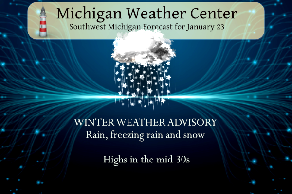
...WINTER WEATHER ADVISORY REMAINS IN EFFECT UNTIL 4 PM EST THIS
AFTERNOON...

* WHAT...Mixed precipitation. Additional snow accumulations of
  up to two inches and ice accumulations of around one tenth of
  an inch.

* WHERE...Portions of central, south central, southwest and west
  central Michigan.

* WHEN...Until 4 PM EST this afternoon.

* IMPACTS...Plan on slippery road conditions. The hazardous
  conditions could impact the morning commute.
Forecast
Weather History
1909: Lower Michigan is in the midst of a three-day stretch of warm weather. Lansing hits a record high of 60 degrees. Grand Rapids reaches 56 degrees, also a record.
1948: Record lows on this date include 19 below zero at Grand Rapids and 13 below at Muskegon as arctic high pressure and deep snow cover have Lower Michigan in the deep freeze.
On January 23, 2019, a mix of snow, sleet, and freezing rain was coming to an end across the region. The Thumb saw snow of around 4 inches, while areas to the south saw a coating of ice due to freezing rain/sleet. After the precip moved out, temperatures rose to around 40 degrees through the rest of the day.
On January 23, 1909, a two-day trend brought record-high temperatures of 59 degrees on the 23rd and 58 degrees on the 24th in the city of Saginaw.
U.S.A and Global Events for January 23rd:
1556: An earthquake in Shaanxi, China, kills an estimated 830,000 people. The estimated 8.0 to 8.3 magnitude earthquake struck in the middle of a densely populated area where many homes were a form of an earth shelter dwelling known as a yaodong. Much is known about this disaster as a scholar named Qin Keda survived the earthquake and recorded the details. Click HERE for more information about Qin Keda from the Science Museum of China. Click HERE for more information from the History Channel.
1812: A second major series of earthquakes was felt as part of the New Madrid Shocks of the winter of 1811-1812. Many observers reported that the January 23 shocks were as strong as the main earthquake on December 16th of the preceding year. Click HERE for more information from Britannica.
1916: Browning, Montana, saw the temperature plummet 100 degrees in 24 hours on January 23-24, from a relatively mild 44 to a bone-chilling 56 degrees below zero.
1969: An F4 tornado cut a 120-mile-long path from Jefferson through Copiah, Simpson, Smith, Scott, and Newton Counties in Mississippi, killing 32 and injuring 241 others. Property damage was estimated at $2 million. An inbound Delta Airlines aircraft reported a hook echo on its scope with this storm.
1971: Alaska, and the US, lowest official temp, -80F (-62.2C), was set at Prospect Creek, a Trans-Alaska Oil Pipeline construction camp. Fun fact: the low was initially recorded as -79F but adjusted after thermometer calibration. Click HERE for a tweet by Rick Thoman.
Forecast Discussion
- Rain and snow today, rain Wednesday

The forecast is progressing more or less as expected and no
major changes were made to the headlines.

Regional radar shows a large area of precipitation across the
Midwest moving northeast. Temperatures across the cwa are a
degree or two either side of freezing and so we`re seeing a mix
of freezing rain, rain, and some sleet.

Continued southwest flow today will draw warmer air northward
and so the freezing rain over the southern cwa will gradually
turn to rain this morning. Farther north along the I-96
corridor, the transition will be slower and we`ll see more snow
mixed in. Forecast soundings show the nose of the warmer air
retreating slightly over the I-96 corridor resulting in more
snow than sleet or freezing rain. An inch or two of snow seems
plausible over the central cwa with perhaps up to 3 inches along
US-10

Road temperatures remain in the 28-31 degree range so some icy
spots are expected, especially secondary roads.

The wave of low pressure moving through today will move away
tonight and precipitation should end this evening. However,
another wave taking a similar track is fast on its heels and
will track from the Red River Valley northeastward to the Great
Lakes Wednesday. The continued feed of warmer air aloft...h8
temperatures rising to 4c...will result in rain developing
Wednesday. High temperatures are expected near 40 south of I-96.
Secondary road temperatures will likely remain around freezing
and so may become icy, especially where they remain snow packed.

- Another round of rain Thursday

Shortwave departs on Wednesday night but some light rain/drizzle and
areas of fog are still expected in lingering moist airmass. A
stronger shortwave heads northeast from the srn Plains longwave
trough on Thursday and looks like it may have more rain with it than
the Wednesday wave. Ensemble QPF spread is still quite large but
there are a few members producing an inch or so of rain around JXN
and the 00Z deterministic ECMWF does as well.

With the upcoming milder temperatures and occasional rain the
current thought is that the flooding threat is relatively low. The
current snow pack will absorb an appreciable amount of rain and the
snowmelt will be only gradual due to highs around 40. Ponding of
water from clogged/frozen storm drains may be the most impactful
hydro part of the mid to late week period.

We`ll have to keep an eye on the srn Plains upper low which is
progged to lift into the Ohio Valley later in the weekend. Newer
guidance is suggesting a swath of accumulating wet snow or mixed
rain and snow occurring north of the upper low; possibly impacting
parts of southern/southeast lower Michigan on Saturday night into
Sunday. Confidence in this scenario is currently low however given
large spread in ensemble QPF and snow amounts.

Once that late weekend system goes by, cooler air infiltrates the
state from the north. Then a shortwave diving south next Monday from
the top of the building upper ridge to our west brings a chance of
snow or mixed rain/snow showers.
Eeeee Eeeee Blowtorch warning now in effect
Some fog is developing here from the melting snow. It’s a sloppy wet mess outside.
Wouldn’t shock me if it gets pretty dense too. We shall see.
Look at all this rain! There goes our snow! Horrible snow conditions coming up for the next several weeks.
New CPC = BLOWTORCH & Below normal precipitation for at least the next couple weeks!
Bring it on and keep ROCKIN!!!
As I said and the GRR NWS agrees, weekend snows are a wishcast at this point.
We`ll have to keep an eye on the srn Plains upper low which is progged to lift into the Ohio Valley later in the weekend. Newer guidance is suggesting a swath of accumulating wet snow or mixed rain and snow occurring north of the upper low; possibly impacting parts of southeast lower Michigan on Saturday night into Sunday. Confidence in this scenario is currently low however.
With high temps near 40 degrees all weekend and dry weather on tap, it looks like a great weekend to get back outside again and enjoy nature!
https://forecast.weather.gov/MapClick.php?lat=42.9664&lon=-85.6719
Wow just WOW HOLY COW! Don’t listen to that hype and propaganda about a weekend snow storm. GFS shows that storm system as mostly rain AND tracking way off to the southeast. More snowstorm fantasies and wishcasting from the usual suspects.
I sure hope there is no storm, I’ve got to fly this weekend
I think you’ll be ok Nathan. Most models show it passing SE of GR at this point. Andy’s model analysis is not correct though. There is a chance for snow on the NW side of the system. It’s shown by both of Euro and GFS although fairly minor. But as stated doesn’t look like much of a concern for GR at this stage. More for SE Michigan
It’s not my analysis. As stated above, the GRR NWS mentioned this in their discussion.
Here is that low position as it travels by us on Saturday night. Just the facts….
Nothing to worry about Nathan
“GFS shows that storm system as mostly rain AND tracking way off to the southeast”
That’s your words, not the GRR discussion.
The GRR discussions mentions the wet snow scenario on the NW side and that is supported by modeling but for SE Michigan. GFS shows accumulating snow and the euro is more mixed.
Ok…..still not a factor in GR. Man you cold weather guys are a grumpy bunch!
Grumpy? It’s called facts, bud.
I know I go after your buddy Rocky on things, but Rocky and I have been doing that for like the past 15 years, back when we were on Bills Blog, so you don’t have to take it out on me, when the weather isn’t going the way you like.
Who’s taking anything out on you? You posted something not supported by facts and I corrected you. I’ve stated many times on here I like weather in whatever form it comes because it’s pointless to get upset over something I have no control over. That would be simply silly. The forecast is what it is my friend weather it’s to our liking or not.
Cool, sounds good! Here’s a little secret, don’t tell Rocky but, I was up at my buddies cabin up north on the weekend of January 13 and they got about 16 inches of snow up there in one night. It was awesome watching that storm blow in sitting by the wood stove looking out the big picture window into the woods! Anyway, they can keep that weather up north!
Andy would not know a fact if it hit him in his face!
I bring all the true facts to this site!
Great News><<<by the end of the first week of Feb all of the teleconnectors are trending towards more cold and snow! Bring it! Rock n roll will never die!
Wow! just Wow Holy Cow! Another possible snowstorm this weekend! How is that possible with above normal temps?
That forecast I posted is right in line with the teleconnectors that the GRR NWS was putting out yesterday! Could be some record highs next week. So after a couple week blip of cold, we’re heading back to our normal wonderful warm pattern we’ve been enjoying this winter!
33 and liquid rain now. The ice that had accumulated on my driveway is now slush.
Wow! Just WOW HOLY COW! Looks like a boring week of melting! But next week looks like a massive BLOWTORCH!!!!
https://weather.com/weather/tenday/l/b523690bfd952b86fef3627c919dd9855281a8da16b83c10bdd381c64ae12cbc
40’s and 50’s? Wow!
The official H/L yesterday at Grand Rapids was 32/14 there was 0.3” of snowfall and 10” on the ground. There was no sunshine. For today the average H/L is 30/18 the record high of 56 was set in 1909 the record low of -19 was set in 1948 the record snowfall of 8.0” fell in 1894. The most snow on the ground was 20” in 1963.
Slim
Well 10 years ago we were getting set to enter into the core of the historic 2013-2014 winter. I do plan on posting the Storm Team 8 videos daily during that stretch for those that really want to look back at just how crazy and relentless that stretch really was.
It was absolutely AWESOME!
Interesting seeing the precip type reports across the area this morning. At my house it’s primarily sleet. The roads are very slippery. Sleet covered roads are not fun to drive on.
Despite the constant warm weather hype – here is the reality! It is snowing today and we will see more snow this weekend into Monday! The snow just keeps coming! Wow!
Very “blah” weather outside right now. We just have ice pellets, so not as bad driving as areas who are getting freezing rain. Was able to drive to get coffee OK
Forecast: rain, rain, and melting
Hope you enjoyed the two week winter!
+10000000
All snow here! Who would have thought?
Every district is closed in this area except Lansing Public. I was going to go to the gym but our driveway is an ice rink. Not leaving home anytime soon.