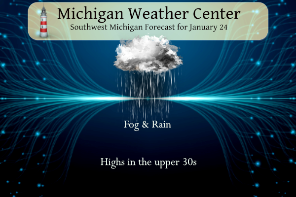

No winter weather concerns today with above-freezing temperatures, but expect reduced visibility in fog and rain. Allow some extra travel time this morning and keep a safe distance from other vehicles.
Forecast
Weather History
1967: A huge storm is gathering over the Plains States. Out ahead of it, strong southerly breezes bring record warmth to Lower Michigan. Lansing soars to 66 degrees, the warmest on record for the month of January.
On January 24, 1963, Detroit had a high temperature of 4 degrees and a low temperature of -13 degrees, which equates to a very cold day!
1940: A record-breaking 19.9 inches of snow fell in Richmond, Virginia, on this day. The storm, which began on the 23rd, produced 21.6 inches of snow in the Richmond area. The headline in the Richmond Times-Dispatch was “Blizzard Sweeps State, Bringing Deep Snow; Public Schools Closed.” Click HERE for more information from the Richmond Times-Dispatch.
1967: A tornado outbreak across the Central U.S. was the furthest north ever recorded in the winter up to that time. Severe weather occurred across a good portion of the southeast and east-central Iowa. Two-inch hail fell at Armstrong, and over two dozen tornadoes were reported. Five miles north of Fort Madison, one fatality occurred from a tornado, along with six injuries. A tornado causing F4 damage killed 3 people and injured 216 in St. Louis County, Missouri. Storms also affected parts of northern and central Illinois. One strong tornado in Mason County killed one person and injured three others. Another tornado moved across the Champaign-Urbana metropolitan area, injuring five people. Other strong tornadoes were reported across Carroll County in Mt. Carroll, where 12 people were injured, and near Gladstone in Henderson County. Funnel clouds were reported across the southwest section of Chicago, IL. Iowa had never recorded a tornado in January before this outbreak. 32 total tornadoes occurred, 14 of them in Iowa. Nine twisters occurred in Missouri, 8 in Illinois, and 1 in Wisconsin. Click HERE for more information from the NWS Office in Davenport, Iowa.

Forecast Discussion
- Dense fog and rain today

Visibilities across West Michigan are mostly around 1/4sm south
of US-10. Earlier, we extended the Dense Fog Advisory for
all counties expect the northern row and this advisory remains
in effect until 11 AM.

The next low pressure wave is already spreading light rain
across IL/IN and will develop in the southwest cwa around 12z,
then continue moving northeast. Rainfall amounts will max out
around a third of an inch over the southern cwa, around a
quarter inch in the central and less than a tenth over the far
northern cwa. Road temperatures are generally above freezing
south of I-96 but closer to 30 north of there. Thus, some roads,
especially secondary roads, could still see some slick spots.

Visibilities are widespread 1/4sm but will likely lift somewhat
as rain moves into the region. The main area of rain will move
east by late afternoon, leaving fog and drizzle during the
evening and dense fog overnight.

A stronger wave will approach Thursday with more rain during the
afternoon. Another tenth of an inch of rain is possible from
18z-00z.

High temperatures will reach the upper 30s today and Thursday,
except in the northeast cwa where lower 30s are expected. Those
colder temperatures could also lead to some freezing rain during
the afternoon.

- Heavier Rain Possible Thursday Night

Guidance QPF continues to trend up with the strong shortwave which
comes through the area on Thursday night, suggesting rain amounts of
an inch or more possible from 00Z to 12Z Friday. This would be
concerning from a hydro perspective although it is worth noting
that the last few cyclones with a similar track were over-deepened
by the global models so perhaps these amounts are a tad high.

A safe forecast at this point is for widespread rainfall amounts of
around one half to three quarters of an inch Thursday night within
the system`s deformation zone. It will be interesting to see what
the HiRes models have to say QPF-wise once the event is within 48
hours. See the hydro discussion for more information regarding snow
melt, rainfall, and expected river response.

Precipitation associated with the main upper low which lifts
northeast from the srn Plains over the weekend may clip
southern/southeast lower Michigan. However forecast confidence
remains quite low regarding precip placement/potential and for now
the model blend solution is for low chance pops for mixed rain and
snow Saturday night into early Sunday south of I-96.

Temperatures remain above normal into early next week although weak
systems diving south from the top of the building upper ridge over
the nrn plains keep the warmest air west of MI through the end of
the month. That may change for the first week of February with
ensemble guidance suggesting the possibility of much above normal
warmth spreading in from the west as upper ridge works in.
Hydrology Discussion
- Melting snow, rising rivers, and minor flooding possible later
  this week

A warmup and several days in a row of rain will bring an
early glimpse of spring to Lower Michigan. There`s currently
between 1.5 and 2.5 inches of water contained within the
snowpack west of a line from Kalamazoo to Mount Pleasant. Lesser
amounts around 1.0 inch or less are more common east of this
line (including Lansing and Jackson areas). While some of this
snow will be melting over the next day or two, mostly it will be
acting primarily to absorb the falling rain today and also with
the 2nd round of rain expected on Wednesday. By Thursday, the
snow won`t be able to absorb much more water, and at this point
we`ll see more significant amounts of water flowing toward our
river systems. This alone would bring multi-foot rises to most
of our rivers, and bring a few of the tributaries on the Grand
River (Looking Glass, Maple, and Sycamore Creek) close to
bankfull.

Unfortunately, another trend has developed in the models and
that is for a 3rd round of rain across much of our area on
Thursday, and it`s looking like this could drop an additional
one-half inch or more of rain across a good chunk of Lower
Michigan. This will increase river rises even more, and may be
enough to push the Grand River to bankfull at some spots and
push those aforementioned tributaries toward minor flood stage,
including the Red Cedar around East Lansing. Meanwhile,
thankfully, the Kalamazoo and Muskegon Rivers both look like
they`ll be able to handle this week`s taste-of-spring without
much issue, though water levels will still be on the rise. If
you live along any of our beautiful rivers or creeks here in
West Michigan, now`s a good time to prepare for melting snow,
rising water levels, and the possibility of minor flooding in
some of the most flood-prone locations.
Great day for a winter hike. The fog radiating off the snow back in the thick piney woods makes for awesome pictures! I love winter hikes!
Sounds great and I might do the same this afternoon!
Well, today is the day this blog took down professional WOOD meteorologists. A week ago, WOOD was forecasting a high in the mid 20’s for today and several of us thought this was way off and that we’d be closer to 40.
They predicted a high of 26 and a low of 6 to be exact. Hmmm?? Imagine that! Kirkwood blows another long range forecast with his cold weather wishcasting! The best part of that forecast was the low temp of 6 degrees. Only missed it by 30 degrees!
Here is one Storm team 8 broadcast from 1/24/14
https://m.youtube.com/watch?v=bwlAd9nsqAw&pp=ygUcU3Rvcm0gdGVhbSA4IGphbmlhcnkgMjQgMjAxNA%3D%3D
As I stated I’m going to try and post these daily till the start of February. If you want to watch them great if not keep scrolling. I enjoy looking back at stuff like this and know others do too since it was such a historic winter.
This was one of best winters ever!!!!!!
I agree!
10 years ago we were kicking off the core of the brutal 2013-2014 winter. A picture popped up on my Facebook memory feed of me and my dad helping pushing a sedan out of a snowdrift on 16th street near 146th Avenue near the town of Dorr in Allegan County. This would have been in the evening that day and it was snowing very hard and blowing.
Despite all the cold weather hype and wishcasting, the blowtorch is right on time! Should be even warmer next week and carry into February.
Walking in our yard is like a slurpee… geesh. A lot of tht snow that was holding branches down has fallen off the past few days.
The official H/L yesterday at Grand Rapids was 34/32 there was 0.41” of cold rain. The day started with 9” of snow on the ground. There was no sunshine. For today the average H/L is 30/18 the record high of 62 was set in 1967 and the record low of -19 was set in 1948. The record snowfall of 6.5” fell in 1930. The most snow on the ground was 19” in 1979. Last year the H/L was 33/29 and there was .2” of snowfall.
Slim
Fog and rain in mid to late January? Nothing could be worse! Bring on the next Polar Vortex baby!
The (seemingly) annual January thaw is in full swing. Pretty foggy here. I estimate 0.5 mile visibility, at most. We’ve lost approx. 50% our snowpack. Washed the salt and grime off our vehicles last night. Have a great day, friends.