We reached 73° yesterday with an overnight low of 42°, doesn’t get much better than that for early November.
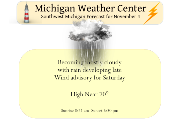
Mild temperatures but unsettled weather can be expected Friday and Saturday. A thunderstorm is possible on Friday, with higher chances for those north and west. Winds may be breezy but severe storms are not expected Friday. Saturday will bring showers and strong winds for the whole area, possibly strong enough cause some power outages. Sunshine returns on Sunday. A wind advisory comes into play tomorrow from 8 am to 8 pm for the state. Cooler weather follows for Sunday into early next week.
Forecast Discussion
-- Showers and a chance of thunder today --

We are starting out today with continued mild and quiet weather once
again. This will change through the course of the day, especially
the further north you go. We will see a low level jet core lift NE
toward the area by this afternoon as embedded short waves coming out
of the long wave trough lift up over the area. This will help to
advect better low level moisture over the area. These factors will
bring rain over the northern two thirds of the area. Thunder chances
remain possible, although they are fairly low for the NW half of the
area.

Winds will pick up a bit more today than yesterday, but will remain
under control. The wind regime is that of a warm air advection one,
where there is limited deep mixing. We will see winds pick up
overnight as the cold front approaches the area later. These winds
will likely keep temperatures up in the 50s and 60s through the
night.

-- Showers and strong winds Saturday --

We will be issuing a wind advisory for all of the forecast area for
Saturday. Winds will still be going strong immediately ahead of the
front. They should then peak with the frontal passage with the
colder air starting to help mix better winds down, the pressure
rises with the passage of the front, and convective mixing with the
showers that will immediately precede the front. Winds aloft are
fairly impressive with 50 knots to about 2k ft agl, and 60 knots at
3k ft agl.

The bulk of the day should see winds in the advisory category for
most of the area. The general consensus of the models is that we
will see 45 to 55 mph wind gusts. There are a few ensemble members
showing High Wind Warning criteria could be touched briefly. After
coordinating with the surrounding offices, it was felt that this is
a solid advisory for now. There is time to upgrade counties if
needed based on future data trends. Winds will come steadily down
after sunset on Saturday night as the upper wave and sfc low pull
away quickly.

The trend continues that the chance of thunder is too low on
Saturday to justify a mention of it in the forecast. Models all
indicate that elevated LI`s are just a little above zero C. This
means that precipitation will mainly just be showers.

-- Quiet and mild Sunday through next Thursday --

It will be somewhat hard to believe on Sunday that we will have a
strong system moving through the day before. It will remain a little
breezy on Sunday, but nothing extraordinary by early November
standards. We will also have plenty of sunshine as the clouds clear
out well as the system pulls away quickly. Temperatures will end up
not significantly different either as the cold pool aloft is fairly
small, and moves through during the night time hours on Saturday
night. We should see highs on Sunday get back into the 60s.

Then, we get under a good area in the upper air pattern over the
CONUS for much of next week. There will remain an upper low to our
West, but it is not able to make much progress toward the area until
late in the week. Also, there is an upper low over the SE states
that does not want to go anywhere quickly.

So we will end up in between these two systems under a ridge in a
somewhat blocked pattern. The air is mild in nature, and with
sunshine will warm up nicely. This looks to continue at this time
right on through Thursday of next week. There does look to be a
potential pattern change beyond this seven day period that would
cool us off.
Breaking news>>>>the last 2 winters provided excellent snow sports conditions!
It you don’t like cold and snow, you better move South because we will be getting hammered this winter!
Or maybe you better move North because we’ve been stuck in a years long pattern of getting hammered by mild Winters?
2-4 feet of snow expected in the Sierra Nevadas. Every little bit helps the horrific drought out west.
Has to be a pretty rare occurrence when the low temp for the day is higher than the days average high temp. I don’t hunt anymore, but if I did I think I’d be out there in shorts.
Yesterdays official H/L at Grand Rapids was 71/48 that 71 the high was also 71 at Lansing. Both locations had the 9th warmest November 9th on record. The high of 71 at Holland was the 7th warmest on record. Now for Muskegon their high of 70 tied the record with 2015 and 1903. There was no rain fall at Grand Rapids yesterday and 94% of possible sunshine. The official overnight low and the low for the day so far at Grand Rapids is 57 if it stays above 55 until midnight that will be a new record warmest minimum for… Read more »
Wow, the warmth stays for at least another 8 days now according to WOOD.
No kidding. Some sites are showing 60s next weekend. Quite a remarkable stretch of weather.
The long range CFSw2 is looking warm for the rest of November. As I stated before could this be the winter pattern?
Slim
It does make me wonder.
This will not be the winter pattern. winter May start slow but all signs point towards a cold and snowy winter! It could be epic!
The wind advisory should make light work of the few leaves left in the trees.
This is a politics-free site, for which I am grateful. I have to share one thing but it’s not political, it’s civic. Our daughter is a college freshman in Illinois. She face timed me last night and told me she mailed in her absentee ballot. She was ecstatic about voting for the first time. #prouddad
Good for her. I haven’t missed one since I turned of age many moons ago. Lol!!
Mark,good for your daughter. Hope she keeps it up.
Slim