The average mean temperature for October at Grand Rapids is 51.5 the record warmest October was in 1900 with a mean of 59.1. That October had 4 days in a row with highs in the mid 80’s. The record coldest October was in 1925 with a mean of 42.9. That October had 4 days in a row with highs in the 30’s with one day of a high of just 30. There was also 7.5” of snow that October. The record high for October is 89 on October 1st 1897 and the record low is 18 on October 31st 1988. The average rain fall for Grand Rapids in 4.02” The most rain fall of 9.69” fell in 2017. The least rain fall was 0.03” in 1952. The average snow fall is 0.03” The most snow fall of 8.4” fell in 1967 (the winter of 1967/68 there was just 55..1” of snow fall) The least snow fall was 0” in many years the last time was in 2022. Last year the meat temperature was 50.6 the high for the month was 77 on the 24th and the low was 29 on the 27th there was a trace of snow fall. And 3.74” of rain fall.
The start of October 2023 looks to be on the warm side. There is a chance of several days of 80 and 70 + The record number of days with highs of 80 or better in October is 8 in 1963 and 1953. 2011 and 2005 were tied for 5th place with 5. As for days with highs of 75 or better the record is 13 set in 1963 and 1947. 2017 is in 4th place with 11. And for Octobers with days of highs of 70 or better 1963 had 19. There have been 12 years when October did not get down to 32 or less the last time was in 2016 there. In 1952 there were a total of 17 nights of low of 32 or less. 1988 is in 2nd place with 13.
The official H/L yesterday at Grand Rapids was 70/54. There was no rain fall the sun was out just 24% of the possible time. There were 3 HDD’s For today the average H/L is 68/48 the record high of 85 was set in 1922 and 1971 the record low of 30 was set in 1993. The record rain fall amount of 3.10″ fell in 1981. Last year the H/L was 66/40. At the current time it is clear and 50 here in MBY
My wife and I are going down to Detroit today and see the next to last game that Miguel Cabrea will play in. It has been great to see such a great player play. This is the forecast for today in Detroit.
AREA FORECAST DISCUSSION
NATIONAL WEATHER SERVICE GRAND RAPIDS MI
325 AM EDT SAT SEP 30 2023
LATEST UPDATE...
SHORT TERM/MARINE
SHORT TERM
(TODAY THROUGH SUNDAY)
ISSUED AT 325 AM EDT SAT SEP 30 2023
LATEST OBSERVATIONS SHOW WIDESPREAD DENSE FOG ACROSS THE CWA WITH
THE EXCEPTION OF THE LAKE SHORE. SKIES ARE CLEAR AND THE DENSE FOG
WILL PERSIST INTO THE MORNING. THUS, NO CHANGES TO THE DENSE FOG
ADVISORY.
A RIDGE AT THE SURFACE AND ALOFT WILL RESULT IN MOSTLY CLEAR SKIES
THROUGH SUNDAY. FORECAST SOUNDINGS ARE A BIT DRIER OVERNIGHT
COMPARED TO CURRENTLY WHICH SHOULD RESULT IN LESS FOG TONIGHT.
DEWPOINT DEPRESSIONS AROUND 3 DEGREES WILL LIKELY RESULT IN SOME
PATCHY FOG, HOWEVER, BUT LIKELY NOT DENSE.
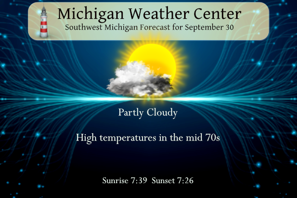
GIVEN THE RIDGE OVERHEAD, WE'LL SEE A GRADUAL WARMING TREND THIS
WEEKEND WITH HIGHS IN THE UPPER 70S TODAY AND LOWER 80S SUNDAY.
WHILE TEMPERATURES WILL BE WELL ABOVE NORMAL, RECORD HIGHS ARE IN
THE MID TO UPPER 80S, EXCEPT FOR 81 AT MKG SUNDAY. THUS, WE'LL
LIKELY BE SEVERAL DEGREES BELOW THE RECORDS.
LONG TERM
(SUNDAY THROUGH FRIDAY)
ISSUED AT 325 AM EDT SAT SEP 30 2023
- UNUSUALLY WARM INTO WEDNESDAY THEN COOLING OFF
INCOMING GUIDANCE CONTINUES TO SUPPORT THE WARMING TREND INTO THE
MIDDLE OF NEXT WEEK. PERSISTENT WARM AIR ADVECTION LINGERS INTO
WEDNESDAY, WHEN THE LOW LEVEL THERMAL RIDGE WILL BE IN PLACE.
ENSEMBLE TEMPERATURE GUIDANCE SHOWS A HIGH LIKELIHOOD FOR MAX TEMPS
REACHING INTO THE 80 TO 85 DEGREE RANGE FOR BOTH TUESDAY AND
WEDNESDAY. A SERIES OF COLD FRONTS PUSH THROUGH FOR THE END OF THE
WEEK. ENSEMBLE TEMPERATURE GUIDANCE TRENDS THE VALUES BACK
CLOSER TO NORMAL VALUES FOR THIS TIME OF THE YEAR FOR THE END OF
THE WEEK.
- POTENTIAL FOR SOME SHOWERS WEDNESDAY NIGHT INTO FRIDAY
THE MID TO UPPER LEVEL LOW OVER THE SOUTHWEST U.S. WILL LIFT OUT AND
WEAKEN AS IT TRACKS INTO THE UPPER PLAINS FOR THE MIDDLE PART OF
NEXT WEEK. HOWEVER TRENDS IN THE MODELS SHOW INCREASING PWAT
VALUES. THUS IT IS LOOKING A LITTLE MORE FAVORABLE FOR SOME SHOWERS
WEDNESDAY NIGHT INTO THURSDAY. WE WILL BUMP UP POPS TO REFLECT THIS
TREND. ANOTHER MID LEVEL WAVE DIGS DOWN FROM THE CANADIAN PRAIRIES
FRIDAY INTO FRIDAY NIGHT. THIS FEATURE WILL GENERATE SOME ADDITIONAL
LIFT SUPPORTING THE POTENTIAL FOR ADDITIONAL SHOWERS. ENSEMBLE QPF
GUIDANCE FROM THE 00Z GFS AND CANADIAN MODELS SUPPORT LIGHT QPF
AMOUNTS WITH THIS SECOND WAVE. THE MODELS ARE SHOWING ENOUGH COOLER
AIR ARRIVING BEHIND THIS WAVE TO SUPPORT LAKE EFFECT SHOWERS SO WE
MAY SEE A WET TREND TO THE FORECAST GOING INTO NEXT WEEKEND.
My weather app shows 6 more above normal temp days in a row! What a stretch of above normal temps! Incredible!
It looks we will see yet another month with above normal temps! This warm pattern has been months on end! What a stretch! Keep it ROCKIN!
Miggy is one of the all time greats. Hard to believe he’s been a Tiger for 16 years. Have fun at the ballpark, Slim.
Super foggy this morning. Zero visibility but the fog is starting to lift. Ground is soaking wet. My lawn is long and overdue for a mow. This week’s weather just didn’t want to cooperate.
Have a great Saturday, my friends. Remember, make someone smile. You never know what someone is going through.
I was just thinking our lawn was getting long too.
Please keep a local family whose child was killed in a farming accident last week in your prayers They are doing his memorial today… I didn’t know the family, but just heartbreaking for them and all involved.
Michael are you headed to Otsego Creative Fest today?
How horrible. Sending prayers up. 🙏
I am sure they appreciate them!! Thanks!!