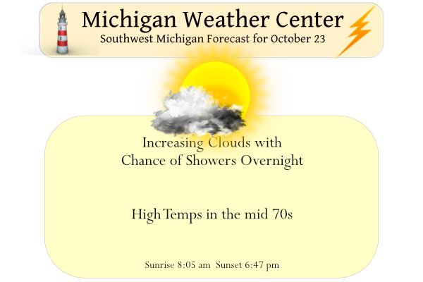
Yesterday we had a high of 77° and the morning low was 47.5°. We can expect another great summer-like day with temps in the 70s before a slight chance of showers moving into the area overnight.
NOAA has come out with their winter forecast, we shall see how this all plays out:
")
Temperature
- The greatest chance for warmer-than-average conditions is in western Alaska, and the Central Great Basin and Southwest extending through the Southern Plains.
- Warmer-than-average temperatures are also favored in the Southeastern U.S. and along the Atlantic coast.
- Below-normal temperatures are favored from the Pacific Northwest eastward to the western Great Lakes and the Alaska Panhandle.
")
Precipitation
- Wetter-than-average conditions are most likely in western Alaska, the Pacific Northwest, northern Rockies, Great Lakes and Ohio Valley.
- The greatest chances for drier-than-average conditions are forecast in portions of California, the Southwest, the southern Rockies, southern Plains, Gulf Coast and much of the Southeast.
- The remainder of the U.S. falls into the category of equal chances for below-, near-, or above-average seasonal total precipitation.
Forecast Discussion
-- Another warm day; scattered showers late tonight --

A deep lee cyclone will emerge from the high plains today, reaching
the Dakotas tonight. With continued southerly low-level flow,
another warm day is in store for Lower MI. Somewhat deeper low-level
moisture (with surface dewpoints in the low/mid 50s F) should allow
for some cumulus development today, but mostly sunny skies are still
expected.

Late tonight, the combination of weak forcing for ascent and PW near
1.2 inches should support scattered showers. Highest PoPs
(chance) will be carried over the western half of the forecast
area, in close agreement with latest HREF probs. RAP profiles
continue to exhibit modest elevated instability, with MUCAPE of
200-500 J/kg for parcels rooted near 750 mb, so a t-storms are
possible. Showers will end Mon morning, with a dry and warm day
thereafter.

-- Rain Tue morning into Wed --

A mid/upper trough will cross the Baja Peninsula this evening, then
phase weakly with a trough over the southern Rockies tonight. Modest
cyclogenesis will occur on Mon as this phased trough approaches a
baroclinic zone in the southern plains. The resulting surface low
will then propagate northeastward, reaching the vicinity of
southern IL/IN by 00z Wed, then the vicinity of IN/OH/MI by 12z
Wed, with EPS and GEFS members still somewhat loosely clustered
around these mean positions.

Ahead of this approaching low, the EPS-mean PW reaches around 1.4
inches by 00z Wed. Expect rain to gradually overspread much of the
the area on Tue as deep-layer QG forcing for ascent (Q-vector
convergence) increases north of the surface low, with one or several
periods of steady rain likely for many areas, primarily between Tue
evening and Wed afternoon. Ensemble probs suggest that some
rainfall amounts of 1+ inch are possible. Rain should end during
Wed afternoon/evening as the system departs northeastward and
subsidence/drying occur.

-- Dry weather Wed night into early Fri --

Ensemble guidance shows broad consensus that surface high pressure
will build into the Great Lakes region on Wed night, then continue
into Quebec by Fri. Meanwhile, EPS and GEFS means suggest that
another upper trough will emerge over the southern Rockies on/around
Thu night, then interact with a baroclinic zone over the southern
plains on Fri. Precip probs have trended lower (shifted southward),
but low-end PoPs will be maintained for Fri afternoon into Sat.
The greenish shaded areas are not the areas that really need the rain/snow, unfortunately.
We will see how the long range CPC guess plays out. In the past they have not done real well. So we shall see.
Slim
We are do for major Blizzard warnings…This Winter INDY
I am reposting this from yesterday
The average last 70 day at both Lansing and Grand Rapids is October 24th so that it looks like this year will be just about average for that to happen. The range at Lansing is from September 15th, 1968, to December 31, 1975. At Grand Rapids the range is from October 1, 1925, to November 31 1931. The winter of 1875/76 at Lansing was a very mild one and while there was a reported 44.4” of snow fall that winter 30.0” of that fell in late March.
Slim
Yesterday was a great late October day here in Grand Rapids with an official H/L of 75/52 there was no rain fall and we had 100% of possible sunshine. It was yet another warm night (for late October) as the low here in MBY was 49 and the official low looks to be 53 at the current time it is 50 here and 55 at the airport with clear skies. For today the average H/L is 58/40 the record high of 83 was set in 1963 and the record low of 19 was set in 1969. The record snow fall… Read more »
Bring on an active winter! I’m ready for one. I could go for a nice blizzard for a change as well but those are pretty hard to get around here it seems.
Watch out, if NOAA is predicting more snowfall than normal for MI a then it could be a winter to remember! Bring it!
There call for last winter was also for a wetter than average winter but we just had average snow fall here last winter.
Slim
Last year was wetter than normal but too much rain! This year it will be SNOW!