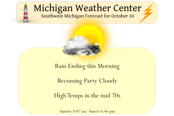
We have some rain moving through the area this morning with chances continuing through the morning hours. We will continue with our warm period today with temps in the mid-70s with a more humid airmass in place. Clouds should break up this afternoon allowing for warmer-than-normal temperatures through tomorrow. Rain moves back into the area for tomorrow and Wednesday.
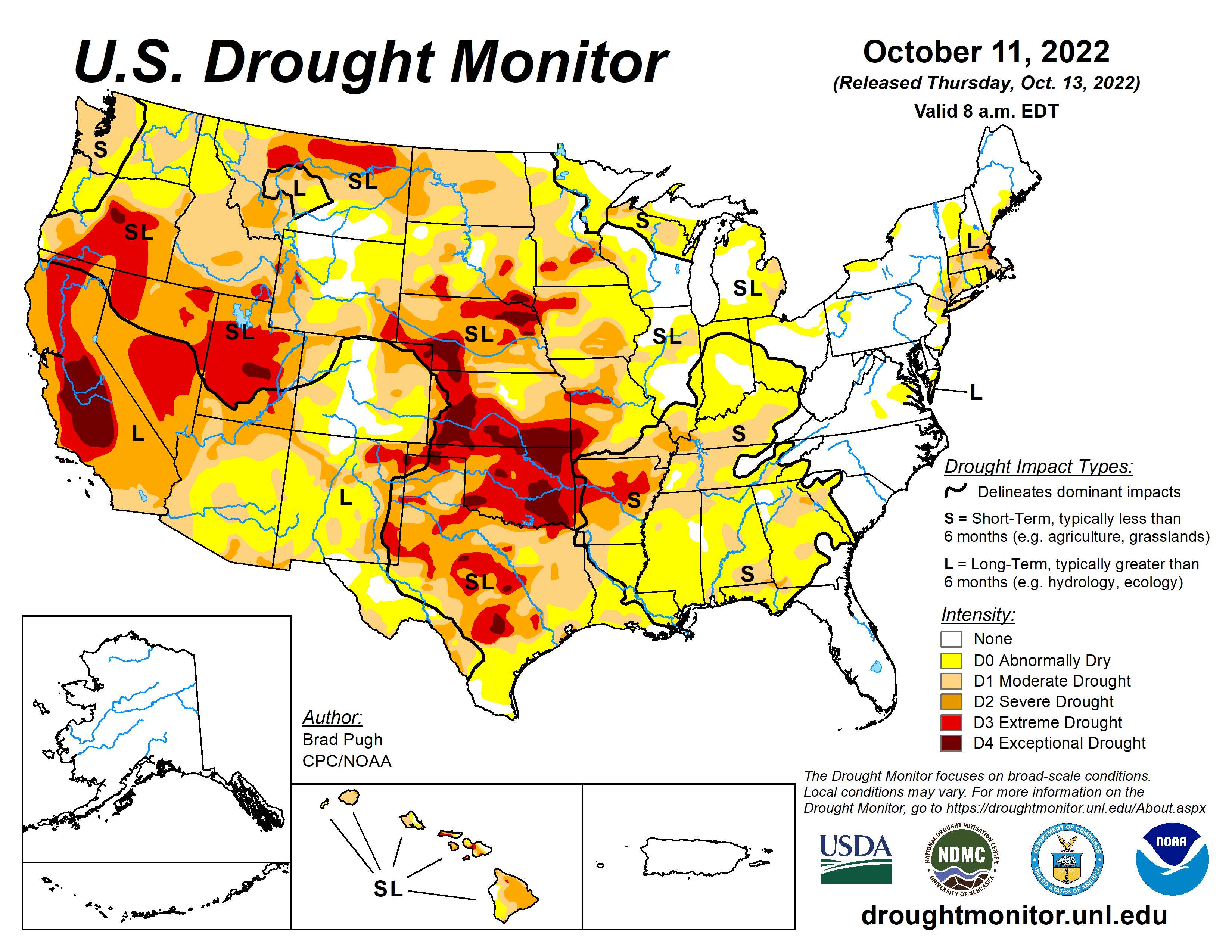
We have been lucky in most of the Great Lakes area to see rain when needed though some regions of Michigan are abnormally dry due to our extended periods of sunny, dry weather. 80% of the U.S. is experiencing drought conditions.
Forecast Discussion
-- Scattered showers this morning, then a dry/mild afternoon --

Showers and a few thunderstorms are ongoing as of 3 AM across
portions of western Lower MI, with additional showers extending
westward into WI and northern IL. This activity is being maintained
by modest forcing for ascent and warm theta-e advection occuring
along the eastern fringe of a low-level jet. Elevated instability
has decreased somewhat from last evening, but RAP profiles continue
to exhibit MUCAPE of 100-300 J/kg for parcels lifted from near 700
mb.

HREF guidance and recent deterministic HRRR runs continue to
indicate that this activity will depart the area later this morning,
with a dry and mild day expected thereafter.

-- Rain Tue morning into Wed --

A frontal boundary and its associated baroclinic zone extend this
morning from a deep cyclone over the Dakotas southward to the
southern high plains. Meanwhile, a digging shortwave trough over
the southern Rockies is undergoing weak phasing with a trough
over northwest Mexico, as evident in recent GOES water-vapor
imagery. In response to the approach of this phased trough, models
continue to indicate that cyclogenesis will occur today along the
southern-plains baroclinic zone. The resulting surface low should
reach southern MO/northern AR at 12z Tue, then the vicinity of
southern Lower MI at 12z Wed.

By daybreak Tue, a broken axis of light rain will likely extend from
northern IL, to eastern WI, and into the U.P. This precip will be
driven by QG forcing for ascent along the stalled north/south-
oriented baroclinic zone, where midlevel confluence/deformation will
contribute to frontogenesis. Models suggest that this rain will make
only slow progress eastward, possibly reaching portions of western
Lower MI late Tue morning to afternoon. More widespread rain is then
expected to develop on Tue evening as deep-layer forcing for ascent
increases with the approach of the mid/upper wave in concert with
continued midlevel deformation/frontogenesis north of the surface
low. Precip will gradually depart eastward through Wed afternoon.

Regarding rainfall amounts during the Tue-Wed period, amounts of 0.5
to 1.0 in should be fairly common across the forecast area. Ensemble
probs of 1+ in are highest in the western/northwestern counties,
with much smaller probs near LAN/JXN.

-- Dry Wed night into Sat; chance of rain Sun --

High pressure will build into the region on Wed night, then continue
toward the eastern Great Lakes by Fri night. Thereafter, global
ensemble means (EPS and GEFS) exhibit broad agreement regarding
the evolution of 500-mb height anomalies into the weekend,
indicating that another trough will dig across the central Rockies
on Thu, with renewed cyclogenesis over the southern plains on Thu
night/Fri. The subsequent track of this system is uncertain, but
some EPS members bring precip northward into the region on Sat
night and Sun. This forecast update will feature PoPs (highest
south) in those periods.
Record high tied at Muskegon. The current reading of 76 ties the record high for any October 24th at Muskegon. It was also 76 in 1975 and 1963. See below for how GR, Holland and Lansing are at the current time. It is now cloudy here so the high may have been reached in GR but maybe not in Lansing.
Slim
The airport is now showing a heat index. In the last week of October??
Wow you are right, 76 with a re-feel of 78 :O
That 76 is the 4th warmest for any October 24th at Grand Rapids. The 77 at Lansing is also the 4th warmest. The 75 at Holland is the 6th warmest.
Slim
It hit 78 at the Lansing airport, which is 21 degrees above average. 20 degrees above or below average doesn’t happen very often.
Looks like GR hit 77, also good for +20 over the average. Good stat for Slim to look up….how many days this year have been 20 or more degrees from average? I think the words that are missing today are “Wow! Just wow!”
9 years ago today we had lake effect snow occurring. I intercepted the snow bands down near Gobles in Van Buren County. The ground was white, roads were slushy and trees were down with power outages due to the leaves still on the trees.
https://www.mlive.com/news/grand-rapids/2013/10/let_it_snow_early_lake_effect.html
For all this talk about a cold October, I believe many parts of Lower Michigan will go above average for the month after today or Tuesday. How can this be?
And looks like the CPC keeps the warmth on for weeks!
I got to see a rainbow in the western sky the entire drive in to Grand Rapids from home almost all the way to 131 this morning. A nice solid 40 minutes of rainbow viewing. Pretty cool
Quite the light show late last night with all the lightning! Lasted for 2 or 3 hours, not a lot of rain, but one of the best light shows of the year. Thunder in the Fall, no snow at all!
The lightning was brilliant. I didn’t know they were calling for that.
Have you seen recent pics of the Mississippi River? It’s shockingly low. 20% of all US agriculture is transported via the Mississippi. Many barges are running aground. It’s no bueno.
I noticed that. I knew it was dry but had no idea it was that bad.
Yesterday was a very nice and warm late October day. The official H/L at Grand Rapids was 75/53 there was a trace of rain fall up to midnight and a total of 86% of possible sunshine. That 75 was the 8th warmest October 23rd on record at Grand Rapids. The overnight low so far here in MBY was a very mild 56 That is the current temperature with partly cloudy skies here. There was a total of 0.13” of rain fall overnight. So far it is a warmer 58 at GRR and they have reported just 0.01” of rain fall… Read more »