The official high at Grand Rapids yesterday was 49 reached at 4:25 AM the temperature fell all day and reached the low of 27 at 11:59 PM. There was 0.35” of ran fall and a trace of snow fall, there was no sunshine. The overnight low here in MBT so far for today is the current temperature of 20 and there is snow falling and I have 2” now on the ground. For today the average H/L is 45/27 the record high of 75 was set in 1894,1903 and 2012. The record low of 5 was set in 1965 and todays record snow fall amount of 5.7” was set in 1965.
March Heat Wave
We generally do not think of the term “Heat Wave” when we think of the Month of March but in March of 2012 we had a very remarkable warm event take place. This was not a one or two day “warm” spell that we sometimes get in March but instead lasted for (at Grand Rapids) for 12 days. It started in earnest on March 14th when Grand Rapids had a high of 80° and for the next 12 days we had temps that would be more like June then March. Reaching a peak on March 21st with a high of 87° In all in that 12-day stretch Grand Rapids had 5 days of 80 or warmer 5 days of 71 or warmer and 2 days in the 60’s
New All-Time Record High Temperatures for March
City New Record High (Date) Old Record High (Date)
Detroit, Mich. 86 (3/22) 82 (3/28/1945)
Lansing, Mich. 86 (3/21) 82 (3/24/1910)
Toledo, Ohio 85 (3/21, 3/22) 83 (3/24/1910)
Bangor, Maine 84 (3/22) 79 (3/29/1946)
Milwaukee, Wis. 84 (3/21) 82 (3/29/1986, 3/31/1986)
Cleveland, Ohio 83 (3/20-3/22) – tie 83 (3/24/1910, 3/25/1945)
Madison, Wis. 83 (3/21) 82 (3/29/1986, 3/31/1981)
Buffalo, N.Y. 82 (3/21) 81 (3/26/1945)
London, Ontario 81 (3/22) 77 (3/30/1998)
Marquette, Mich. 81 (3/21) 71 (3/8/2000)
Ottawa, Ontario 81 (3/21) 80 (3/29/1946)
International Falls, Minn. 79 (3/18) 73 (3/31/1963)
Toronto, Ontario 79 (3/22) 78 (3/28/1945)
Montreal, Quebec 78 (3/21) – tie 78 (3/28/1945)
Caribou, Maine 75 (3/21) 73 (3/30/1962)
Winnipeg, Manitoba 75 (3/19) 74 (3/27/1946)
Quebec City, Quebec 65 (3/21) 64 (3/30/1962)
The ‘Heat Wave’ of March 2012, By the Numbers
32 The gap, in degrees, between the old and new record high on March 21 in Marquette, Mich. The new record high was 81 degrees, obliterating the old record of 49 degrees. The margin of defeat was so great that the 21.2 The temperature departure (in degrees Fahrenheit) from normal for the month of March thus far in Winnipeg, Canada. This occurred despite temperatures having dropped below zero for four days early in the month.
1921 The last year it was above 80 degrees in Boston before March 28 of any given calendar year. In reaching 83 degrees on March 22, this came to fruition for the first time since March 21, 1921.
86 The new all-time record high temperature for March in Detroit, Mich., set on March 22. In fact, a new all-time high temperature was set two days in a row, with the mercury first climbing to 84 degrees on March 21.
60 The average low temperature in Chicago, Ill., from March 17 to March 22 of this year. Such low temperatures, about 30 degrees above normal, are more typical for mid-June.
e low temperature that day was even higher than the old record high temperature
9 The number of consecutive days that Chicago, Ill., has broken a record high, from March 14 to March 22. Eight of those days saw the mercury climb above 80 degrees, which is normal for mid-June.
93 The temperature swing that occurred over the course of just nine days in International Falls, Minn., from a low of minus 14 degrees on March 9, to a high of 79 degrees on March 18. Also, 10 straight days of new record highs (March 13 to March 22).
26 The number of inches of snow that melted over the course of just seven days in Caribou, Maine, from March 15 to March 22, thanks to the unusual warmth. Also, 18 inches of snow was still on the ground when the first record high fell on March 18 (64 degrees).
In Detroit, the mid-March heat wave was enough to vault the month to the top of the list of warmest Marches on record. Not only that, but the records for the most consecutive March days with highs above 60, 70, and 80 degrees were also set.
Of course there was a price for crops to pay as April 2012 ended up close to average and there was a hard freeze on April 29th when the temp fell to 28° causing a lot of damage to crops that year.
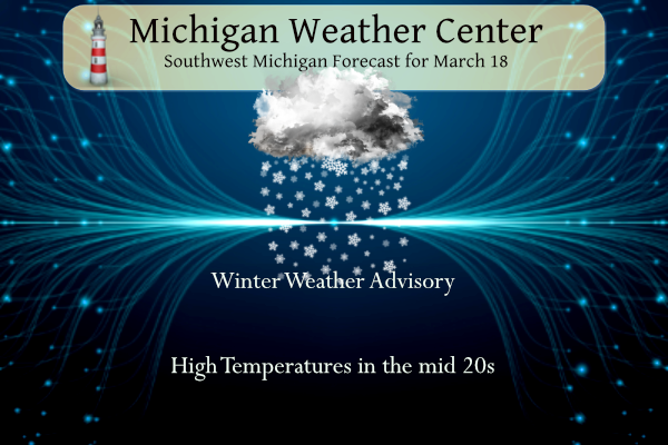
AREA FORECAST DISCUSSION
NATIONAL WEATHER SERVICE GRAND RAPIDS MI
345 AM EDT SAT MAR 18 2023
LATEST UPDATE…
DISCUSSION/MARINE
DISCUSSION
(TODAY THROUGH NEXT FRIDAY)
ISSUED AT 344 AM EDT SAT MAR 18 2023
— BLUSTERY TODAY; LAKE-EFFECT SNOW CONTINUING THROUGH TONIGHT —
INITIAL LAKE-EFFECT SNOW ACTIVITY HAS EVOLVED LARGELY AS EXPECTED AS
OF EARLY SAT MORNING. STRONG LOW-LEVEL COLD ADVECTION IS UNDERWAY,
WITH COLDEST 850 MB TEMPS (AROUND -18C) LIKELY TO TRAVERSE LAKE
MICHIGAN LATER TODAY. WITH LAKE-SURFACE TEMPS OF 2-3C, THE
RESULTING SURFACE-850-MB DELTA-TS (>13C) WILL YIELD SUFFICIENTLY
STEEP LOW-LEVEL LAPSE RATES TO SUPPORT LAKE-EFFECT SNOW INTO
TONIGHT.
CYCLONICALLY CURVED LOW-LEVEL FLOW, ALONG WITH SPEED CONVERGENCE VIA
DIFFERENTIAL (LAKE-LAND) FRICTION, WILL CONTRIBUTE TO BOUNDARY-LAYER
CONVERGENCE/LIFT THROUGH TONIGHT. ADDITIONAL LIFT MAY ALSO BE
PROVIDED BY AN APPROACHING SHORTWAVE TROUGH / VORT MAX PIVOTING
ALONG THE SOUTHERN PERIPHERY OF THE MID/UPPER LOW. THIS IMPULSE IS
CURRENTLY EVIDENT IN WV IMAGERY OVER WI AND APPEARS WELL DEPICTED
IN RECENT RAP MESOANALYSIS.
HRRR TIME-HEIGHT SECTIONS SHOW RATHER IMPRESSIVE CONVECTIVE CLOUD-
LAYER DEPTHS THIS AFTERNOON AND EVENING, WHEN INVERSION HEIGHTS ARE
HIGHEST. LAKE-MODIFIED PARCELS EXHIBIT SBCAPE OF ~40-60 J/KG WITH AN
EL OF ~9 KFT. THE DGZ (-12 TO -18C LAYER) RESIDES ENTIRELY WITHIN
THIS CONVECTIVE CLOUD LAYER, SUPPORTING EFFICIENT CRYSTAL GROWTH VIA
DEPOSITION AND HIGHER SLRS (15-20:1).
SNOW SHOWERS WILL LIKELY MAINTAIN APPRECIABLE INLAND REACH TODAY.
THIS WILL BE AIDED BY STRONG WESTERLY CLOUD-LAYER WINDS (25-30
KTS), ALONG WITH MODEST DAYTIME LAND-SURFACE WARMING THAT WILL
HELP TO FOSTER STEEP LOW-LEVEL LAPSE RATES FAR INLAND. GREATEST
ACCUMULATIONS ARE LIKELY TO OCCUR SOMEWHAT INLAND AWAY FROM THE
LAKESHORE, GIVEN THE AFOREMENTIONED CLOUD-LAYER WINDS.
TONIGHT, QG FORCING FOR SUBSIDENCE SHOULD CONTRIBUTE TO A LOWERING/
SHARPENING OF THE INVERSION, WITH A CONCURRENT REDUCTION IN THE
CONVECTIVE CLOUD-LAYER DEPTH. ACCORDINGLY, AS THE INCREASINGLY
SHALLOW MOIST LAYER BECOMES SEPARATED FROM THE OVERLYING DGZ, LAKE-
EFFECT SNOW ACTIVITY SHOULD LARGELY DISSIPATE BY DAYBREAK SUN.
NO CHANGES TO THE EXISTING WINTER WEATHER ADVISORY ARE PLANNED WITH
THIS UPDATE. SNOW AND BLOWING SNOW WILL CONTRIBUTE TO SLIPPERY
ROAD CONDITIONS TODAY AND TONIGHT, AND QUICK DROPS IN VISIBILITY
ARE POSSIBLE IN THE HEAVIEST BURSTS OF SNOW.
— DRY ON SUN —
MODELS INDICATE THAT THE MID/UPPER LOW OVER THE REGION TODAY WILL
CONTINUE EASTWARD INTO QUEBEC ON SUN WHILE A MIDLEVEL SHORTWAVE
RIDGE APPROACHES THE GREAT LAKES. SUBSIDENCE/DRYING, ALONG WITH
WARMING 850-MB TEMPS, SHOULD ALLOW FOR APPRECIABLE AFTERNOON
SUNSHINE ACROSS THE AREA.
— SLIGHT CHANCE OF RAIN/SNOW ON MON EVENING INTO TUE —
NUMEROUS EPS AND GEFS MEMBERS PRODUCE LIGHT PRECIP DURING THIS
PERIOD IN ASSOCIATION WITH A LOW-AMPLITUDE SHORTWAVE DISTURBANCE.
THERMAL PROFILES SUPPORT RAIN AND/OR SNOW, BUT OVERALL AMOUNTS ARE
FAVORED TO BE LIGHT AND COVERAGE WILL LIKELY BE LIMITED.
— PRECIP LIKELY TUE NIGHT AND WED, MAINLY RAIN —
THE DETERMINISTIC GFS AND ECMWF SOLUTIONS SUGGEST THAT A LEE CYCLONE
WILL ORGANIZE OVER CO ON TUE, THEN EMERGE NORTHEASTWARD, REACHING
THE VICINITY OF MN/WI ON WED MORNING. NORTHWARD MOISTURE TRANSPORT
OCCURRING EAST OF THIS LOW SHOULD RESULT IN PW INCREASING TO NEAR
0.6″ (EPS MEAN) OVER THE FORECAST AREA BY WED MORNING. THIS
MOISTURE, IN CONJUNCTION WITH FORCING FOR ASCENT ACCOMPANYING LOW-
LEVEL WARM ADVECTION, SHOULD SUPPORT LIGHT PRECIP OVER MUCH OF THE
FORECAST AREA. THERMAL PROFILES SUGGEST THAT RAIN IS FAVORED.
— ACTIVE WEATHER LIKELY CONTINUING FOR THU-SAT —
EPS AND GEFS MEANS SUGGEST THAT A VIGOROUS MIDLEVEL LOW/TROUGH WILL
REACH THE CA COAST ON TUE, THEN ADVANCE ACROSS THE INTERMOUNTAIN
WEST ON WED. AHEAD OF THIS FEATURE, A SURFACE LOW OR FRONTAL WAVE
MAY EMERGE INTO THE PLAINS ON WED NIGHT, WITH ASSOCIATED PRECIP
PERHAPS REACHING THE AREA ON THU. THIS MAY BE FOLLOWED BY THE
DEVELOPMENT OF A DEEPER PLAINS CYCLONE ON THU OR FRI, WITH
ADDITIONAL PRECIP POSSIBLY AFFECTING THE AREA INTO SAT. HOWEVER, THE
TIMING OF THESE PRECIP EPISODES AND THE ASSOCIATED PRECIP TYPES/
AMOUNTS IS YET UNCERTAIN, AND WILL LIKELY BE SENSITIVE TO
FRONTAL/SURFACE-LOW POSITIONING.
Detailed Forecast For Grand Rapids
Overnight
Snow showers. Steady temperature around 19. West wind around 17 mph, with gusts as high as 28 mph. Chance of precipitation is 90%. Total nighttime snow accumulation of less than one inch possible.
Saturday
Snow showers. Patchy blowing snow before 1pm, then patchy blowing snow after 2pm. High near 25. Wind chill values as low as zero. Breezy, with a west wind 17 to 21 mph, with gusts as high as 33 mph. Chance of precipitation is 90%. New snow accumulation of around 2 inches.
Saturday Night
Snow showers likely, mainly before 2am. Patchy blowing snow before 7pm. Mostly cloudy, with a low around 21. West northwest wind 14 to 16 mph, with gusts as high as 25 mph. Chance of precipitation is 60%. New snow accumulation of around an inch possible.
Sunday
Mostly sunny, with a high near 34. West wind 10 to 18 mph, with gusts as high as 28 mph.
Sunday Night
Clear, with a low around 30. West southwest wind 11 to 14 mph, with gusts as high as 23 mph.
Detailed Forecast For Muskegon
Overnight
Snow showers likely. Cloudy, with a steady temperature around 22. Breezy, with a west wind around 20 mph, with gusts as high as 28 mph. Chance of precipitation is 70%. Total nighttime snow accumulation of less than one inch possible.
Saturday
Snow showers. Patchy blowing snow after 2pm. High near 27. Breezy, with a west wind around 22 mph, with gusts as high as 32 mph. Chance of precipitation is 80%. New snow accumulation of around an inch possible.
Saturday Night
Snow showers likely, mainly before 2am. Patchy blowing snow before 7pm. Mostly cloudy, with a low around 24. Blustery, with a northwest wind 16 to 20 mph, with gusts as high as 31 mph. Chance of precipitation is 60%. New snow accumulation of around an inch possible.
Sunday
Mostly cloudy through mid morning, then gradual clearing, with a high near 37. West northwest wind 14 to 18 mph.
Sunday Night
Mostly clear, with a low around 33. Breezy, with a west southwest wind 17 to 20 mph, with gusts as high as 31 mph
Detailed Forecast For Lansing
Overnight
A 50 percent chance of snow showers. Mostly cloudy, with a steady temperature around 26. West wind around 17 mph, with gusts as high as 28 mph.
Saturday
Snow showers likely, mainly after 8am. Mostly cloudy, with a high near 26. Breezy, with a west wind 18 to 21 mph, with gusts as high as 31 mph. Chance of precipitation is 70%. New snow accumulation of less than one inch possible.
Saturday Night
A 30 percent chance of snow showers before 2am. Mostly cloudy, with a low around 20. West wind 14 to 18 mph, with gusts as high as 29 mph.
Sunday
Mostly sunny, with a high near 37. West wind 13 to 17 mph, with gusts as high as 25 mph.
Sunday Night
Clear, with a low around 27. West southwest wind 13 to 15 mph, with gusts as high as 25 mph.
Nearly 110 inches of snow! I love long winters! Is winter dead yet! Wow to the wow, WOW!
Today was the kind of day that if you could stay in you should. Roads were too slick and white outs made it treacherous. It would be snowing so hard you couldn’t see and the sun would come out and snow would stop for a couple of minutes. Looking forward to better weather tomorrow. It sure is going to warm up nice as the week goes on.
Over 6 inches out in my hood tonight and the snow is still coming down this easy could of been a Winter storm warning today great scotty!! INDY
Good call on the WWA! Incredible cold and snow today.
The roads were horrible and people need to slow down and stop tailgating!!
Agreed! People need to slow down for conditions as well. Everyone is in such a hurry nowadays!
I can‘t wait till next week when mookie and Andy will say “winter is dead “! The same thing they have said for about the last 6 weeks! Basically they say winter is dead and a few days later we are in a WWA for accumulating snow! This has happened for weeks on end! Keep it coming baby! Incredible!!
Ck this out! Is winter dead yet?
https://www.pivotalweather.com/model.php?m=ecmwf_full&p=sn10_acc-imp&rh=2023031812&fh=240
Freeway closed in both directions here at Portland. 50+ vehicles involved. Be careful driving out there.
Man I wish we could have rainbows with snow we would’ve had so many rainbows today.
GGR is getting absolutely plastered with Snow! Wow just wow, Wow! Incredible!
The Wow to the Wow, WOW! Winter continues to roll on!
Incredible record breaking winter and the snow just keeps coming and coming! Keep the rock n roll winter rolling!
Sunny one minute and then cloudy with snow flurries. Lake effect is pretty cool. We had a dusting early this morning but it quickly melted. Nothing is sticking here and we have no snow on the ground. It certainly is blustery.
What a storm, what a winter! Let’s keep the party rolling!
Getting a snow shower here at the current time . There is now 3″ of snow on the ground here.
Slim
Looks like winter storm conditions here in this snow band. We should be topping 20” for March (and we had almost 30” in November, so definitely a front/back loaded winter)
I would imagine top 5 for most snowfalls ever?? Winter of 2022 2023 yeahhh!! INDY
Before today’s snow fall Grand Rapids with 105.2″ was in 4th place. 107.0″ in 2007/08 is in 3rd place. At this time it looks like GR will end up with the 3rd snowiest winter season. But there will be one or two posters that will tell you how short this winter has been. It was a very mild but snowy winter and will end up being around 130 days long.
Slim
Great facts always Slim thank you ….INDY
Wow to the wow! The snow just keeps coming and adding up and up!!
Roads are terrible outside stay home if need be .. Cars sliding off everywhere.. Wow …INDY
White out conditions currently in my hood …wow to the wow ….INDY
Wow the snow is really coming down at my house and blowing. Looks like mid January.
It feels like 2 degrees here currently, on March 18! Honestly it feels colder than most of our days from Jan-Feb this year
15 degrees and snowing the Winter thats never ending lol….Hekoo January… more record snowfall happening this is not a short winter by the way…INDY