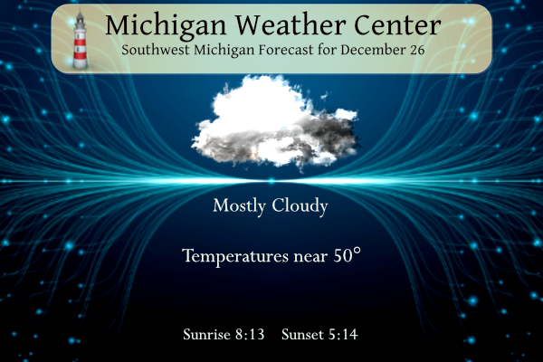
I hope everyone enjoyed their warm Christmas. We reached 58° in Otsego! I think our high today will be 53° which we had at midnight before dropping off into the 40s as the day progresses. Any light showers this morning will be moving out of the area. Our rainfall total was .15 of an inch overnight which brings our total for the month to 2.51 inches.
Forecast
Weather History
1985: Muskegon sets a daily snowfall record of 14.4 inches during a long stretch of snowy weather. The monthly total for December is 57 inches.
2001: A foot of lake effect snow piles up at Grand Rapids as a week-long snow blitz drops about 4 feet of snow at Grand Rapids.
On December 26, 2016, Detroit, Flint, and Saginaw set record highs of 57, 56, and 54 respectively.
Also on December 26, 2012, a large Gulf low lifted northeast along the Appalachian Mountains and clipped southeast Michigan bringing a widespread accumulating snowfall to the area. By the following morning, 4″ to 7″ had accumulated across the southeast half of the area, with higher amounts of 14″ in Lakeport and 11.1″ in Port Huron. Detroit and Flint measured storm total accumulations of 6.2″ and 5″ respectively. Further northwest, Saginaw received a glancing blow and measured only 1.5″.
Also on December 26, 1914, the overnight temperature plummeted to -12 degrees in Saginaw, which is 30 degrees below the average overnight temperature!
U.S.A and Global Events for December 26th:
December 26, 1776:
George Washington crossed the ice-clogged Delaware River. He marched on Trenton in the midst of snow and sleet thus surprising and capturing many of the British garrisons.
December 26, 2004:
A magnitude 9.1 earthquake near Sumatra, Indonesia generated a tsunami that caused tremendous devastation throughout the Indian Ocean. The quake, which is the third largest in the world since 1900, caused severe damage and casualties in northern Sumatra, Indonesia, and in the Nicobar Islands, India. The tsunami that followed killed more people than any other tsunami in recorded history, with 227,898 dead or missing. The total estimated material losses in the Indian Ocean region were $10 billion, and insured losses were $2 billion.
Forecast Discussion
- Lingering morning showers -

KGRR radar trends early this morning show steadier showers will
soon be exiting our far nne fcst area with scattered light rain
showers across the rest of our area. The 00Z HREF and a consensus
blend of higher res short range guidance suggests scattered light
rain showers will linger this morning before tapering off later
today. Unseasonably mild conditions will continue today with high
temps in the upper 40`s to middle 50`s over our eastern fcst area.

- Tranquil weather tonight and Wednesday -

Rather tranquil wx is forecast tonight and Wednesday with isolated
light rain showers over our eastern fcst area this evening. Drier
air will gradually advect into the boundary layer overnight as
winds veer to the west to nw. This in conjunction with light
boundary layer mixing will inhibit fog from dense or widespread
fog from forming. Then for Wednesday high temps will reach the low
to mid 40`s with mostly cloudy conditions and weak nw flow caa.

.LONG TERM...(Wednesday night through Tuesday)
Issued at 300 AM EST Tue Dec 26 2023

- Rainy Thursday -

On Wednesday precipitation chances will spread southwestward beneath
a pivoting upper deformation zone. There is a signal for brief light
freezing rain across far southwest Lower Michigan at the leading
(south) edge of the precipitation shield; however, this should have
little if any impact as any freezing rain quickly gets subsumed by
the larger area of rain with increased precipitation rates. Highs
Thursday in the lower 40s make a rain/snow mix even less probable
compared to just rain. As noted previously, precipitation
accumulations during this time will be light, probably staying below
a tenth of an inch for the most part.

- Impacts not expected into early next week, details unclear -

Nothing to add to the previous discussion. The most we would expect
at this point is a dusting of an inch or two of snow along the
lakeshore at some point from late weekend into early next week. This
would bring minimal, if any, impacts.

We are looking at northwest flow aloft with lower tropospheric
temperatures for the most part remaining a tad too warm to support
lake effect snow. Cluster analyses are unable to discern any
meaningful signals for this timeframe. This is likely due to the
fact that, as mentioned previously, any weather-makers would be
associated with clipper systems dropping southeastward in the upper
flow. Positional certainty with any of these features will likely
remain low for a while longer, which probably explains the
persistent smeared out clustering we`ve been seeing. Deterministic
model runs are not going to be much help either; we note significant
swings in control run solutions through several of the past
iterations of the GFS, Canadian, and ECMWF ensembles.
I believe constantly posting links to the cpc is too funny!
Good news…..the teleconnectors are still trending towards cold and snow as we move into January! Stay tuned for later updates!!!
I believe the CPC still shows warm temps and no snow well into January!
I believe wishcasting for winter to last more than a few weeks is pretty funny!
I believe some of the best winters start in January and last right into Spring with snow in April! Late start and late finish = awesome! Bring it!
I believe the best winters start in mid January and last for a few weeks just like this year! We’re at 3 inches of snow TOTAL for this winter so far LOL!! With no change in sight! WOW!!!
I believe the winter of 2022-23 will go down as a top three snowfall season for GR! Many history making snowfall events last year! It was an incredible season for snowfall! Wow!!
I’m keeping a eye eyee on around the 10th of January pretty good storm system maybe close! Some interesting models out there showing it off!! INDY
What? We will have a snowstorm this year? Some of the warm weather nuts said winter is cancelled this year! I know, total delusion!
I believe 2023 will be our 4th warm year in a row!
+7.7 degrees above average for December so far. Woah!
I’m hoping we avoid any arctic air through mid-January. The running conditions have been amazing! Along with not having to drive on ice. I’m sure by January 15-20th it will inevitably be cold, but I can’t complain
Not sure how I feel about weeding in December… 😂
I might have to mow my lawn!
Love the title of the recent post: Last Warm Day! WOW, just wow, WOW!
The pattern is changing! Get ready ! Incredible!
Mid 30’s for highs by the weekend and beyond! Forget these above normal temps! I love it!
Mid 50’s and no snow – certainly not a cold winter as some on here were hyping! Bring on some more warmth!!!!!
We are in the middle of a long warm pattern and no snow in sight! What could be better?
End of December 50’s! The warm pattern is locked in and before you know it Spring will be rocking!
Someone forgot to get more propane for the blowtorch because it’s starting to go out Lol! Bring on the colder temps and snow!
Great to see the above normal temp pattern will be ending soon! Bring on the Snow!!!
Slow slip in temps after today! Incredible!
Merry Christmas Mv’s Best!! I hope the weekend was a good one for all of you!! Still waiting on the big turn to some good Winter weather around here heading to Boyne in couple weeks should be interesting!!!! Have a great day and Go Blue!!! INDY
Good to hear from you Indy! Yes the big turn to cold
and snow will be fun, unless you are a warm weather fanatic living in fantasy land! Yes, go BLUE!
I hope everyone had a very Merry Christmas. At Grand Rapids with a H/L of 57/47 the low of 47 set a new record for the warmest minimum for December 25th and the mean of 51 was the 2nd warmest for the day. At Muskegon the high of 59 was the 2nd warmest and the low of 49 was the warmest minimum. At Lansing the high of 54 was the 6th warmest and the low of 46 was the warmest. For today the average H/L is 34/22 the record high of 61 was set in 2019 and the record low… Read more »
A blowtorch December with still no significant snow or cold in sight! What could be better?