We close out the winter that wasn’t today. With the exception of a couple of weeks of snowy conditions this winter turned out to be rather mundane. We had 29 inches of snow in Otsego and the coldest temperature was -8° on the early morning of January 13.
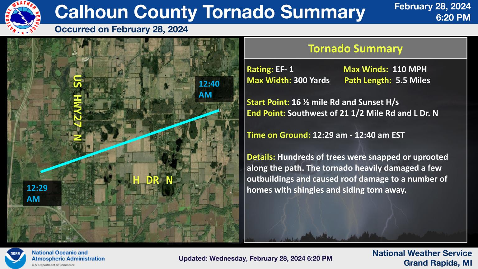
We have confirmed 1 tornado occurred in the early morning hours of Feb. 28. An EF1 tornado occurred near Marshall in Calhoun County with 110 mph winds.
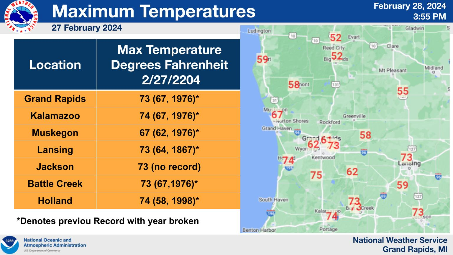
Warm air advection out ahead of the approaching weather system caused record high temperatures across southern Michigan yesterday February 27th, 2024 Some of these record temperatures broke 70 degrees which in Grand Rapids had never been recorded before.
NWS Forecast
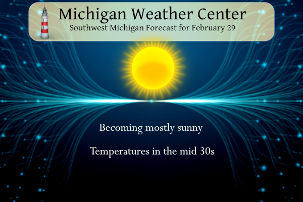
The area will see high temperatures only in the 30’s today with skies becoming mostly sunny. A warming trend is expected over the weekend as a south to southwest flow develops and persists, possibly into Monday. Overall the pattern looks dry through the weekend.
Weather History
1884: It is the coldest Leap Day on record in Lower Michigan with Lansing falling to 15 below zero and Detroit to 6 below.
2000: Leap Day record highs include 63 degrees at Muskegon, 60 at Lansing, and 58 at Grand Rapids.
2008: A Leap Day snowstorm drops 4 inches of snow at Grand Rapids, bringing the monthly total to 41.6 inches, the snowiest February on record.
1884: San Diego, California, saw its wettest February in history with 9.05 inches. February 1884 is currently the third wettest month on record (wettest: 9.26 inches in 12/1921). The year 1884 ended as the wettest in San Diego’s history with 25.97 inches.
1964: Thompson Pass in Alaska finishes the month with 346.1 inches of snow, the highest monthly total ever for Alaska.
2008: The world’s tallest snowman, actually a snowwoman, is unveiled in the western Maine town of Bethel. “Olympia,” named for Maine Senator Olympia Snowe, is about 122 feet tall, 10 feet taller than “Angus, King of the Mountain,” which has held the tallest snowman record since 1999. He was named for Angus King, Maine’s governor at the time.
2012: A tornado outbreak occurred across the central plains and the Ohio River valley region on the 28th and 29th. The most destructive tornado struck Harrisburg, Illinois, killing 8 people in one neighborhood. This tornado had EF4 strength with winds of 166 – 200 mph.
Forecast Discussion
- Mainly dry through early next week with warming temperatures

We are seeing the lake effect cloud cover and snow showers gradually
diminishing over time this morning across the entire area. There are
just a few narrow bands of cloud cover present, with a few flurries
remaining mainly along the U.S.-10 corridor. Plenty of clearing is
present between the narrow bands of clouds.

The trend for clearing should only continue through the day today.
The upper wave/cyclonic flow aloft is lifting out of the area early
this morning. This will allow a strong upper ridge/anti-cyclonic
flow aloft to build over the area. This will lead to strong
subsidence, which is combining with the dry low level air in place
with dew points in the single digits F. The other nail in the coffin
for the lake effect are low level temperatures quickly moderating
from the negative mid teens C this morning, to near 0C this evening.

There will be one fly in the ointment that will prevent long term
clearing, and maybe dry weather going into the weekend. That will be
a short wave that is across southern AZ this morning. This short
wave is forecast to lift NE and will travel just south of the area
by late Friday afternoon. There will be an increase in cloud cover
with this feature, especially across the south on Fri. A light
sprinkle/shower can not be completely ruled out across the I-94
corridor late Friday afternoon. It does look like just about all of
the pcpn with it should stay south of the area. This wave just
doesn`t have a good Gulf feed of moisture into it.

- Turning unseasonably warm into early next week

The models continue to show deep warm air advection over the weekend
and into Monday.  Looking at 925 mb temps, they rise from 4 deg C
Saturday, to 9 deg C Sunday and 13 deg C Monday.  Mixing to that
level supports max temps generally 50 to 55 Saturday, and into the
60s for Sunday and Monday. Ensemble max Temp guidance supports 60s
for both Sunday and Monday. Min temps Sunday night are forecast to
drop only into the upper 40s to low 50s, which would be roughly 25
to 30 degrees above normal. Monday does look like the warmest day
and we could make a run at record levels at several locations. Here
are the current Monday record high temps, MKG 62, GRR 66, LAN 64,
BTL 69, BIV 72 and AZO 72.

- Showers Possible Later Monday into Tuesday

There is still a lot of spread in the ensemble qpf guidance during
this period as a weakening cold front moves in.  Trends support less
of a chance for rain Monday as the front had trended slower.  If the
cold front passes through Monday night, there will be less of a
chance for storms as any instability steadily diminishes.   With the
front in the area Tuesday, there will be a potential for showers and
ensemble qpf guidance supports this scenario.
I would consider the nine-day stretch in January the only true, legit winter-like weather this season. It’s been one of the easiest, if not the easiest winter I can remember. Looking ahead, the clocks will spring ahead in ten days.
Yes… any snow that might come along wouldn’t stay long…words my Dad always said.
Here comes spring! Winter has been dying as I said 5 weeks ago!
Happy Leap Day. The official H/L yesterday at Grand Rapids was 56/20 that 56 was just after midnight. The was 0.09” of precipitation and 0.02” of snowfall. There was no sunshine. Here in MBY there were several snow showers and at times the ground was covered but it do not stay on the ground long. For today the average H/L is 38/23.
Slim
All of the records are for February 29th the record high is 58 set in 2000 the record low of -2 was set in 1980 the record rain fall of 0.58” fell in 2012 the record snowfall of 4.1” fell in 2008. The most snow on the ground for February 29th is 10” in 1912. On the last leap day in 2020 the H/L was 33/17.
Slim