This has been a rather dreary month with about 9% sunshine, we had some sun leaking through the clouds after 4 pm yesterday. All the cold air has moved back into northern Canada and Alaska with some areas 40 to 50 below zero. With a blocking pattern setting up in the CONUS we will see temperatures above normal and precipitation below normal into a least the first couple weeks of February. We do have better chances of seeing more sunshine during this period.
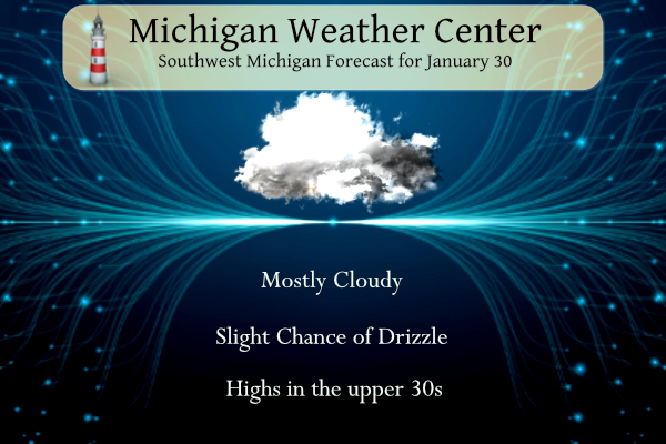
Forecast
Weather History
1951: A huge arctic high pressure center moves south from Canada all the way to the Gulf of Mexico and brings snow to Florida. Temperatures fall to record lows in Lower Michigan. Grand Rapids sets their all-time record January low of 22 degrees below zero. Baldwin, Michigan plunges to 37 below zero.
2008: Rain changes to snow as an arctic cold front brings a flash freeze to lower Michigan during the night of the 29th, leaving a sheet of ice on the roads. Temperatures fall from the upper 40s to the single numbers, with occasional blinding white-out conditions in falling and blowing snow. There were numerous traffic accidents and some roads were closed for a time. School and event cancellations were widespread, and there were also sporadic power outages.
2019: Arctic air combined with strong winds gusting over 30 mph to bring dangerously cold wind chill temperatures of 20 to 40 below zero. Actual air temperatures remained below zero through the entire day across much of Lower Michigan with a 2 pm temperature of 12 below zero at Kalamazoo.
On January 30, 2019, a record cold snap began across the region with Detroit, Flint, and Saginaw seeing high temperatures of 1, 2, and 4 respectively, which broke the daily low maximum temperature records at each site. Temperatures bottomed out well into the negative teens overnight.
On January 30, 2014, the last accumulating snow of the month fell. Amounts were less than one inch, but it pushed the record monthly snowfall totals to 39.1 inches in Detroit and 32.9 inches in Flint. It was the snowiest single month on record for both locations. The monthly total in Saginaw was 15.6, which was still good for its 20th snowiest January.
Also on January 30, 2012, all three Southeast Michigan climate sites saw temperatures soar to new daily record high temperatures. Saginaw, Flint, and Detroit respectively recorded highs of 56, 58, and 62 degrees.
Also on January 30, 1951, Flint had a record low of -16 degrees for this day.
U.S.A and Global Events for January 30th:
1607: The Bristol Channel floods in England resulted in the drowning of many people and the destruction of a large amount of farmland and livestock. Recent research has suggested that the cause may have been a tsunami. Cardiff was one of the most badly affected towns, with the foundations of St. Mary’s Church destroyed.
1954: A tornado touched down near White Point Beach, Nova Scotia. A great deal of hail and lightning was reported along the coast near Liverpool, Nova Scotia.
1966: The Blizzard of 1966 impacted New York and paralyzed the region. The train service was disrupted. Numerous highways, the New York State Thruway from Albany to the Pennsylvania state line, and the Buffalo Airport and other airports throughout western and central New York were closed. The Syracuse-Oswego area’s hardest hit, where Bob Sykes, a meteorology professor at the State University of New York at Oswego, reported a whopping 102.4 inches! Some schools in Orleans County were closed for the entire week following the blizzard. Economic loss from the storm was estimated at $35 million. Winds gusting to 60 mph and temperatures in the teens, and heavy and blowing snow created severe blizzard conditions. Click HERE for more information from Syracuse.com.
2002: One of the driest Januarys on record in Iowa was broken up by a winter storm that produced snowfall across the state from January 30-31. The snow was heaviest across southern and southeastern Iowa, where storm total accumulations ranged between 11 and 13 inches along and south of Chariton’s line through Ottumwa to Wapello and Burlington. The highest reported totals were 13.2 inches at Leon and 13.0 inches at Bloomfield and Fairfield.
Forecast Discussion
-- Quick shot of wintry road conditions this morning --

True to earlier guidance, the narrow band of precipitation from
isentropic lift ahead of the shortwave trough has steadily
become a little heavier and more effective at reaching the
ground as it moves east. P-type remains a little tricky to nail
down given temperatures on the margins of 32 degrees from the
ground to 5,000 feet, though mPING reports from Mount Pleasant
and obs from NWS-GRR indicate there is some sleet (or partially
melted and refrozen snow) mixing in at the onset. Expecting it
to be cold enough near and east of US-131 for mainly snow, and
quick accumulations around an inch or two remains possible
southeast of Battle Creek and Lansing by late morning. Can`t
rule out a little freezing rain mixing in either. Road
temperatures are close to 32 so a slick and slow morning commute
is likely south/east of Grand Rapids.

As the low passes through during the middle of the day, the
loss of mid-level moisture, featuring dry air in the DGZ and
really anywhere colder than about -5C, will limit precipitation
to drizzle or sporadic light showers. May have to keep an eye
for fog development this evening in south-central Michigan as
winds go light and stratus clouds are trapped not far off the
ground.

-- Seasonably mild and possibly some sunshine later this week --

Beyond midweek, expectations are for milder than normal
temperatures to continue along with a growing probability for
sunshine to finally exert itself by late this week right on
through the weekend. The upper level pattern closely resembles
an omega block by Friday into Saturday as upper heights build
across the Great Lakes, buffered by longwave troughing and
possible closed lows across the eastern and western CONUS. A
transition to a Rex block looks likely as the western CONUS
upper low undercuts the Great Lakes upper high by late in the
weekend and leads to a stormy pattern across the southern U.S.,
typical of strong El Nino winters. What this translates to for
us is an extended period of dry and tranquil conditions
beginning midweek. Given the upper pattern and low level wind
trajectories, we will likely stay dry for many days and
prospects for sunshine look very good Friday through the
weekend. Ensemble sky cover guidance as well as the NBM favor
this scenario unfolding.
This was mentioned below, but the 8 day outlook looks more like early-mid March than mid-winter. Hopefully we get lots of sun!
The fog has really rolled in here on the NW side of GR.
Slim
El Nino update:
https://www.mlive.com/weather/2024/01/el-nino-warmth-in-michigan-how-long-will-it-last.html
I would agree the worst of winter probably past us
Slim
Wasn’t yesterday the coldest day of winter (on average)?
I think you are right, January 29th is for the past 30 years. Used to be about a week earlier with the old records.
Hey Slim, wondering if there will be some good aurora opportunities coming up soon? I guess there have been some major solar storms on the sun the past couple of days.
There might be a chance later in the week but don’t count on it.
https://spaceweather.com/
Slim
Michael,
Saw the sun for a little bit before it went down. I still have some lights outside… just too dark too early still.
WOOD now has 7 out of the next 8 days 40-45 degrees. Blowtorch warning remains in effect!
The 10 day is still looking excellent too!
https://weather.com/weather/tenday/l/b523690bfd952b86fef3627c919dd9855281a8da16b83c10bdd381c64ae12cbc
If traveling east of lansing man lookout. These freeways are solid ice. Total mess.
It sure snowed hard for a short time last night. I picked up about an inch in probably about a half hour. Roads have icy spots this morning and ground and trees have a fresh layer of white
Just rain with snow mixed here. No new snow on the ground here. At this time it is 35 with some mist.
Slim
I went out for a nice walk outside yesterday. While most of the snow now gone I noticed that there are daffodils starting to pop up. Remember it is still only January
Slim
The official H/L yesterday at Grand Rapids was 35/31 there was no rain/snow before midnight. You might have missed it but there was 6 minutes of sunshine good for 1%. The average H/L for today is 31/17 the record high of 54 was set in 2013 the record low of -22 was set in 1951. The record snowfall of 5.5” fell in 1900. The most snow on the ground was 22” in 1978. Last year the H/L was 24/10 there was 0.6” of snowfall and there was 7” on the ground.
Slim