The Lions won the first half of yesterday’s final game and lost the second half, ultimately the game. We could go through many of the ‘what ifs’ of the game, however we should be satisfied knowing they had a great season. So, hold your heads high gentlemen, you provided us with a lot of excitement and entertainment this year.
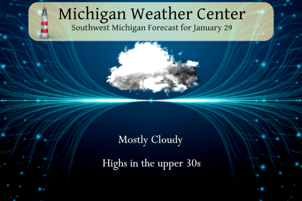
We will see mostly cloudy skies today with highs in the upper 30s. A light mix of rain and snow is possible on Tuesday with little to no impact on travel.
Forecast
Weather History
1909: A snowstorm dumps from 6 to 10 inches of snow across southern Lower Michigan.
1966: A week-long cold snap reaches its nadir as temperatures fall to record lows of 16 below zero at Grand Rapids and 12 below at Muskegon.
On January 29, 2023, a winter storm brought heavy snow (up to an inch per hour for several hours) to the Tri-Cities where snow totals of 6 to 8 inches were observed.
On January 29, 2018, widespread accumulating snow fell over Southeast Michigan. Most locations saw 1-5″, but a very narrow band of heavy snow developed along a line from Perry to Durand to Flint. Ten inches of snow was observed at Flint, making it the 16th largest snow in its climate record.
On January 29, 1947, 1.32 inches of rain fell in Flint!
U.S.A and Global Events for January 29th:
1921: A small but intense windstorm resulted in the “Great Olympic Blowdown” in the Pacific Northwest. Hurricane-force winds funneled along the mountains downed vast expanses of Douglas fir trees, and the storm destroyed eight billion board feet of timber. Winds at North Head, WA, gusted to 113 mph. On January 31, 1921, the International News Services reported from Aberdeen, Washington, “It is reported that thousands of dollars in damage was done to buildings and storms in Aberdeen and Hoquiam. The wind velocity was estimated at from 125 to 150 miles an hour. Four steel smokestacks reaching almost 200 feet into the air were the first to collapse before the terrific onslaught of the gale. The giant chimneys crashed down on dwellings crushing them like houses of cardboard.” Click HERE for more information from the Office of the Washington State Climatologist.
1947: On this date through the 30th, a fierce winter storm buried southern Wisconsin under two feet of snow. Strong northeasterly winds piled drifts up to 10 feet high in the Milwaukee area, shutting down the city for two days. Click HERE for more information.


2002: A major three-day winter storm blasted parts of Kansas and Missouri. A catastrophic ice storm occurred south of the snow area, with two inches of ice and snow accumulating in the Kansas City, Missouri area. Thousands of trees were felled by the storm, blocking roads, felling utility lines, and causing fires. Two “Bicentennial Trees,” estimated to be over 200 years old, were badly damaged by this storm. After the 31st, 325,000 people were reported without power in Kansas City alone. Click HERE for pictures of this winter storm from Fox4kc.com.
2008: A sharp cold front moved across Illinois during the day, producing a drastic temperature drop. Temperatures fell 20 to 40 degrees in just a couple of hours, with areas from Springfield, Illinois to St. Louis, Missouri seeing temperatures fall as much as 50 degrees between noon and 6 pm. Temperatures in the mid-60s in central Illinois at midday on the 29th had fallen to near zero by the next morning.
Forecast Discussion
- Rain and Light Slushy Snow Tonight Through Tuesday

The rain and fog has moved out of the area, but we remain stuck with
widespread low clouds over the area. There was some hope that we may
at least partially clear out this afternoon with high pressure
moving through. However, the models showing the clearing taking
place do not have a good handle on the stratus out to our West over
IL/WI/IA/MN this morning. The likely scenario is that we keep the
clouds in, with a small chance we clear out some if we can mix
through the strong inversion into the drier air aloft.

Any clearing that might take place will be short lived, as
additional clouds move in later this evening and overnight. These
clouds, and eventual precipitation will be associated with the next
robust upper wave diving in from the NW. The initial precipitation
should be in the form of rain with the lower levels supporting
enough of a melting layer.

We will see the melting layer cool due to evaporative cooling
effects as the low levels moisten up. We will also see cooler air
filter into the area to help precipitation change over from rain to
snow. We are not expecting this to produce much in the way of
impacts as it changes to snow, as sfc temps are likely to stay above
freezing for the event. Also, ground/road temps have risen over the
past few days and would not support accumulations unless the snow
rates were high enough. We do not expect that to happen.

The eastern portion of the area toward U.S.-127 remains the most
likely area for snow accumulations on the grassy areas and elevated
sfcs. This is because the cooler air aloft moves in by the time the
heavier precipitation axis makes it there. Worst case scenario per
ensemble progs would support no more than 1-2 inches of snow on the
grassy areas, with less more likely.

The precipitation is expected to move out very late Tuesday
afternoon and Tuesday evening as the upper low moving through makes
it far enough SE of the area, that ridging starts to build in and
end lingering rain/snow.

- Mild and Dry Stretch For The End of Next Week

A fairly prolonged stretch of dry weather is likely to occur from
mid week through this coming weekend. The 500mb height pattern looks
to evolve into an omega block scenario, or close to it, by the end
of the week. Before that occurs, a dry cold frontal passage is
anticipated Thursday or Thursday night with some modest cold air
advection shown at 850mb. This will likely drop our highs from the
upper 30s/low 40s mid week back down into the low to mid 30s for
Friday into the weekend as low, mid, and upper level flow shifts
N/NE. That is a far cry from what the ECE mean and median max T was
once showing for that period just a few days ago (low to mid 50s was
indicated). For minimum temps, looking like teens and 20s should
settle in Thursday night into the weekend.

At Grand Rapids, we have achieved only 9% of possible sunshine in
January, which is already a climatologically cloudy month as it is.
Given the upper pattern slated to develop later this week, odds will
favor dry N/NE flow settling in with low dew points. The ECE, GEFS,
and CMC ensemble suites all indicate odds favoring an increase in
sunshine by the end of the week and weekend.
I went out for a nice walk outside and with most of the snow now gone I noticed that there are daffodils starting to pop up. Remember it is still only January.
Slim
We have only had 8% sunshine the past 6 weeks. Likely explains some of the warm nights (cloudy nights are warmer). Typical of an El Nino pattern
That is true the clouds have kept the nights warmer but also have helped keep the days cooler.
Slim
Here is a fun fact. While January has had 31.2″ of snowfall at GR and has had as much as 15″ of snow on the ground and had 10 days with over 10″ on the ground. But so far this winter season there have only been 19 days with one inch or more on the ground. The record for the least number of days with 1″ or more is 23 in the winter of 1982/83 and in 2nd place is 30 in the winter of 1931/32.
Slim
That’s pretty incredible. It’s almost February and just 19 days with one inch of snow or more on the ground?
So much for winter!
I hear ya Mookie, check out the CPC! Now with the snow pack gone, the temps can climb a lot easier during the daylight hours as well! It made 40 here today!
Lions = Great season and an epic heartbreaking collapse in the second half with so many mistakes it is impossible to list them all! This team and coach may never recover from this loss! Worst Lions loss of all time!!!!!!
Phew, it’s been mild for this time of year for almost a week now. Looks like this continues for at least another week or two. Blowtorch warning remains in effect!
Now this is a great looking 10 day forecast for February! WOW!!
https://weather.com/weather/tenday/l/b523690bfd952b86fef3627c919dd9855281a8da16b83c10bdd381c64ae12cbc
With just 3 days to go January 2024 has had 14 nights with lows of 30 or above. There has only been one day with a high of 40 or above. So while the nights have been very mild the days have not been so much. In fact that high of 40 if it holds would be coolest maximum for any January since 2009. When we flip to February the average highs and lows will trend warmer.
Slim
Tell ya what Slim, the CPC models are just a thing of beauty over the next couple weeks, especially today’s update! Who wouldn’t want warm temps this time of year??
The official H/L yesterday at Grand Rapids was 40/32. There was 0.03” of rain fall and there is now just trace amounts of snow on the ground. Once again there was no sunshine. For today the average H/L is 31/17 the record high of 59 was set in 1914 the record low of -16 was set in 1966 the most snowfall of 7.5” fell in 1909 the most on the ground was 22” in 1978. Last year the H/L was 26/23 there was 1.9” of snowfall and 8” on the ground.
Slim
The high of 40 yesterday is the warmest high so far this January and if it stays below 41 that 40 will be the lowest maximum in an January since 2009. So while the lows have been above 32 for most of this thaw the highs have not been all that warm.
Slim
The result of the game was disappointing, but what a season! Like I mentioned yesterday, it’s not one that we shall ever forget.
I agree that although the Lions lost yesterday they indeed did have a great season.
Slim