Weather Lore Sayings For The Month of June:
- If June is sunny, the harvest will come early.
- In June, when there is no dew, it indicates rain.
- A cold and wet June spoils the rest of the year.
- June, damp and warm, does a farmer no harm.
- A good rain in June sets all in tune.
- The north wind in June blows in a good rye harvest.
- An early harvest is expected when the bramble blossoms early in June.
- When it is hottest in June, it will be coldest in the correlating days of the following February.
- A wet June makes a dry September.
- If on the 8th of June it rains, it foretells a wet harvest.
- If it rains on the feast of St. Medard (June 8th), it will rain forty days later; but if it rains on St. Prottis (June 19th), it will rain for the next forty days.
- Rain on St. Barnabas’ Day (June 11) is good for grapes.
- If St. Vitus’s Day (June 15) be rainy weather, it will rain for thirty days together.
- If Midsummer Day (June 24) be ever so little rainy, the hazel and walnut will be scarce; corn smitten in many places; but apples, pears, and plums will not be hurt.
- Cut your thistles before St. John (June 24), and you will have two instead of one.
- If it rains on June 27th, it will rain for seven weeks.
- If it rains on St. Peter’s Day (June 29), the bakers will have to carry double flour and single water; if dry, they will carry single flour and double water.
- Rain on Peter and Paul (June 29) will rot the roots of the rye.
- Calm weather in June sets corn in tune.
At Grand Rapids the official H/L yesterday was 77/50 there was no rain fall and the sun was out 98% of the time. There were no CDD’s and 1 HDD’s. For today the average H/L is 78/57 the record high of 93 was set in 1933 and 1999 the record low of 36 was set in 1980. The record rain fall of 1.37” fell in 1979.
It has been extremely dry in much of Michigan and at Grand Rapids there has only been 0.04” of rain fall since May 8th. And there has only been 0.86” since May 1st and going back to April 22nd just 1.15” of rain has fallen. During that time there has just been one thunderstorm. Most of lower Michigan is mow is the short term dry category.
https://droughtmonitor.unl.edu/CurrentMap.aspx
In looking at some past drought maps there seems to be a lag in the time from when a area enters a drought and also when an area leaves a drought. We will see how this plays out in the days ahead.
AREA FORECAST DISCUSSION
NATIONAL WEATHER SERVICE GRAND RAPIDS MI
341 AM EDT SAT JUN 10 2023
LATEST UPDATE…
SHORT TERM/LONG TERM/MARINE/FIREWEATHER
SHORT TERM
(TODAY THROUGH SUNDAY)
ISSUED AT 340 PM EDT SAT JUN 10 2023
RAIN PROBABILITIES REMAIN HIGH LATER TONIGHT AND SUNDAY ALTHOUGH
QPF AMOUNTS HAVE UNFORTUNATELY BEEN TRENDING DOWN AND ARE NOT
LOOKING ALL THAT IMPRESSIVE. LATEST 00Z HREF 48 HR PROBABILITY-
MATCHED MEAN IS ONLY ON THE ORDER OF 0.10 TO 0.25 INCH FOR THE
PERIOD ENDING 00Z MONDAY.
BASED ON TIMING OF THE APPROACHING MID LEVEL SHORTWAVE AND SFC
COLD FRONT, POPS RAMP UP FIRST AROUND LUDINGTON THIS EVENING,
SPREADING SOUTH THROUGH CENTRAL LOWER MICHIGAN TONIGHT AND OVER
THE REST OF THE REGION ON SUNDAY MORNING WITH THE FROPA.
PWATS RISE TO SLIGHTLY HIGHER THAN ONE INCH AS SFC FRONT SLIPS
SOUTH THROUGH THE REGION TONIGHT. MUCAPE VALUES FROM THE RAP ARE
MOSTLY LESS THAN 300 J/KG SO THE RISK OF ANY THUNDER OR HEAVIER
PRECIP AMOUNTS WITH THIS SYSTEM IS QUITE LOW.
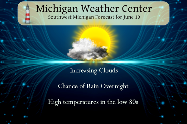
ONE MORE DRY, WARM DAY IS IN STORE TODAY WITH HIGHS REACHING THE
LOWER 80S INLAND FROM LK MI AS H8 THERMAL RIDGE OF 14C SNEAKS IN
AHEAD OF THE APPROACHING COLD FRONT. INCREASING MID AND HIGH LEVEL
CLOUDS ARRIVE THIS AFTERNOON SO SUNNY SKIES TURNING PARTLY SUNNY.
QUITE A NOTICEABLE CHANGE COMING FOR SUNDAY AS CLOUDS, SHOWERS,
AND NORTHEAST WINDS ON THE OTHER SIDE OF COLD FRONT HOLD TEMPS IN
THE 60S.
LONG TERM
(SUNDAY NIGHT THROUGH FRIDAY)
ISSUED AT 340 PM EDT SAT JUN 10 2023
— CHANCE OF SHOWERS MON (HIGHEST NORTH) —
EPS AND GEFS ENSEMBLE MEANS SUGGEST THAT A SURFACE LOW WILL BE
POSITIONED NEAR WESTERN NY AT 12Z MON, WITH THESE MEANS HAVING
RECENTLY SHIFTED SLIGHTLY EASTWARD. THIS LOW WILL LIKELY PROPAGATE
NORTHWESTWARD ON MON AS THE OCCLUSION PROCESS PROCEEDS, WITH THE
CYCLONE ULTIMATELY BECOMING NEARLY VERTICALLY STACKED ON MON NIGHT.
IN TANDEM WITH THESE PROCESSES, A MIDLEVEL DRY SLOT WILL LIKELY
DEVELOP OVER THE REGION ON SUN NIGHT, WITH THE AXIS OF HIGHEST PW
SHIFTING WELL EAST OF THE FORECAST AREA. PRECIP COVERAGE/AMOUNTS
WILL LIKELY BE LIMITED ON MON, BUT POPS WILL BE MAINTAINED (HIGHEST
NEAR US-10) WITH THIS FORECAST UPDATE, GIVEN THE PRESENCE OF LOW-
LEVEL CYCLONIC FLOW AND THE PROXIMITY OF THE UPPER LOW.
— SHOWERS LIKELY MON NIGHT AND TUE —
MEDIUM-RANGE GUIDANCE SUGGESTS THAT A TROWAL AIRSTREAM ASSOCIATED
WITH THIS CYCLONE WILL SHIFT SOUTHEASTWARD INTO THE FORECAST AREA ON
MON NIGHT AND TUE. DEEPER MOISTURE AND QG FORCING FOR ASCENT, BOTH
COLLOCATED WITH THIS TROWAL, SHOULD FOSTER GREATER PRECIP COVERAGE
COMPARED TO MON. ADDITIONALLY, COOL MIDLEVEL TEMPS (-16 TO -20C AT
500 MB) IN THE VICINITY OF THE UPPER LOW, COMBINED WITH MODEST
DAYTIME BOUNDARY-LAYER WARMING, MAY YIELD SUFFICIENT INSTABILITY FOR
A FEW T-STORMS.
— WED AND BEYOND —
FORECAST UNCERTAINTY BECOMES CONSIDERABLY GREATER FOR THE LATTER
HALF OF NEXT WEEK. EPS AND GEFS ENSEMBLE MEANS HAVE LATELY TRENDED
TOWARD A HIGHER-AMPLITUDE RIDGE ON TUE-WED ACROSS THE CENTRAL
PROVINCES OF CANADA. THE DETERMINISTIC ECMWF SOLUTION SUGGESTS THAT
THIS RIDGE AMPLIFICATION MAY FOSTER THE DOWNSTREAM DEVELOPMENT OF AN
UPPER LOW OVER ONTARIO ON WED AS A POSITIVE PV ANOMALY IS DISPLACED
SOUTHWARD. THIS UPPER LOW MAY SUBSEQUENTLY INTERACT WITH THE
ANTECEDENT UPPER LOW OVER THE EASTERN GREAT LAKES, PERHAPS RESULTING
IN A BROAD/REINFORCED CIRCULATION CENTERED NORTH OF THE REGION
DURING THE THU-FRI TIMEFRAME. THE EPS MEAN HAS TRENDED TOWARD THIS
SCENARIO, WITH A SIZABLE NUMBER OF MEMBERS PRODUCING PRECIP OVER THE
FORECAST AREA ON WED NIGHT AND THU AS A MIDLEVEL VORT MAX DIVES
SOUTHEASTWARD. THE GEFS MEAN, IN CONTRAST, DEPICTS GRADUAL HEIGHT
RISES ACROSS THE REGION AS THE EARLIER UPPER LOW DEPARTS EASTWARD.
OVERALL FORECAST CONFIDENCE DURING THIS PERIOD IS LOW, BUT SLIGHT-
CHANCE POPS HAVE BEEN EXPANDED AREA-WIDE FOR THE WED NIGHT AND THU
TIMEFRAME.
Detailed Forecast For Grand Rapids
Today
Mostly sunny, with a high near 82. South wind 6 to 15 mph becoming west in the morning. Winds could gust as high as 23 mph.
Tonight
A 30 percent chance of showers, mainly after 4am. Increasing clouds, with a low around 57. West southwest wind 6 to 9 mph becoming north northeast after midnight.
Sunday
Showers. High near 67. North northeast wind 7 to 13 mph. Chance of precipitation is 80%. New precipitation amounts between a tenth and quarter of an inch possible.
Sunday Night
Showers likely, mainly before 8pm. Partly cloudy, with a low around 47. North northeast wind 10 to 13 mph. Chance of precipitation is 60%. New precipitation amounts of less than a tenth of an inch possible.
Monday
A 40 percent chance of showers, mainly after 2pm. Mostly sunny, with a high near 65. West northwest wind 13 to 17 mph, with gusts as high as 25 mph.
Monday Night
Showers likely, mainly after 2am. Mostly cloudy, with a low around 50. Chance of precipitation is 70%.
Tuesday
Showers likely, mainly before 2pm. Partly sunny, with a high near 67. Chance of precipitation is 60%.
Tuesday Night
A chance of showers before 8pm. Partly cloudy, with a low around 51.
Detailed Forecast for Lansing
Today
Mostly sunny, with a high near 84. West wind 6 to 13 mph.
Tonight
A 30 percent chance of showers, mainly after 5am. Mostly cloudy, with a low around 59. West wind 5 to 10 mph becoming north northeast after midnight.
Sunday
Showers, mainly after 8am. High near 67. Northeast wind 7 to 11 mph. Chance of precipitation is 90%. New precipitation amounts between a quarter and half of an inch possible.
Sunday Night
Showers, mainly before 8pm. Low around 48. North northeast wind 10 to 13 mph. Chance of precipitation is 80%. New precipitation amounts between a tenth and quarter of an inch possible.
Monday
A 40 percent chance of showers, mainly after 2pm. Partly sunny, with a high near 67. West wind 10 to 15 mph, with gusts as high as 23 mph.
Monday Night
Showers likely, mainly after 2am. Mostly cloudy, with a low around 49. Chance of precipitation is 60%.
Tuesday
Showers likely. Mostly cloudy, with a high near 66. Chance of precipitation is 70%.
Tuesday Night
Partly cloudy, with a low around 52.
Lows in the 40’s all week next week! Wow just wow, WOW! The cool pattern is hanging on!
LATEST UPDATE… Long Term .SHORT TERM…(This evening through Sunday night) Issued at 238 PM EDT Sat Jun 10 2023 Visible satellite imagery shows a band of mid clouds stretching from northeast Lower west to near Green Bay. This band of clouds delineates the cold front that will move through the cwa during the next 24 hours. Overall, models trends have continued to decrease QPF during the next several days a bit. However, any rain we receive will be beneficial. Radar shows a few thunderstorms developing over Wisconsin attm near the front and they will move east. HRRR shows these storms… Read more »
What’s a cold front? It’s been so long since we’ve had one 😃
A big cold front came through a week or so ago and put an end to the mini heat wave! We had temps down into the mid 40’s and highs barely 70 degrees! Incredible cold!
It wasn’t that cool here.
Wow, highs in the 60’s for a few days! The persistent and long term cool pattern continues to rock n roll! No heat waves in sight! Incredible!
I enjoyed this post. Thanks Slim.
It’s gonna be a warm one today. I’m out back enjoying my coffee. Our pooch is laying next to me. Sun feels almost hot already. Daisy is just soaking it in.
Have a great Saturday friends, and make someone smile 😃
Wow Slim…so much folklore!!! When the weather channel first came out they had a folklore calendar. My Dad got it for me…we both liked weather. I wish I still had it.
Sad to see total qpf has trended downward. Regardless at least we are getting some rain. The only question after this rain is do we slip back into a dry pattern or will there be more periodic rain chances? We shall see.
Yup, even if we happen to squeak out an inch, the ground will soak it right up and dry quickly. I put posts in the ground yesterday and there was no ground moisture until 30+” down.
Yikes yeah it’s getting bad
They tilled up the fields by our house. Not sure what was planted as nothing is coming up yet and it’s been a little while. Lots of dust blowing around out there today with the occasional dustnado spinning around.