We pulled through a soggy second half of June with multiple tornadoes in the state and exit the first half of the year into July and midsummer. Our rainfall total since March 1st is 13.47 inches of which 9 inches fell in June! Last year we had 16.87 inches during the same period of which 4.06 of it fell in June. Last July we had 2.33 inches of rain. These are Otsego totals.
June ended up being warmer and wetter than average. Grand Rapids saw 8.49 inches of rain and Kalamazoo 10.66 inches.
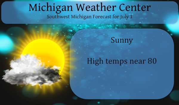
So, what will July bring us? The CPC is suggesting chances of above-normal temps and rainfall through the first half of the month.
Looking at the tropics we have tropical storm, Elsa, off the coast of Guyana in South America which is projected to move north towards Florida next week. Central and the eastern Pacific remain free of tropical storms and cyclones.
Hazardous Weather Outlook and Forecast Discussion
There is a high swim risk this afternoon into this evening due to
high winds and large waves. The north sides of piers will be
particularly dangerous.

Isolated thunderstorms are possible near and east of US-127 this
afternoon. Gusty winds, brief heavy rain, and cloud to ground
lighting would be the expected hazards from these storms.
- Minor River Flooding Continues

We continue to have minor flooding at three of our river points.
Comstock Park, on the Grand River, is about at it`s crest today
and should begin to fall tomorrow, being below flood stage by the
4th. Maple Rapids, on the Maple River, has created a few days ago
and should be below flood stage by tomorrow morning. Hastings, on
the Thornapple River, has also crested and should be below flood
stage by tomorrow.

- Isolated thunderstorms this afternoon

There continues to be the chance for afternoon thunderstorms,
mostly to the east of US-127. This is result of the cold air aloft
associated with cold core upper low dropping that is moving nearly
due south today. The center of the upper low should be over
northern Lake Huron by late this afternoon. There is around 500
j/kg of cape this afternoon over the central and eastern CWA.
However there is also very dry air above 700 mb, so any storms
would be isolated.

- Slightly cooler with lower humidity today into Friday

We continue to see the northern stream upper low drop south to
Lake Huron this evening and near Niagara Falls tomorrow morning.
This system is moving rather quickly and has only a narrow area of
cold air associated with it. By tomorrow afternoon, the upper jet
on the west side of the system, will be crossing this area. The
system is expected to be east of this area by Friday night. That
puts southwest Michigan back into air from the western CONUS
(which has been rather hot of late).

While we are under the influence of this upper low, today and
tomorrow we will have cooler and dry weather.

- Warmer and mostly rain free 4th of July weekend

Once we get out of the influence of the upper low, the upper high
that has been stalled over the Pacific Northwest, causing that
record heat waves, heads this way. However it is sheared out by
another system coming out of upper low over the Gulf of Alaska.
The result will be warmer air but not nearly like what has been
happening over the Pacific Northwest.

Since this will not be air from the Gulf, it will not have a lot
of humidity with it. Expect mostly rain free weather from now
into Monday night. The system that shears out the upper high that
was over Pacific Northwest ends up tracking north of Michigan
Saturday night into Sunday. The warm front from that system moves
through this area late in the day on Saturday. It would not be out
of the question there could be thunderstorms over our northeast
CWA later Saturday into early Sunday. However, at this point the
air will be too dry so no precipitation is in the forecast.

One odd thing about this pattern is the we will see warm advection
from the north Saturday. This is the result of the hot air having
been lifted well north into central Canada prior to moving into
this area. This will mean northern and western sections of
Michigan will the the warmest air first. Northwest Lower Michigan
may be warmer than the southern third of Lower Michigan on
Saturday.

Once we are totally in the warm air, we could see high
temperatures inland reaching near 90 Sunday and Monday.

- The threat of rain returns by the  middle of next week

The cold front, that ends our period of summer like temperatures,
should come through here on Tuesday with some thunderstorms. After
that, the upper air pattern becomes less amplified and more
zonal. This will allow systems coming off the Pacific Ocean to
track over Michigan. This could lead to a wavy stationary front
with periods of showers and thunderstorms. Currently the GFS is
stronger with the cold air behind the next cold front so that
precipitation would mostly be south of us. However the ECMWF is
not as strong with the push of cold air, so the front stalls near
us. We will have to see how this plays out.
July…sad. It’s all down hill from here.
Looks like a chance at 90 degrees Sunday, Monday, and Tuesday. July is starting warm after a warm June!
Well June 2021 is now in the record books. At Grand Rapids the mean for the month was 70.9 that is a departure of +2.0. It was tied with 1971 for the 12th warmest June on record. There was a total of 8.49″ of rain fall and that is good for 2nd place. The high for the month was 90 on the 11th and 12th and the low came kind of 41 was on the 22nd. That was the 2nd coldest low for that date. At Grand Rapids there were a reported total of 9 thunderstorms. Remember as far as… Read more »
Just another above average temperature month!! How could that be?!?!
That’s what I was wondering as a couple posters kept telling us how cold it was.
INDY
So basically June will go out below average now wow ….Let’s keep it going through July ..INDY
June 24, 2021 7:55 am
Rocky (Rockford)
Rocky (Rockford)
Yes just another of many below normal temp months! Incredible!
June 24, 2021 12:06 pm
Whoops! Good finds LOL
Thanks for listening and keep up the fan club!
Thanks Slim. What were the warmest means ever for June?
The warmest June means at Grand Rapids is 74.9 in 1919, 74.0 in 1933, 73.4 in 1921, 73.2 in 1934.
The coldest June means at Grand Rapids are 61.8 in 1969, 61.9 in 1928, 62.0 in 1958, 62.3 in 1926.
Slim
I can’t believe 2021 is half over already. The weather looks to be great this weekend. Can’t wait to chill with family at the lake.