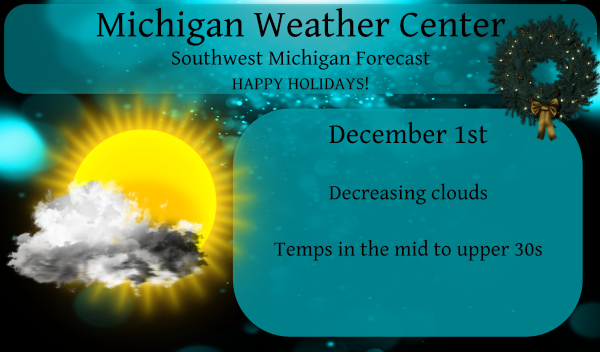
Welcome to December! We are far from the heart of winter and have very little in the way of snow or the cold temps one would expect this time of year.
We closed out November with above normal temps. We had 1.97 inches of rain and half an inch of snow for the month both below normal for Otsego.
This is the latest update on our December forecast from the NWS, NOAA and the Weather Company:
December may trend chillier in parts of the South and East, while remaining rather mild in many other parts of the United States, according to the latest outlook issued by The Weather Company, an IBM Business.
Temperatures are expected to be near or somewhat cooler than average in December in much of the Deep South from Texas to Florida and the Carolinas.
The rest of the country from the West to much of the Plains, Midwest and Northeast is expected to have at least near, if not above-average temperatures in the last month of 2020.
The warmest temperatures, relative to average, are expected from the northern Rockies to the northern Plains and upper Mississippi Valley.

What Changed This Forecast? It’s Not La Niña.
Heading into winter, a strengthening La Niña is expected to last through spring and could become strong, according to the latest outlook from NOAA’s Climate Prediction Center.
This periodic cooling of sea-surface temperatures in the equatorial Pacific Ocean can influence weather conditions across the globe.
La Niña winters are typically chilly and wet in the Pacific Northwest and northern Rockies and chilly in the northern Plains. Conversely, in the South and parts of the East, La Niña most often delivers warm and dry conditions.

La Niña isn’t the only factor that can shape the atmospheric pattern.
The forecast for early December indicates a large northward bulge of the jet stream over the western U.S. and western Canada, rather than over the north Pacific Ocean, and a pronounced southward plunge over the southern and eastern U.S.
This pattern, known to meteorologists as the positive phase of the Pacific-North American (PNA) oscillation, would bring cooler, wetter weather to the South and East and warmer, drier weather to the Northwest and northern Rockies.
This type of pattern could also bring the possibility of wintry precipitation in parts of the South and storms to the East Coast.

“It’s a pattern that more closely resembles something you might see during mid-winter in a strong El Niño,” said Todd Crawford, chief meteorologist at The Weather Company.
Crawford said this strong positive PNA pattern is being triggered by warmer than average Indian Ocean water producing more tropical thunderstorms farther west than is typical in a La Niña.
Where these thunderstorms are more numerous and persistent – and where they’re more absent – can impact the weather pattern over the Pacific Ocean and over the United States.
As to how long this non-La Niña pattern may hold into December, it’s a tricky call.
“We do expect the early month pattern to flip to a more typical La Niña pattern by the latter half of the month,” Crawford said.
Average December Temperatures
Highs in December are typically in the 30s or colder along most of the northern third of the U.S. from the northern Great Basin and northern Rockies to the northern Plains, upper Midwest, Great Lakes and interior Northeast.
Along the southern tier, 50s and 60s are common, with 70s in South Texas and the Florida Peninsula.

Frosts and freezes are common in the South in December and occasionally occur as far south as north Florida and South Texas. Lows in the 50s and 60s are typical in central and South Florida.
Lows in the single digits, teens and 20s are the norm in December over much of the northern half of the county.

The season’s first measurable snow typically occurs in December along the Interstate 95 corridor from New York City to Washington D.C., from the central Plains to the lower Ohio Valley, and also in the Pacific Northwest to the west of the Cascades, including Seattle and Portland, Oregon.
So, it appears another warmer, perhaps dryer than normal month is in store for us in Michigan as we start Meteorological winter. Unless things change drastically we could see another winter with below normal snowfall once again. It is my humble opinion we will see a back loaded winter with most of our snow coming in late January into February. That said, my forecast as with many others last year are the opposite of what actually comes into being. Looking at the big picture of our weather patterns winter begins western based from the Indian Ocean rather than eastern based from the Pacific giving us a zonal air flow rather than a northern airflow (simply put).
Of course we all know weather patterns and forecasts can change abruptly and we could end up being buried with snow (or not).
Looks like a sunny start to December. This has been an incredibly sunny year!
Thank you, Michael. Lots of good information today.
CPC still sending us shots of warm air for as far as the eye can see!! Also, well below average precipitation!!
https://days.to/until/spring
Beautiful bright and sunny day to start December! Anyone have the stats for November sunshine? Had to be well above average with all the clear days we had.
Another day with out snow is another day closer to spring .. I love winter ..
As we head into the winter season here is a write up that should show some insight as to the “snow fall maps” that will pop up in the coming days
https://www.mlive.com/weather/2020/11/snow-forecasts-here-are-some-important-points-to-remember-as-we-enter-winter.html?fbclid=IwAR3nx7HHELHmyAvdke_denD2t8QbONxffpEIlHMz2WQQqaPDMnfQiRvQh0U
Slim
Nice read Slim! We do have one or two of those “snow fall map” posters on here.
Mark makes valid points on medium range forecasts more than 2 days out – don’t get excited on snowfall projections beyond that.
At this time it is partly cloudy and 31 here. There was no snow that I seen here yesterday.
Slim
Welcome to December and the start of meteorological winter. With November now in the record books it can be pointed out that it was a mild and for our area sunny month. At Grand Rapids the mean was 44.3 that is a departure of 4.2 the high for the month was 77 and the low for the month was 22 there was just 0.4” of reported snow fall. November 2020 is now the 7th warmest November at Grand Rapids. At Muskegon the mean was 45.9 that is a departure of +5.7. The high for the month at Muskegon was 75… Read more »
Thanks MV for the December update.
Slim
Hopefully by mid to late December the pattern changes to a cold and snowy one! Let the rock n roll party begin!
There is talk of a pattern flip mid month however, we had the same talk last year and we all know how that turned out…
A pattern switch will be awesome!
Informative and interesting post today MV! With the way most of this year has gone I don’t think there are to many that would complain about a mild and quiet December.