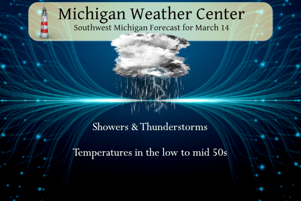
Yesterday was about as good as it gets in the weather department with almost zero breeze and the temperature was 73° (in Otsego) under mostly sunny skies. Showers and thunderstorms are expected today with high temperatures ranging from near 50° farther north towards US-10 to around 60° farther south towards I-94. Southern Michigan is in a marginal risk for severe weather today. Winds will be from the east or northeast at 5 to 15 mph. After a pause in precipitation from late Friday into Saturday, we will see colder temperatures Sunday and especially Monday with a chance for light snow by the lakeshore.
NWS Forecast
Spring Safety
Spring_Safety_Presentation_2024Weather History
1904: A snowstorm drops up to a foot of snow across Lower Michigan with record daily snowfall of 10.5 inches at Grand Rapids, 10 inches at Lansing, and 8.0 inches at Muskegon. This snow would contribute to some of the worst floods on record in southwest Lower Michigan when it melts off during the last week of the month.
2019: Thunderstorms with heavy rain combined with snowmelt and frozen ground brought significant flooding across parts of central Lower Michigan. Newaygo County saw the worst flooding, with in more than 150 homes and 9 businesses flooded, as well as the closure of more than 100 roads and the complete washout of more than 30 roads. The flooding continued for several days with damage estimated at nearly 2 million dollars.
On March 14, 2019, a tornado outbreak occurred across the I-69 corridor during the afternoon and evening hours. 4 tornadoes developed from a line of severe storms – an EF0 near Corunna, an EF2 near Vernon, an EF0 near Flushing, and an EF0 near Genesee Township. The Vernon EF2 tornado had max estimated winds of 125 mph, was on the ground for 20 minutes, and had a path length of over 18 miles as it tracked northeast. Thankfully no injuries were reported from these storms, but numerous homes suffered damage.
On March 14, 1997, low pressure tracked across Southeast Lower Michigan. The storm brought widespread precipitation, mostly in the form of freezing rain, to Southeast Michigan from late on the 13th into the morning of the 14th. Total precipitation amounts ranged from around an inch to nearly two and a half inches. In the Detroit Metropolitan area, the ice storm resulted in power outages to over 425,000 homes and businesses; one of the largest outages in history. Several thousand residents were without power for as long as 4 to 5 days. In addition to powerlines, falling trees damaged dozens of cars and houses throughout the area.
1933: A deadly tornado outbreak affected the Middle Tennessee region, including Nashville, on this day. The outbreak, which produced five or more tornadoes, killed 44 people and injured at least 461 others. The strongest tornado, F3, cut a path through the center of Nashville. About 1,400 homes were damaged or destroyed. Windows were blown out of the State Capitol Building.
1935: Suffocating dust storms frequently occurred in southeast Colorado between the 12th and the 25th of the month. Six people died, and many livestock starved or suffocated. Up to six feet of dust covered the ground. Schools were closed, and tenants deserted many rural homes.
2008: An EF2 tornado moved through downtown Atlanta, Georgia, shortly before 10 pm, damaging the Georgia Dome where the SEC men’s basketball tournament was underway. Click HERE for more information from the NWS Office in Peachtree City, Georgia.
Forecast Discussion
- Showers and Scattered Thunderstorms Today

A warm front extending from west to east near the MI/IN border
will focus development of showers and scattered thunderstorms
today. The overall svr wx risk which was low has decreased further
as an overall short range guidance consensus and 00Z HREF all
suggest the warm front will not make it much further north than
the MI/IN border. This keeps instability of any significance
focused south of our area across IN/OH. The 00Z HREF shows only
100-250 j/kg of SB/MU CAPE near to south of I-94.

So the svr wx risk looks very low today and mainly confined to
near/south of I-94. Weak elevated instability north of the warm
front will result in scattered non severe convection. Rainfall
amounts with this system should generally fall into the one
quarter to three quarters inch range with locally higher amounts
in excess of an inch as suggested by the 00Z HREF LPMM product.
These type of rainfall amounts are not sufficient enough to cause
any significant hydro issues.

Lingering evening showers and isolated convection early will come
to an end rather quickly by mid to late evening on the back side
of this system. Skies will become partly sunny Friday and it will
be cooler with weak northerly flow cool air advection.

- Chance of rain Saturday, then colder with snow showers

No significant changes planned for this forecast. As noted
previously, late Saturday is trending slightly drier south of M-46.
We will get a shot of light lake effect snow Sunday morning in the
wake of the cold front associated with Saturday`s precipitation.
Accumulations should be nearly non-existent given relatively warm
surface temperatures.

No changes in expectations for Sunday night into Monday with the
secondary surge of colder air. Light accumulations by the lakeshore
seem like a reasonably good bet, with an emphasis on "light". A
slight chance for light snow remains possible early Tuesday due to
the possibility of a clipper type of feature dropping down the back
side of the broader scale exiting upper trough.

After reasonable confidence for a dry Wednesday, predictability
breaks down again from Thursday onward. This is due to possible
development of a southern stream trough over the southern plains. At
this time thunderstorms are not expected, however.
I see the ski resorts are already closed or are closing super early this year. Yikes! What a horrible year for winter sports.
Speaking of golf, looks like a great golf day for tomorrow! Partly cloudy, mid 50’s and a light wind is perfect! Gonna have to hit up Moss Ridge for a tee time tomorrow afternoon! What a spectacular winter we are having!!
https://weather.com/weather/hourbyhour/l/52aab230ef88e4f2bb12857231a5dd58392e78a71b90e01d57a11d827658eb55?traffic_source=footerNav_Hourly
Winter of no snow and warmth it was perfect! Have fun snowshoeing and cross country skiiing!
After a multi-month blowtorch, we have 40’s and 50’s upcoming with two days that may be in the 30’s. Still sounds great to me! Winter is dead and spring is here!
Get ready for winter weather and wind chills in the teens and 20’s! Incredible cold is coming! Have fun golfing!
The official H/L yesterday at Grand Rapids was 71/40 there was a trace of rainfall. The sun was out 85% of the possible time and the highest wind speed was 19 MPH out of the SW. For today the average H/L is 44/26 the record high of 80 was set in 2012 the record low of 0 was set in 1895. The wettest and most snow fall of 0.79” that fell as 10.5” of snow was in 1904. 1904 also had the most snow on the ground with 11” Last year the H/L was 37/21 there was a trace of… Read more »
With yesterday’s high of 71 it was the 1st time there have been back to back days of 70 or better in March since 2012. Here in MBY I recorded 0.06” of rainfall overnight and the low was a warm for March 50 that 50 is the current temperature here in MBY.
Slim