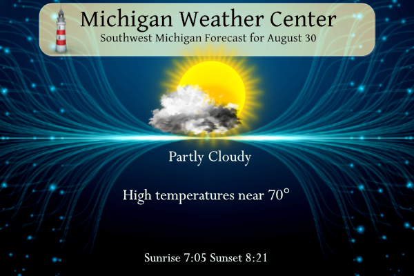
A cool and cloudy morning will make way for some sunshine by this afternoon. Highs will only reach around 70 degrees today. Steady warming will occur through the rest of the week and this upcoming long weekend with highs reaching 90 for most locations by Sunday and Monday as we start the beginning of meteorological fall.
Grand Rapids Forecast
8 30 grrWeather History for SW Michigan
August 27
1948: A late-season heat wave with eight straight days in the 90s at Grand Rapids is underway. Record highs are set at Lansing with 98 degrees, Grand Rapids with 95, and Muskegon with 91.
1977: Only two days after setting a record low of 43 degrees, the low temperature at Muskegon is a balmy 74 degrees, a record-warm low temperature for the date.
2004: A weak tornado struck near Sherman City in Isabella County. A mobile home was slightly damaged but no one was injured.
August 28
1982: A strong cold front pushes through and temperatures tumble to 36 degrees at Lansing, setting a record low for the date.
1986: There is an autumnal chill as morning lows fall to a record low of 41 at Grand Rapids and to 36 degrees at Lansing, tying the record low set only four years before.
August 29
1863: A hard freeze ends the growing season at many interior locations. Lansing falls to 26 degrees, the coldest ever recorded in August there.
1982: Cool air from Canada continues pouring in, with a record low of 38 degrees at Muskegon and 41 degrees at Grand Rapids.
August 30
1949: A weak tornado struck just north of Grant in Newaygo County, causing some minor damage to small buildings and crops.
1976: Grand Rapids falls to 39 degrees, the coldest ever recorded during the month of August. Scattered frost occurs in rural areas.
1984: A tornado struck about 5 miles northeast of St. Johns in Clinton County, damaging two homes, but causing no injuries.
August 31
1993: Flash flooding hits Norton Shores in Muskegon County as slow-moving thunderstorms dropped about an inch and a half of rain. Elsewhere, three people were struck by lightning in Otsego in Kalamazoo County. One suffered cardiac arrest but was not killed. The other two were treated for minor burns. The lightning strike occurred while two stranded motorists were huddled under an umbrella, watching the wrecker operator connect their vehicle. The lightning struck the umbrella and the motorists, then struck the wrecker operator, jolting him to the ground.
1953: August ends with a late-season heat wave that will continue into September. Record highs of 97 are set at Grand Rapids, 96 at Lansing, and 91 at Muskegon.
1975: Heavy rains on the last day of the month ensure that this will be the wettest August on record at Lansing and Muskegon. One to three inches of rain falls across the region, boosting the monthly total close to 10 inches.
2009: August ends on a cool note with a record low of 41 degrees at Muskegon. Some other readings include 34 at Big Rapids, 32 at Cadillac, and 28 at Leota, in Clare County.
September 1
1953: A heat wave that began in late August continued into September, with record highs of 97 degrees at Grand Rapids and 96 at Lansing. The 95 degrees at Muskegon tied the record high for the month there.
2009: September begins with temperatures more typical of October. Lows include 41 degrees at Muskegon, 36 at Ludington, Hersey, and Baldwin, and 35 at Harrison. Cadillac fell to 32 degrees for the second morning in a row, and Leota in Clare County fell to 30 degrees.
2018: Four tornadoes occurred within a two-hour period during the evening. The first was a brief tornado that snapped trees near Gull Lake in Barry County. This was followed by a tornado with winds estimated at 100 mph that destroyed a manufactured home at Morley in Mecosta County. Two other tornadoes took down trees, some of which fell on houses, in Jackson and Clinton Counties.
September 2
1894: Lansing hits 99 degrees, setting their record high for the month of September.
1913: Grand Rapids hits 98 degrees tying their record high for the month of September.
Weather History for SE Michigan
August 27
On August 27, 1965, thunderstorms in Wayne County brought winds of 73 mph at 7:00 pm.
August 28
On August 28, 2020, several rounds of morning showers and thunderstorms trained over the same areas, bringing 2 to 4 inches of rainfall over just a few hours and causing flooding throughout the Metro Detroit area. Scattered severe storms during the afternoon then brought damaging wind to the US-23 corridor as well as large hail (up to 2 inches near Flushing).
On August 28, 2018, a line of severe storms impacted the Tri-Cities and Thumb regions with damaging winds downing numerous trees and power lines.
On August 28, 2013, an EF0 tornado touched down near Brighton, Michigan. The path width was 0.3 miles wide and 2.8 miles long. Peak winds were estimated to be near 80 mph. Numerous trees were uprooted and minor siding damage to homes occurred.
Also, on August 28, 1992, the temperature rose to only 59 degrees in Flint!
August 29
On August 29, 2022, a strong squall line raced across the state, leaving widespread wind damage in its path. Gusts of 60 to 75 mph were common, and several gustnados were reported along the lead edge of the line in Cambridge Twp, Highland Twp, Putnam/Hamburg Twp, Richmond, and Fort Gratiot. These gustnados produced localized corridors of enhanced damage. In total, around 375,000 customers lost power due to these storms.
On August 29, 2021, temperatures soared to the upper 80s/lower 90s before a strong cold front moved across the region and brought a line of severe storms. This line produced isolated damaging wind gusts all across Southeast Michigan.
On August 29, 2008, 0.10 inches of rain fell on Detroit, one of only six days during the month that had light rainfall. That pushed the monthly total up to 0.27 inches making August 2008 the third driest August on record.
Also on August 29, 1982, Detroit, Flint, and Saginaw set new record lows for the month of August. The temperature fell to a chilly 37 degrees in Flint and Saginaw and 38 degrees in Detroit.
Also on this day in 1979, one F0 and three F1 tornadoes were sighted over Monroe County between 6:45 p.m. and 7 p.m.
August 30
On August 30, 1984, an F2 tornado moved through Wayne County at 4:40 am. It caused $4 million worth of property damage and caused 4 injuries.
August 31
On August 31, 2010, Detroit and Flint closed out August with three consecutive 90+ degree days with no rainfall. This marked the end of a very hot and dry August. When combining the two, it was the hottest and driest August combination on record for Southeast Michigan. Detroit had its sixth warmest and sixth driest August. Flint recorded its fifth warmest and driest August.
On August 31, 1980, there were peak wind gusts of 69 mph.
Also, August 31, 1894, marked the end of the driest summer month ever recorded in Detroit, with only 0.16 inches of rain falling throughout the entire month.
September 1
On September 1, 1967, Detroit experienced a record low of 42 degrees.
September 2
On September 2, 1984, an F3 tornado moved through Sanilac County at 5:40 PM. This tornado caused one injury and over $500,000 in damage. This was the strongest tornado to ever hit Sanilac County and also caused the only injury ever reported in Sanilac County.
Forecast Discussion
High pressure will continue to build into the northern Great Lakes
region today bringing fair wx with seasonably cool temperatures.
Fairly extensive low stratus cloud cover noted in ir sat trends
and sfc obs early this morning should gradually erode during the
mid to late morning hours.

High temps will only reach the upper 60s to lower 70s today with
cool mins tonight in the 40`s with clear skies and calm winds.
A fairly large diurnal temp swing is expected Thursday with high
temps reaching the lower to middle 70s after a cool start to the
day with mostly sunny skies and a dry airmass in place.

- Turning Up the Heat for Labor Day Weekend...And Staying Dry

Excellent ensemble guidance agreement shows upper 80s to low 90s
continues to be expected for the Sunday through Tuesday time frame,
along with dry conditions. Until then, Friday and Saturday are
likely to be near to slightly above average temperatures with upper
70s to mid 80s.

Upper troughing across the eastern CONUS will help steer Hurricane
Idalia well away from the Great Lakes region, making it a non-player
in our extended forecast period. Upper ridging will propagate from
the mid central U.S to the eastern Great Lakes during Labor Day
weekend, positioning Lower Michigan in an area of low level warm
advection and rising surface temperatures. The airmass looks too dry
for precipitation here, with the only nearby threat for a few
showers possibly coming across northern Lower Michigan and the U.P.
Saturday, but not for our region at this point.

By Labor Day into Tuesday, rising dew points into the 65 to 70
degree range will likely create heat index readings in the mid 90s
and possibly a bit higher. Not impossible we could come close to
Heat Advisory criteria one or both of those days. That said, NBM
wind guidance is indicating 10-20 mph southwesterly winds pumping in
our warm surface temperatures, so it is not looking like a stagnant
airmass which is always worse to deal with. All in all, this is
looking like a pretty classic end-of-summer weekend to send us into
September.

In terms of rainfall, dry conditions are favored into Tuesday.
Ensemble 500 mb heights and 850 mb temperatures indicate a cold
front is favored to move through by mid week, dropping us out of the
90s. With this front will likely come a risk for rain, but timing is
very uncertain this far out and ensemble 24 hr QPF chiclet charts
show a scattershot representation of members indicating various
amounts of rain during different periods, leading to low confidence
in how significant any rain would be.
The moon is amazing tonight!
Well since the start of this year there has been 8 severe thunderstorm warnings issued for Kent County. The counties with the most warnings in the GRR coverage area has been Barry, Eaton and Montcalm at 11. The least is Muskegon County at only 1.
The counties with the most warnings issued in the state have been Livingston and Washtenaw at 15. (Livingston also leads with the number of tornado warnings at 3).
It looks like Oscoda, Montmorency, Emmet and Keewenaw are at 0
Great sleeping weather last night. I had the windows open and actually had to pull the comforter over me.
Here’s an update on next week’s possible heat wave.
https://www.mlive.com/weather/2023/08/will-it-really-hit-105-degrees-in-michigan-next-week-here-is-what-we-know.html
The official H/L at Grand Rapids yesterday was 76/55 officially at GRR there was 0.05” of rain fall, here in MBY I had a little more with 0.09”. The highest wind speed of 31 MPH was out of the NW There was 24% of possible sunshine. For today the average H/L is 79/59 the record high of 95 was set way back in 1899 and the record low not only for the date but for the month of 39 was set in 1976 that 39 is the only time it has gotten below 40 at Grand Rapids in August. The… Read more »
At this time, it looks like most Michigan locations will see a cooler than average August. One exception looks like it may be Muskegon. Today and tomorrow will be cool before warming up for the weekend. Then it looks like there will be a chance of several very warm days but it looks like there will be some wind with the warm reading so it should not be too bad.
Slim
What? Another below normal temp month! This pattern has been locked in for months! Wow, just wow, WOW!
Get ready – lows in the 40’s tonight! Incredible!
I’m predicting that this summer will (obviously) end up cooler and cloudier than average, but fall is looking quite mild. Especially the first few weeks of September… maybe warmer than this past August?
Looks like the only time September was warmer than August at Grand Rapids was in 1927. At Lansing the only times were 1865 and 1927. With the mean we will have in August it will be very hard for September 2023 to be warmer than August 2023. It would take a record warm September to do it.
Slim
https://www.cpc.ncep.noaa.gov/products/predictions/WK34/