We had no rain here in Otsego yesterday, our high/low was 84° / 59°. Most of the rain fell in the eastern part of the state, not even a drop here. We have gone eight days without rain.
The days are getting longer. As I write this in the early morning, the skies become light before 6 am. Sunrise today is 6:19 and sunset is at 8:59. We will continue to incrementally gain daylight through just past midmonth in June (the 21st is the summer solstice).
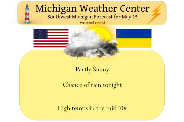
There is another chance of rain and storms tonight mainly after midnight. Viewing the lunar eclipse tonight (totality between 1129 PM and 1254 AM) doesn`t look good, but perhaps clouds will be thinner with a couple of breaks far to the northwest.
Forecast Discussion
-- Fairly Dry Today --

Areas of fog are present this morning where local downpours
occurred on Saturday, including at Mount Pleasant and Alma. This
fog should mix out quickly after sunrise. Moisture at 10,000 feet
streaming in from southern Wisconsin this morning has just enough
instability to work with to give it a mixed stratiform and weakly
convective appearance on radar. It likely won`t amount to much
given the amount of dry air beneath the high cloud bases.

Fire weather concerns remain elevated in areas that haven`t
received much rain in well over a week, particularly in conifer
forests. Scattered heavy downpours occurred Wednesday between
M-20 and US-10, and on Saturday near and east of US-127. But even
within these zones, there are plenty of spots that haven`t
received much rain or have fuels that dried out again. Away from
the Lake Michigan shore today, dry air, mild temperatures, and
breezy winds in the afternoon may be close to red flag warning
conditions. Conditions could be mitigated slightly by patches of
mid and high level clouds.

-- Rain Likely Tonight --

An upper level trough moves through tonight, inducing cyclogenesis
along the front in Indiana. Moisture and uplift in the mid to
upper levels tonight will likely bring light to moderate rain to
southern/southeastern portions of the lower peninsula. Amounts
greater than a quarter inch are most likely near and southeast of
Kalamazoo to Lansing. Viewing the lunar eclipse tonight (totality
between 1129 PM and 1254 AM) doesn`t look good, but perhaps clouds
will be thinner with a couple of breaks far to the northwest.

-- Cooler first half of the week --

Northwest flow the next couple days will bring cooler air into
the region, actually considered cooler than normal at this point
in the year with temperatures in the low 60s on Tuesday.

-- Warmer then potentially active late in the week --

A strong upper level jet arriving over the Pacific coast and
digging trough over the western CONUS in the latter half of the
week will send temperatures rebounding upward in our area on
Thursday. From Friday through the weekend, ensemble members
diverge significantly with the temperatures and rain amounts,
depending on how quickly the developing mid-latitude cyclone
traverses the continent and where it tracks. A round or two of
thunderstorms would be possible in Michigan at some point between
late Thursday and Saturday, according to ensembles of the ECMWF,
GFS, and Canadian.
No fans on tonight feels great outside….InDY
Wow, the cpc is trending colder the rest of this month! Who would have thought?
Not a big request…just some rain, to wash the pollen away.
Incredible pattern change and cold is coming! Get prepared!
I did the Automated Data Plotter to see which counties have received Severe Thunderstorm Warnings so far this year in Michigan. Here is the latest data. As you can see the most severe weather has been north and east of Grand Rapids. That could potentially change as West Michigan is in the Day 6 outlook for Severe Weather.
https://mesonet.agron.iastate.edu/plotting/auto/?_wait=no&q=90&t=state&v=lastyear&ilabel=yes&geo=ugc&drawc=yes&year=2022&year2=2022&sdate=2022%2F01%2F01+0000&edate=2022%2F05%2F15+0000&station=DMX&state=MI&phenomena=SV&significance=W&cmap=jet&interval=1&_r=t&dpi=100&_fmt=png
It’s not often that we are in a day 6 outlook 😮 Will need to keep an eye on it
Yes definitely worth watching. To early to determine timing or specifics or if we will even get anything but based on the latest looks like all hazard types are on the table.
Forecasted high for Friday is 82 and 65 for Saturday, which coincides with the passage of the front discussed in the Day 6 outlook.
Things that make you go hmmmm..
Yes looks to be a strong system in that timeframe. Latest NWS discussion says dew points near 70 with CAPE values of at least 2,000 J/kg. Of course plenty of time for things to change, but something fun to track regardless!
Today will be our 7th warm day in a row! Our last 5 days have been 13-19 degrees above average!
This sure has been nice stretch of summer weather in May. It feels much better than that wet and cold we had in late April and early May.
Slim
Wow low to mid 60’s as far as the eye can see.
Love it …Indy
The official H/L at Grand Rapids yesterday was 85/60 At Muskegon it was 83/52 and to the east at Lansing it was 87/63 Lansing officially had 0.35″ of rain. GRR did not record any rain fall. Here at my house I had 0.02″ in a brief but heavy shower. The overnight low here at my house was 53, At the airport it looks to have been 55. At this time there are clouds moving in and it is 61 here.
Slim
You may not see 80 degrees the rest of this month as below normal temps will dominate! Incredible!
Summer is over, so get ready for the COLD! An ice box is coming! Get your furnace cranked up, get your blankets out, fire up the fireplace, get the campfire ready! Wow!