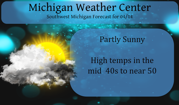

April 14 pollen forecast
We begin a pattern shift to cooler than normal temps today struggling to reach 50° with a chance of (gasp) rain and snow showers overnight into Thursday morning. This cooler pattern will exist into early next week and perhaps beyond.
[columns] [span6]
[/span6][span6]
[/span6][/columns]
Weather History for SW Michigan
April 11
1965: The second worst tornado outbreak in United States history struck from Iowa to Ohio, killing 256 people. In Michigan, the worst damage is near the Indiana state line as two violent tornadoes moved on parallel tracks about a half-hour apart, killing 44 people and injuring hundreds. A tornado struck northwest of Grand Rapids, killing five people in Comstock Park. One person was killed by a tornado that moved from near Dewitt in Clinton County to Bennington in Shiawassee County.
2001: Severe thunderstorms produced large hail, flash flooding, and two weak tornadoes. The tornadoes briefly moved through rural areas near Coopersville in Ottawa County and Cloverville in Muskegon County.
April 12
1972: A tornado put down an intermittent damage path about four miles long southeast of Ludington in Mason County. A barn was destroyed, but there were no injuries.
1974: A tornado brief tornado damaged a building in Vicksburg in Kalamazoo County.
2014: Severe downbursts with winds over 80 mph struck from near Muskegon to Big Rapids. Damage to trees was widespread along with some structural damage. Heavy rains and melting snow resulted in severe flooding along the Muskegon and Pere Marquette Rivers following the storms.
April 13
1941: Temperatures reach the 80s across Lower Michigan. Record highs set on this date include 87 degrees at Detroit, 82 at Lansing and 80 at Grand Rapids.
1950: High temperatures struggle to reach the mid and upper 20s across Lower Michigan after morning lows in the teens. At Lansing, the high temperature is only 24 degrees after a morning low of 17.
2018: Wind and air pressure changes from lines of thunderstorms across northern Lake Michigan generated meteotsunamis that affected the coast at Ludington and Manistee. Several docks near the mouth of the Manistee River and the Ludington pier were submerged during the height of the water rises.
April 14
1953: It is a cold morning across Lower Michigan. Record low temperatures include 20 degrees at Muskegon and 21 degrees at Grand Rapids.
April 15
1943: Temperatures plunge into the teens as snowflakes swirl in the arctic winds. Record lows included 16 degrees at Muskegon and 18 degrees at Grand Rapids.
2002: A four-day stretch of record warm weather peaks across Lower Michigan with Grand Rapids hitting 86 degrees and Lansing 84.
2018: A late-season winter storm brought up to 4 inches of snow, 2 inches of sleet and almost half an inch of icing along with strong winds across Lower Michigan from the 14th to the 17th. Almost half a million people lost power.
April 16
1961: From 6 to 12 inches of snow falls across southwest Lower Michigan. The storm drops 12.2 inches at Grand Rapids, the heaviest April snowfall on record there.
April 17
1875: Extreme late-season cold sets records across Lower Michigan. Detroit falls to 10 degrees on this date and 8 degrees on the 18th. Lansing bottoms out at an incredible zero degrees.
1922: Heavy rain from a slow-moving thunderstorm causes some street flooding in Grand Rapids. The daily total of 2.94 inches at Grand Rapids is a record for April.
Weather History for SE Michigan
April 11
On April 11, 1965, the Palm Sunday Tornado Outbreak occurred. This outbreak mostly affected Michigan, Indiana, and Ohio and produced 47 tornadoes that killed 271 people and injured 3,400 people in just a 12-hour span. Two F4 tornadoes that were a part of this Outbreak affected southeastern Michigan quite severely. These two tornadoes were responsible for 44 deaths, 612 injuries, and over $32 million in damage in Hillsdale, Branch, Lenawee, and Monroe counties.
April 12
On April 12, 2014, showers and thunderstorms were prevalent along a warm front in Southeast Michigan. One storm, in particular, grew strong enough to produce damaging winds to 70 mph from Flint to Detroit. The damage included uprooted trees, downed power lines, and some building damage. The storm was also a prolific hail producer, covering the ground with hail up to a couple of inches deep.
Also on April 12, 1976, the overnight temperature dropped to 18 degrees in Detroit, which is the record low temperature for the day. The very next year, in 1977, the daytime temperature rose to 89 degrees, which is the record high temperature for the day!
April 13
On April 13, 1977, the temperature soared to 87 degrees in Detroit, which is the record high for the day. This marked the fourth day in a row (April 10-13) that record daily highs were set, including the record high of 89 degrees on April 12, 1977, which is the record high for the entire month of April in Detroit.
April 14
On April 14, 2018, a mid-season Spring storm spanning April 13th-15th reached its peak. After widespread rain the night of April 13th ended as freezing rain and accumulating sleet the morning of the 14th, precipitation wound down and strong marine winds continued for the remainder of the day. Wind gusts over 50 mph were common in Saginaw Bay and the shoreline of Bay County where storm surge inundated coastal communities. Severe coastal flooding was also observed in Monroe County along the Lake Erie shoreline. Freezing rain and sleet redeveloped early on the morning of the 15th before ending as rain that afternoon. All told, Southeast Michigan had observed 2-3″ of heavy rain, 2-3″ of sleet, and 1/4″ to 1/2″ of ice from freezing rain. DTE and Consumers Energy reported power outages for nearly 500,000 customers due to the event.
In addition, the 0.6″ snow measurement, which was mostly sleet, made on the 15th tied Flint for its snowiest winter on record at 83.9″. This tied the record set just 4 winters prior in 2013-2014.
April 15
On April 15, 2014, light snowfall, the last of the season, blanketed Southeast Michigan. Detroit and Flint received 3.2″ and 1.3″, setting a new record for snowiest winter at each location. Detroit recorded 94.9″ for the 2013-2014 winter season while Flint finished with 83.9″. Saginaw would eventually finish the season at 60.3″, its 15th snowiest winter.
Also on April 15, 1904, a two-day snowstorm ended in Saginaw. The storm left the city with 12.5 inches of snow.
Also on April 15, 1976, the county of Midland was hit by an F1 tornado at 3:30 PM causing $25,000 in property damage.
April 16
On April 16th, 2018 Flint exceeded its all-time record snowfall of 83.9″ set in the winter of 2013-2014. A light snow accumulation of 0.2″ put the site at 84.1″ for the season. It would not be the final snow of the year.
Also on April 16, 1992, Wayne County was hit by an F2 tornado at 4:03 PM.
April 17
On April 17, 1963, Monroe County was hit hard by an F3 tornado at 6:20 PM that injured 1 person and caused approximately $250,000 in property damage.
Forecast Discussion
-- Rain and snow likely tonight through late Thursday --

We continue to focus on tonight and Thursday as being the periods
where precipitation is most likely in the short term. Leading into
tonight, the trends for a few showers has diminished a bit compared
to previous forecasts. It appears that the main reason for this
diminishing trend in precipitation for today is a slightly more
northern track of the short wave coming through today.

Even with the more northerly track of the short wave today, we still
expect the upper low to move right across the area tonight, and then
slowly pull east of the area through Thursday. The precipitation
starts out as some rain as it pushes into the area. Then, as the
colder air filters in, areas of higher elevations across Central
Lower will have the best chance of snow. We can not rule out a
dusting on the grassy areas. All areas have at least a chance of
seeing snowflakes tonight and Thursday morning, even if they don`t
stick at all.

If portions of the area are able to clear out Thursday night and
Friday night, we will see some temperatures that would support some
frost development, and maybe even a local freeze up north.
Coordination between neighboring offices and partners have agreed
that Freeze warnings would be the main headline issued for all of
the area if needed, except the normally colder locations for
Interior portions of Central Lower at this time based on the
impacts. Frost advisories are not in play at this time based on
an agreement between other offices and partners on the impacts.

-- Small chances for rain over the weekend --

The weekend continues to look like it will be mostly dry, with the
best chance of rain coming on Saturday afternoon. This chance will
be the result of a short wave trough that will clip the southern
portion of the area. This short wave will help to give a boost to
some instability present with the wave and the area of cooler air
aloft coming through during the warmer part of the day.

The chances for rain on Sunday have diminished a bit, as we kind of
thought might happen. The models are now showing the upper short
wave diving SSE over the Upper Midwest, diving a little further
south. This trend will take the better forcing and instability south
of the area, leaving almost no chance of precipitation on Sunday.

-- Staying generally cool early next week --

We will see a break in the precipitation continue into Monday, with
temperatures slightly moderating. This will be out ahead of another
upper trough and sfc front that will be pushing SE toward the area.
The latest timing of this front, and associated precipitation would
be from late Monday afternoon, into early Tuesday morning. Behind
this front will be a reinforcing shot of colder weather that will
stick around into mid portion of next week.
Get ready for the snow!!
Currently 42* degrees in my area that’s 16* degrees below average turn the heat on …INDY
41* degrees in my area nice and cool below normal Sprites day I mean Spring day lol…INDY
Hope everyone enjoyed the “warm” anomaly. April has returned to establish reality, and brought May along as a reinforcement. Cold, overcast, wet, with winds from the North, for the next 60 days. Once June arrives, warmth, sunshine and happiness will reign… sure it will.
Fun fact. It has snowed on this date in the last 3 years with 1″ last year 4.1″ in 2019 and in 2018 0.1″ fell. What is odd about this is that there have only been 10 years since 1892 when measurable snow fell on this date and there have been 3 years in a row and of the 10 years 4 have been in the last 10 years. That 4.1″ in 2019 is the record for the date.
Slim
That IS interesting.
Clouds have now moved in. At this time it is cloudy and 43 The average H/L for today is 58/37. 59/38 on Saturday and by next
Wednesday it is 61/40. At this time it looks to be cool for the next week or so and there don’t look to be any record highs or lows set.
Slim
Great poool Weather lol….INDY
Pool weather will begin in June!
34 with frost here. You can tell it’s mid April. The bunnies are very active. They are all over the place. Anyone else notice them recently?
Get ready for more cold and snow! Incredible!
Possible snowstorm is brewing!
https://www.pivotalweather.com/model.php?m=gfs&p=sn10_acc&rh=2021041400&fh=384&r=conus&dpdt=&mc=
https://weather.com/weather/tenday/l/b4ea0280869baa46799dc75eacef8904785ec43ad2f6fb098355fbc208a55e2c
LOL
LOL!!! 🙂
Love it,,,,