I don’t know how many times I have to explain the variability of weather currents in the great ocean of our atmosphere when it comes to trying to predict the weather for any particular day. We can try to predict what may or may not happen a week from today but ultimately one small change in a pattern can change everything.

The butterfly effect is an idea that is more commonly used in chaos theory. A small change can make much bigger changes happen; one small incident can have a big impact on the future. The idea started from weather prediction to give an idea of how hard forecasting can be.
The Butterfly Effect was introduced by Edward Lorenz (a meteorologist) in the context of atmospheric predictability. … The Butterfly Effect is real, in the sense that small changes at small scales can change the weather forecast the farther out the forecast but it’s doubtful that a butterfly in of itself could affect any kind of meaningful change in the weather.
Of course, there is an iconic scene in “Jurassic Park” where Jeff Goldblum explains chaos theory. “It simply deals with unpredictability in complex systems,” he says. “The shorthand is ‘the butterfly effect. ‘ A butterfly can flap its wings in Peking, and in Central Park, you get rain instead of sunshine.”
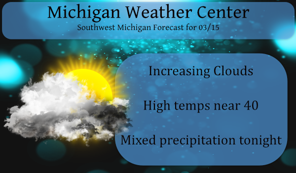
We will have a cool day today – A light wintry mix of snow, sleet, rain, and even some freezing rain, will move into the area this afternoon and evening continuing through early Tuesday. Any accumulations of snow or ice will be light, but we could still see some slick spots Monday evening through Tuesday morning. Highs Monday will reach close to 40 degrees. At this point, most of the precip will be from I96 to the south.
Forecast Discussion
- Low pressure brings snow/wintry mix tonight

There are two low pressure areas to watch this week. The first is
forecast to slowly approach from the southwest on Monday with a
wintry mix possible Monday morning across the southwest forecast
area. This area of mixed precipitation spreads north and weakens
by Tuesday as the low occludes and dry air continues to feed into
Lower Michigan on easterly flow. This is a favorable synoptic
setup for freezing rain but QPF is relatively light so impacts are
not expected to be great. P-type may be mostly snow across the
central and northern forecast area where model soundings show
thermal profiles below freezing through the column.

- Another Low brings chance snow/rain Thursday

A second low forms over the Southern Plains quickly in the wake
of the first one, and tracks northeast. There have been both
northward and southward trends in recent model guidance, but
enough spread to suggest that at least our southern forecast area
will get precip on Thursday. P-type is an issue. The model
guidance shows a high centered to the north as a source of cold
air, but thermal profiles across the southern zones are marginal
for snow. Further north soundings are cold enough for snow or
mixed precip to be the most likely p-type. The storm moves east
by Friday night and Saturday.
Looking promising! Bring it!
https://www.pivotalweather.com/model.php?m=gfs&p=sn10_acc&rh=2021031518&fh=384&r=conus&dpdt=&mc=
Oh yeah, that snow really accumulates with highs in the 50’s and 60’s! Get a grip!!
https://weather.com/weather/tenday/l/b4ea0280869baa46799dc75eacef8904785ec43ad2f6fb098355fbc208a55e2c
WWA for accumulating snow and possible freezing rain! Incredible!
Mostly sunny and 52 on Wednesday!!! Outstanding!!!
Blowtorch over Michigan in the new CPC outlooks!! Plenty of golf weather coming with no end in sight!! We are about to get pummeled with warmth and sunshine!!
Loving them shades of red over us on the CPC. !
Forget golf, it is still winter! I hope we get pummeled with snow! Bring it!
Lol!!! Why forget golf??? Plenty of golf weather in the 10 day!!
https://weather.com/weather/tenday/l/b4ea0280869baa46799dc75eacef8904785ec43ad2f6fb098355fbc208a55e2c
Just another great WINTER day! Wind chills around 20 degrees and a WWA! I absolutely love it! Maybe ANDY should head to the golf course! What a joke!
I will this weekend when it’s in the 50’s & 60’s! I love front and back loaded springs!
Winter weather advisory great Scotty. .8pm till tomorrow morning 10am . .INDY
Bring it, you mean the nice warm Spring weather is not here to say! How is that possible?
Tornado threat in Dixie Valley on Wednesday and it looks like the warm trend will continue through the rest of the month. I don’t like comparing every year to 2011, but we have a similar La Lina and a continued trend of warm air. Either way… definitely more active than last year
So much for a cold second half of March. CPC has us in a blowtorch, and next week looks incredible in the 50’s and 60’s!