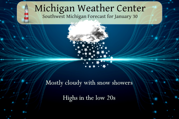
Michigan is back to its status as a winter wonderland. Temperatures will remain well below freezing (32°) this week so our snow cover won’t be going anywhere soon. At this point, it doesn’t appear to be any major snow storms on the horizon over the next several days, just a few light snow showers with maybe a couple of inches (or less) for SW lower Michigan. Temperatures will be falling throughout the day into the teens. We have 21° at 6 am.
Grand Rapids Forecast
1 30 grrLansing Forecast
1 30 lanKalamazoo Forecast
1 30 kzoForecast Discussion
-- Areas of light snow / flurries this morning --

Regional radar mosaics have shown light reflectivity in recent hours
from mesoscale bands of snow. Persistent virga was evident earlier this
morning on KGRR radar (most apparent at higher elevation tilts),
a consequence of sublimation within a dry layer centered near 7
kft. Nevertheless, light snow has been reported in numerous recent
surface obs. This banded snowfall appears to be associated with
an area of weak low/midlevel frontogenesis along the sloped
frontal zone that remains positioned over the region. Recent 3-km
NAM guidance is representing this activity reasonably, and
suggests that this activity will depart east of the forecast area
after 9 AM. Where snow reaches the surface, a light dusting is
possible.

-- Lake-effect snow showers later today and Tue; light accums --

A broad area of surface high pressure--currently over the central
plains--will advance eastward into the region today, accompanied by
broad subsidence and anticyclonic low-level flow curvature. Low-
level cold advection ahead of this high will yield 850-mb temps
falling to near -19C by this evening. Model time-height sections at
lakeshore locations continue to indicate somewhat low inversion
heights (4-5 kft) and shallow cloud-layer depths. However, the DGZ
will be fully positioned within the cloud layer, supporting light
lake-effect snow showers today and tonight. With northwest boundary-
layer flow, lake-effect showers will mainly affect areas along/west
of US-131. In this area, snowfall accums through tonight will
generally range from a dusting up to 1".

Inversion heights will likely decrease overnight, but forcing for
ascent in advance of an approaching vort max on Tue may foster a
slight rebound in inversion heights and increased lift in the DGZ.
Still, any additional accums on Tue are expected to be light once
again.

-- Dry Wed, sunshine likely in many areas --

As surface high pressure departs southeastward on Wed, low-level
warm advection will contribute to 850-mb temps warming to -7C by Wed
evening. Time-height sections suggest that lake-induced
stratocumulus will likely erode appreciably, allowing some sunshine
in many areas.

-- Thu into Sat --

Guidance continues to suggest that a midlevel shortwave trough will
dive southeastward over the northern Great Lakes on Thu. This wave
will likely facilitate cyclogenesis over Quebec, culminating with
the establishment of a deep upper low/trough over central Quebec on
Fri. Meanwhile, a trailing cold front will progress southward
through the Great Lakes on Thu. Behind the front, Lower MI will be
glanced by advancing arctic air. Coldest 850-mb temps (around -42C)
will likely be found in Quebec on Fri, with temps near
-18C (EPS median) over the forecast area.

Some glancing light synoptic snow may occur across the northern
forecast area on Thu, associated with the aforementioned shortwave
trough and front, but no PoPs will be introduced with this update. A
period of lake-effect snow is possible on Thu night and Fri, then
ensemble guidance continues to suggest that another strong surface
high will settle into the region around Fri night. Low-level warm
advection will commence again on Sat as this high continues
eastward, with warming daytime temps likely for the weekend.
9 degrees out in my hood thats definitely ice fishing weather love it INDY
Text from the GRR afternoon forecast update January 30, 2011. They certainly did a great job with this storm.
NEAR BLIZZARD CONDITIONS WILL BE POSSIBLE AS THE CORE OF THE
STRONGEST BOUNDARY LAYER WINDS COME THROUGH THE HEART OF THE CWA
LATE TUESDAY NIGHT INTO EARLY WEDNESDAY. THESE DETAILS WILL BE
IRONED OUT IN FUTURE FORECAST PACKAGES ALSO…AS BLIZZARD HEADLINES
ARE STILL A POSSIBILITY.
THE WATCH HAS BEEN POSTED FOR THE POSSIBILITY OF A VERY HIGH IMPACT
EVENT. TRAVEL…AND COMMERCE IN GENERAL…COULD BE PARALYZED WITH
NEAR RECORD BREAKING SNOWFALL.
12 years ago the NWS just posted all of West Michigan under a Winter Storm Watch for the incoming Blizzard of 2011. Here is Storm team 8 on this day 12 years ago
https://m.youtube.com/watch?v=FdH82CK9k2U
Looks like a whopping 5 inches of snow for Kent over the next 16 days on Rocky’s overblown fantasy maps!! FACTS!!
https://www.pivotalweather.com/model.php?p=snku_acc-imp&rh=2023013012&fh=384
More facts!! Keep it ROCKIN!! Blowtorch getting ready to fire again!

Unfortunately “warm” for the first half of January is anything above 31-33, so still winter conditions. Although in 2017 we had that week of 60s around February 20th… that would be nice. I went biking to the zoo that day
I can’t remember the exact year (maybe 2017) there were tornado warnings right at the Michigan/Indiana state line on February 28th. There was even a tornado watch that came right up to the state line. I was in Sturgis right on the state line that night with tornado warnings and big storms. Loud thunder. Was so weird for February.
It was awesome out on the trails today! Who wouldn’t love cold and snow this time of year! Rock n roll will never die!
Doing any snowshoeing? You may know about them already but down in Yankee Springs Recreational area in Barry County there are great trails for it.
+1
We have had light snow all day…
Sun is out today (at least for a little bit)!
Pattern is treading back to warmer than normal after Saturday! Just the facts!!
https://weather.com/weather/tenday/l/b523690bfd952b86fef3627c919dd9855281a8da16b83c10bdd381c64ae12cbc
Bernie is right per NOAA: If you like cold and snow better enjoy it this week, it’s not gonna stick around for long! Per NOAA: “The cold spells over the last few months haven’t lasted more than a couple of weeks, so there is no reason to think the upcoming (into early February) cold spell will be different,” said Todd Crawford, Vice President of Meteorology at Atmospheric G2. “We expect the final three weeks of the month to be warmer than normal on [a] national [scale] with the cold generally confined to the western half of the U.S. Finally, what… Read more »
Very cold night ahead tonight. Some places will likely go below zero.
Getting a moderate snow shower here at this time
Slim
Yesterday’s official high of 26 at Grand Rapids was the coldest high so far this January and the coldest high since December 27th The official low for yesterday was 23. There was 0.13” of total precipitation and a official snow fall amount of 1.9” and the official snow depth was 8” I was on the far southwest side of town yesterday and you can tell there is less snow on the ground there then here in my area. With the snow over the weekend Grand Rapids is now up to 80.4” for the season. For meteorological winter Grand Rapids is… Read more »
Looks like we have decent sun chances to start February. Maybe the cloudy pattern will finally be breaking (hopefully…).
I’d imagine January will end up being a near record warm and record cloudy month. With the storm, we probably won’t be seeing any snow records anymore.
Looks like I better get my skis out this week and get to it. This may be the only week in Feb with below average temps before the snow melts again (?)
Wrong we will see the polar vortex around the middle of Feb! Get ready!
Looks to be a very quiet week ahead weatherwise. But, it looks like I will have to break out the winter coat. I haven’t needed it much this winter so far.