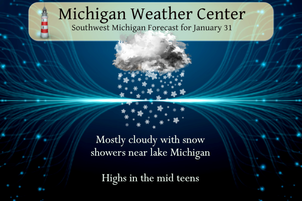
We have our coldest air of the new year thus far, our overnight low in Otsego is 8.4°. Yesterday we managed to get to 24° with around an inch of snowfall. We will have another cold day with temperatures in the mid-teens and snow will be confined mainly west of 131 with chances of seeing some glimpses of the sun inland.
Grand Rapids Forecast
1 31 grrLansing Forecast
1 31 lanKalamazoo Forecast
1 31 kzoForecast Discussion
-- Lake effect snow to continue into tonight --

The lake effect snow machine will continue unabated this time of
year with a flow off the lake, instability, deep enough moisture
and some lift. All of those factors will be present both today and
tonight. While significant accumulations are not expected, the
lakeshore counties will certainly see some fluffy light
accumulations.

BUFKIT overviews off the 3km NAM tell the story with shallow
moisture and solid lift all the way through tonight. The DGZ is
completely centered within the shallow moisture between 500 and
3,000 feet. Lift is squarely within the moisture and DGZ which has
allowed light snow shower activity to continue all night. Given
no change to the variables of moisture (3,000 to 4,000 foot
depths), lift (a shortwave plows in from the west this evening),
winds off the lake (NW becoming W) and instability (delta T`s in
the upper teens C to low 20s C) the lake snow shower activity will
continue. Thinking an inch or two today with another inch
possible tonight in the lakeshore counties.

-- Arctic front on Thursday --

An Arctic front is set to sweep through the forecast area on
Thursday which will bring the area snow showers on the front and
post frontal lake effect snows Thursday night into Friday. The
front will also plunge temperatures once again with -21C overhead
on Friday.

As for the snow showers, we may see some convectively driven snow
showers Thursday afternoon and evening given the front will be
powerful and there is some small CAPE that develops on the order
of 50 j/kg in spots. Not expecting much in the way of
accumulation, but visibilities could be driven fairly low for
short periods given some gusty winds and the deeper convective
snow showers. Lake effect will then commence almost immediately
behind the front as delta t`s rapidly surge towards 20 C and
larger. Some light accumulations towards the lakeshore will be
possible in the northwest flow. Given air temperatures in the
single digits and teens, travel will be impacted even in light
accumulations due to snow covered and slippery roads.

A cold period like the one we are in now will begin Thursday night
and continue into Saturday morning. Highs on Friday may not make
it out of the single digits in some areas. Depending on extent of
clearing Friday night could be one of the colder nights in quite
awhile with lows dipping towards -10F, especially inland.

-- Warming trend for the weekend into early next week --

The flow aloft becomes zonal and southwest with time during this
period which will quickly shunt the cold air back north and east
into Canada. The cold is really only a glancing blow towards the
end of this week. By Monday, 850mb temperatures will have climbed
all the way back to positive numbers around +3C. High temperatures
are forecast to be back above freezing on Monday.

In terms of sensible weather, a shortwave trough will move
through on Saturday and we have chances for snow showers in the
forecast from Saturday into Sunday. Precipitation does not look
too heavy and there is some disparity between the operational GFS
and ECMWF with the EC being dry for the most part. Given the range
in the forecast confidence is low at this point in terms of
precipitation.
Possible snowstorm is coming! Stay tuned for updates!
https://www.pivotalweather.com/model.php?p=snku_acc-imp&rh=2023013118&fh=264
Wow just wow! What a fantastic day out on the slopes! Just dress for cold and get outside and enjoy winter! I absolutely love these temps!
Latest CPC=BLOWTORCH!!! BRING IT! LET’S ROCK!!!
Read it and weep KIRKWOOD!!
https://www.mlive.com/weather/2023/01/spring-fever-will-set-in-with-the-abnormal-warmth-coming.html
One of my favorite places to be during the winter is Yankee Springs Recreational area. Great area for winter sports. I might have to go do some snowshoeing.
Excellent!
It was 4 below zero this morning at my house. Bone chilling. One of the colder pockets on my street read -6 on my car. It is currently 12.
I love long winters with above normal snowfall! What a winter! Skiing here I come baby!
I just hope this snow sticks around longer to enjoy it. But it looks like next week the above normal temps return. It’s like we get shots of winter weather and then “blah“. I don’t understand how people don’t like snow, if anything, it is prettier than brown dormant plants everywhere. Haha.
I agree with that Jesse. If you live up north during the winter where it’s cold there might as well be some snow on the ground. I don’t like the long periods of no snow where everything looks muddy and dead. A fresh blanket of snow really freshens up the landscape.
Only 14 here, but nice and sunny. With no wind it actually feels great out today
Good thing winter is winding down and we get to look forward to glorious Spring in 48 days! Could very well be earlier than that with all the forecasts and models coming into alignment on the warm up starting Sunday!
https://weather.com/weather/tenday/l/b523690bfd952b86fef3627c919dd9855281a8da16b83c10bdd381c64ae12cbc
Well, after a very snowy winter so far, we can look forward 8 more weeks of snow chances and snowstorms! What a winter! GR over 80 inches so far! Wow to the wow!
It sure is a bit cold out there this morning. Not for my dog. She thought she could sit in the snow and look around. The sun keeps trying to peek out.
Well, after a very warm January and only a week or two of colder air… it looks like we go right back to warmth according to the CPC. Sure was a short winter this year!
I love short Winters! Especially the kind where you get pummeled with snow and then it all melts a week later!! Funny thing is we’ll be above average for snow this winter, but we only had about 20 days where the snow was actually covering the grass! LOL!!! My kind of Winter for sure!
I love todays temps! No snow melt and great outdoor sports conditions! Dress for the cold and get outside and enjoy!
It’s a nippy -3 here. Nostril-freezing cold. Much too cold to be outside.
My Dad called it “squeaky snow” temps. In reference to how the snow sounds when you walk in different temps. Lol
Good call, Dad. It’s definitely a squeaky snow day.
Lol.
I remember winter days in Maine when we had to wear goggles to keep our eyes from freezing. Minus 40 isn’t anything to mess with.
I have zero interest in experiencing anything like that.
Good morning! Yesterday was the 1st below average mean day of 2023 and the 1st in the last 33 days. The official H/L at Grand Rapids yesterday was 24/10 there was 0.03” of total precipitation and 0.6” of snow fall. Tor the season GR is now at 81.0” January will end up being either the 4th or 5th warmest in recorded history. The overnight low here at my house so far is +9. For today the average H/L is 31/17 the record high of 57 was in 1989 and the record low of -20 was in 1899. The record snow… Read more »