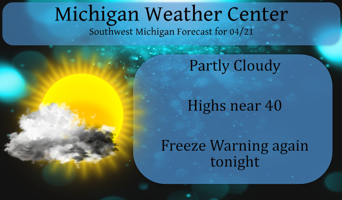
We currently have 25° at 6 am this morning under clear skies. It will be a cool day again today by late April standards. Normal highs today are around 60. We will be 20 degrees cooler than normal with highs only around 40°.
A northwest wind of 10 to 20 mph will make it feel even cooler. Skies will generally be partly cloudy today. We cannot rule out an isolated rain or snow shower over Central Lower Michigan and in the far southwest corner of the state. Tonight we return to the 20s with areas of frost once again.
We had a few snowflakes around yesterday in Otsego, though not enough to even amount to a trace. We have had 1.17 inches of precipitation so far for April.
Weather History for SE Michigan
April 18
On April 18, 1975, 2.69 inches of precipitation fell in Flint. This is the maximum precipitation record for the month of April in Flint.
April 19
On April 19, 1953, the temperature in Flint never rose above 35 degrees. This temperature was a record temperature, in that it was the lowest maximum temperature for that day. The next day, the record lowest maximum temperature for Flint was 34 degrees.
April 20
On April 20, 2000, 3.58 inches of precipitation fell in Detroit. This is the maximum daily precipitation record for the month of April and the sixth heaviest all-time daily rainfall in Detroit.
April 21
On April 21, 1976, an F2 tornado moved through Shiawassee County at 3:35 PM. This tornado was one of the most damaging tornadoes in Shiawassee County since 1950 and caused 1 injury and over $500,000 in damage.
April 22
On April 22, 1875, Detroit had a record low temperature of 20 degrees. The day before, on the 21st, Detroit had another record low of 21 degrees.
April 23
On April 23, 1985, the daytime temperature rose to 85 degrees in Flint, which is the record high temperature for the day. Curiously enough, the very next year, in 1986, the overnight temperature dropped to 22 degrees, setting the record low temperature for this day!
April 24
On April 24, 2005, a 3-day snowstorm swept across Southeast Lower Michigan dropping 16.5 inches of snow on NE Clarkston. The thumb reported drifts of 3-4 feet of snow. The storm began on the 23rd and lasted through the 25th.
Weather History for SW Michigan
April 18
1880: A tornado struck Chester, in Eaton County where barns were destroyed and livestock was killed. A quarter-mile wide swath of trees was leveled in a forest by the tornado.
April 19
1957: Less than a week after record low temperatures in the teens, high temperatures are pushing 80 degrees across Lower Michigan. Muskegon went from 19 degrees on the 15th to a high of 79 on this date, a rise of 60 degrees in four days.
April 20
1966: A tornado killed livestock and damaged a barn and garage in Morley in Mecosta County. Another tornado hit Peach Ridge in Kent County, damaging a steel tower.
April 21
1923: A tornado struck three miles west of Scottville in Mason County. It destroyed an unoccupied home and carried pieces of it over a mile.
1967: A tornado outbreak hits from Missouri to Michigan, killing 58 people. The worst of the damage was in northern Illinois, where dozens of people were killed in Belvidere and Oak Lawn. At least seven tornadoes hit Michigan, injuring more than 50 people and destroying dozens of homes. A tornado moved across the southern outskirts of Grand Rapids, doing heavy damage. Thirty-two people were injured and a total of 65 buildings were destroyed and another 60 heavily damaged. Another tornado injured eight people and killed 34 sheep as it moved from Westphalia to the south edge of Fowler in Clinton County.
2013: Heavy spring rains caused severe flooding. The Grand River crested at 21.85 feet in downtown Grand Rapids on the 22nd, with fish being photographed from the submerged windows of buildings along the river.
April 22
1976: A tornado damaged several homes northeast of Burlington in Calhoun County.
April 23
1968: A tornado struck Big Rapids in Mecosta County, injuring 11 people and doing half a million dollars in damage as it covered a path 10 miles long.
1986: Freezing weather prevails across Lower Michigan. Record cold temperatures for the date include 19 degrees at Muskegon and 20 degrees at Grand Rapids which is also a record for coldest so late in the season.
April 24
1980: Only two days after setting record highs in the 80s, a record snowfall blankets Lower Michigan. Grand Rapids sets a record for the date with 2.4 inches of snow, after hitting 86 degrees on the 22nd.
Forecast Discussion
-- Freezing Warning continues tonight --

Temperatures are slowly easing into the 20s this morning at most
locations. The coldest readings are in place across Central Lower
Michigan where mid 20s are becoming common. The thermal trough
remains in place area wide tonight, so we are looking at another
cold night coming up. There will be wind in place through the
lowest several thousand feet, so if there is a bright spot it will
not be ideal radiational conditions. Also, there is the chance at
some lake effect stratocumulus clouds tonight which would help in
keeping the temperatures up a bit. That said the advective aspect
of this event is probably more important with simply cold air in
place and continuing to be pushed in from upstream. We will not
recover much today (highs in the 40s) so we do not have far to
fall to get back into critical temperatures for early season fruit
trees.

We are not out of the frost and freezing temperature threat until
we get into next week. The two most concerning nights look to be
over the weekend after tonight on Saturday night and Sunday night
with 20s quite possible again.

-- Light precipitation possible today --

There are some small chances for precipitation today, but feel
most areas will remain dry. There is the chance of some lake
effect precipitation over Central Lower Michigan being advected in
off of Northern Lake Michigan. Also, not out of the realm of
possibilities we see some light returns off of Lake Michigan
upstream of our area. Best chance for precipitation, albeit small,
will be in the far southwest corner of the state near a shortwave
diving southeast through the Great Lakes. Not expecting a lot, but
we have 20-30 percent pops in the forecast for some light rain and
snow showers.

-- Next chance for precipitation Fri Night - Sat Night --

Next chance for precipitation (rain showers) will come Friday
night through Saturday night with an upper trough moving through
the Great Lakes. The main shortwave embedded within the upper
trough will be located to our south however. The surface
reflection of this wave will be a good distance from us,
traversing the Ohio Valley. An inverted trough extending north
from this low will move through our area with the most widespread
rain occurring on Saturday it appears. PWAT values do come up to
around 0.70 so we will see solid chance for rain. Totals look to
remain around a half inch or less at this point.

-- Dry Sunday through Tuesday --

A period of dry weather looks to be setting up from Sunday through
Tuesday with ridging in place aloft. Southerly flow will begin to
nudge our temperatures upward. Above normal temperatures look
likely Tuesday into Wednesday in the increasing southerly flow
ahead of our next system. That system looks to move through the
area Wednesday into Thursday. A better chance for heavier rain
with that system and possibilities for thunderstorms as well.
I generally consider April 21-October 21 the warmest 6 months of the year (average high is 60+). Highest sun angle is also just 2 months away. So while I do enjoy the snow, I am definitely looking forward to the warmer weather ahead!
Also I would imagine today will be the coldest day until next season. I find it hard to believe we will have a 40/25 temp reading again.
Also the sun angle is 60-70 degrees from April 21-August 21, so the sunniest third of the year has begun.
This is from the long range guess from accuweather on Typhoon Surigae “Though the typhoon recurves at a farther south latitude for the tele-connection rule, there is still a chance in the overall pattern in the Pacific changing to impact the pattern in the eastern U.S. at the start of May. We still feel that an upper trough will hold for a few days, resulting in chillier air and unsettled weather despite what some of the new runs are showing.If the trend of the PNA remains the same, then the mean upper ridge should remain in the eastern Rockies. This… Read more »
Here’s an incredible coincidence. I cued up Prince on Spotify and you’re not going to believe the song that just came up: “Sometimes It Snows in April.” No joke.
Interesting
Slim
Plus today is Prince’s 5th anniversary of his death…
No kidding? I can’t believe it’s been five years already. That’s another coincidence that I cued him up today.
I read an interesting article re: Typhoon Surigae, which fortunately spared the Philippines. A couple of highlights from the piece: – Intensified from a Cat 2 to a Cat 5 (190 mph winds) in less than 24 hours. – A monster of a storm, the diameter of the eye was 26 km (16 mi). – The strongest typhoon, cyclone or hurricane ever observed in the month of April. – When the storm rapidly intensified to category 5 strength on April 17, 2021, it marked the earliest date in the year that any storm in the Northern Hemisphere had reached such… Read more »
Wow, that is interesting. 75-foot waves!!!
Slim
34* degrees out in my area right now put the winter coat on wow ….INDY!!
April is the dead of Winter…snow, frost, freeze, cold…routine.
You know it and temps in mid 20’s tonight! Incredible!
End of April and we getting light snow In my area I hope mookie is enjoying the poool today lol…He’s been missing for 2 weeks now hmmmmm??? INDY
Amazing cold and snow! Absolutely incredible! Very cold last half of April this year! Who would have thought?
Yes, especially next week when we may struggle to reach the mid 70’s.
Got a question for Slim. It got down to the mid-20’s last night at home, but did not have any frost on the ground or any plants. If frost did not accumulate on the plants and flowers around my house, would the plants be damage by cold temps alone??
yes. What happens is that they freeze. There was no frost here at my house either I should point out that most plants that are native to Michigan should had done all right.
Slim
Yes it was obviously a hard freeze so plenty of damage happened last right and more of the same tonight! Get prepared now!
I did cover all the plants I have that had bloomed, so those should be fine. I’m leaving them covered until at least mid-day Thursday!
Where’s our snow we were promised over and over by some last week? Whoops! LOL!
Getting some light snow here now. It did snow to the south and south east of here so it was a matter of location.
Slim
24* degrees in my area this yes that’s January cold around the end of of April GREAT SCOTTY!!! INDY
Yesterday’s highs were some of the coldest for the date. The high at Grand Rapids of 40 was the 4th coldest maximum for the dated. At Lansing their high of 39 was the 5th coldest at Muskegon the high of 42 was their 9th coldest. At Kalamazoo the high of just 39 was their 3rd coldest and at Holland the high of 41 was their 4th coldest. For today with highs forecasted in the low 40’s could be the 2nd day in a row with some of the coldest highs. The overnight low here at my house was 25 but… Read more »
I just seen a black squirrel in my yard. I thought that might be rare but it looks like they are becoming more common in Michigan.
Slim
We have seen a couple around here as well!!!
My wife is from Battle Creek. There are many there, and Port Huron too. My father in law told me long ago that WK Kellogg brought them here from Europe.
What an incredible cold stretch along with accumulating snow just to our Southeast! Wow!
I am in Brighton this morning and yes, there is snow on the ground here.