Here we are entering the last month of Meteorological winter with the groundhog rustling in his burrow dreaming of his prognostication for the rest of the winter. There will be a bit more sunshine today across all of Southwest Lower Michigan. Skies will vary between partly and mostly sunny. Although high temperatures will be warmer today in the 20s versus the teens (Tuesday’s highs) it will still feel cold as an increasing southwest wind drives wind chill values into the 5 to 15 above range.
Weather History for SW Michigan
January 29
1909: A snowstorm dumps from 6 to 10 inches of snow across southern Lower Michigan.
1966: A week-long cold snap reaches its nadir as temperatures fall to record lows of 16 below zero at Grand Rapids and 12 below at Muskegon.
January 30
1951: A huge arctic high-pressure center moves south from Canada all the way to the Gulf of Mexico and brings snow to Florida. Temperatures fall to record lows in Lower Michigan. Grand Rapids sets their all-time record January low of 22 degrees below zero. Baldwin, Michigan plunges to 37 below zero.
2008: Rain changes to snow as an arctic cold front brings a flash freeze to lower Michigan during the night of the 29th, leaving a sheet of ice on the roads. Temperatures fall from the upper 40s to the single numbers, with occasional blinding white-out conditions in falling and blowing snow. There were numerous traffic accidents and some roads were closed for a time. School and event cancellations were widespread, and there were also sporadic power outages.
2019: Arctic air combined with strong winds gusting over 30 mph to bring dangerously cold wind chill temperatures of 20 to 40 below zero. Actual air temperatures remained below zero through the entire day across much of Lower Michigan with a 2 pm temperature of 12 below zero at Kalamazoo.
January 31
1914: A snowstorm drops from 6 to 14 inches of snow across southern Lower Michigan.
1977: One of the coldest months on record comes to a close with yet more arctic air and lake-effect snow. High temperatures are only in the teens during the last week of the month with 2 to 4 feet of snow piled up along the Lake Michigan snow belts.
February 1
1918: February opens on a frigid note during one of the most severe winters in history across the central and eastern United States. Muskegon tumbles to a record-cold 22 degrees below zero and Lansing also sets a record with 16 below.
February 2
1868: It is a chilly Groundhog Day as Lansing sets their all-time record low with a reading of 37 below zero.
February 3
2007: Blizzard conditions prevail across southwest Lower Michigan as an arctic blast of frigid air moving over Lake Michigan produces thundersnow and whiteout conditions. Grand Rapids sets a record for snowfall for any February day with 11.3 inches of snow.
February 4
1838: An ice jam on the Grand River causes flooding of much of Grand Rapids during early February. Several people had to be rescued from flooded neighborhoods and at the fur trading post.
1996: One of the coldest arctic outbreaks of the 20th century sends the thermometer down to 17 below zero at Grand Rapids and 19 below at Muskegon, both records for the date.
Weather History for SE Michigan
January 29
On January 29, 2018, widespread accumulating snow fell over Southeast Michigan. Most locations saw 1-5″, but a very narrow band of heavy snow developed along a line from Perry to Durand to Flint. Ten inches of snow was observed at Flint, making it the 16th largest snow in its climate record.
On January 29, 1947, 1.32 inches of rain fell in Flint!
January 30
On January 30, 2019, a record cold snap began across the region with Detroit, Flint, and Saginaw seeing high temperatures of 1, 2, and 4 respectively, which broke the daily low maximum temperature records at each site. Temperatures bottomed out well into the negative teens overnight.
On January 30, 2014, the last accumulating snow of the month fell. Amounts were less than one inch, but it pushed the record monthly snowfall totals to 39.1 inches in Detroit and 32.9 inches in Flint. It was the snowiest single month on record for both locations. The monthly total in Saginaw was 15.6, which was still good for its 20th snowiest January.
Also on January 30, 2012, all three Southeast Michigan climate sites saw temperatures soar to new daily record high temperatures. Saginaw, Flint, and Detroit respectively recorded highs of 56, 58, and 62 degrees.
Also on January 30, 1951, Flint had a record low of -16 degrees for the day.
January 31
On January 31, 2019, record cold lingered across the region. Detroit and Flint each experienced a high temp of 3 degrees and a low temp of -14 degrees which easily beat the respective previous records. Both sites spent 36 consecutive hours below 0 degrees during this cold snap. Wind gusting over 35 mph at times resulted in wind chills near or below -35 degrees for numerous hours.
A snowstorm in 1982 brought our 13th biggest snowstorm to the metro Detroit Area. The snow began late on the 30th and continued throughout much of the 31st. When it ended, nearly a foot /11.8″/ was officially measured at Detroit Metro Airport.
February 1
On February 1, 2015, a snowstorm for the record books blanketed the Great Lakes Region in snow. Light snow began in the predawn hours and gradually intensified until accumulation rates reached one inch per hour in the early afternoon and persisted into the evening.
As snow tapered off late that night into the following morning, amounts at Detroit had reached 16.7 inches, its third biggest snowstorm on record. In Flint, the total of 9.2 inches was its 22nd biggest snowstorm while the 11.2 inch total at the NWS White Lake was the 8th biggest in its rather abbreviated climate record.
Also, on February 1, 2014, a general 3 to 6 inches of snow fell across Southeast Michigan, including 4.1 inches in Detroit, 3.5 in Flint, and 3.6 in Saginaw. Port Huron measured the greatest accumulation of 7.5 inches.
Also, on February 1, 1881, a two-day snowstorm dropped 12.5 inches of snowfall on Detroit.
February 2
On February 2, 2011, the Groundhogs Day Blizzard affected a large area of the country from Oklahoma to the New England States, including southeast Michigan. The snow started during the evening hours of the 1st and continued into the 2nd. Snowfall accumulations generally range from 6 to 12 inches. Isolated higher amounts were recorded across the Thumb and Tri-Cities Region. Northeast winds gusting between 25 to 35 mph caused some blowing and drifting of snow. Frequent wind gusts to 35 mph came off Lake Huron and Saginaw Bay, leading to blizzard conditions north of the I-69 corridor. Some of the higher snowfall reports across the area included: Pigeon 14 inches; Port Huron 14 inches; Lapeer 13.6 inches; Lexington 13.5 inches; Bridgeport 13 inches; Mayville 13 inches; Pinconning 12 inches; Flushing 11 inches; Lake Orion 10 inches; and Romulus 9 inches.
Also on Groundhog Day in 1967, Flint measured 9.3″ of snow from another snowstorm that occurred February 1st-2nd. The groundhog probably had trouble getting out of his burrow that morning, let alone seeing his shadow.
Also, on the 2nd back in 1936, this marked the last day of a streak of 11 days (Jan 23-Feb 2, 1936) with daily temperatures colder than 19 degrees.
February 3
On February 3, 1985, the overnight temperature dropped to a freezing -15 degrees in Detroit.
February 4
On February 4th, 2018, a period of accumulating snow spanning two days came to an end. Most of Southeast Michigan saw 4-6″ with a peak observation of 6.1″ near the town of Peck.
Also on February 4, 2006, the city of Fairgrove in Tuscola County received 10.0 inches of snow. The snowstorm lasted from the 4th to the 5th.
Also on February 4, 2007, arctic air plunged over the Great Lakes Region on strong winds. The high temperature at Detroit was only 8, Flint was 4 and Saginaw was 5 above zero. The arctic air mass remained in place through the 6th.
Forecast Discussion
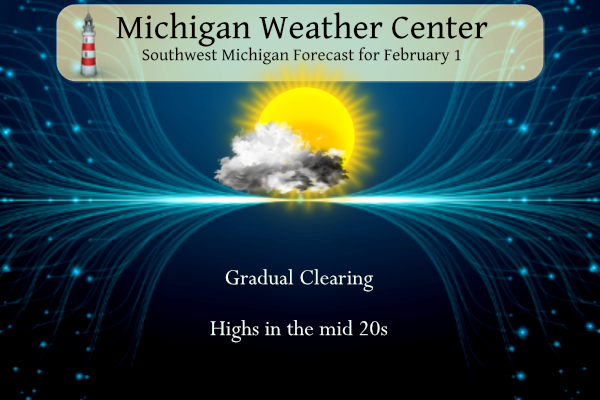
-- Zonal flow today --

Westerly flow today will continue through the morning before
shifting to the southwest. Cloudy skies will improve by this
afternoon as the winds shift to the southwest. This is out ahead
of a boundary with moist air to the north and dry air to the
south. This will lead to a fair day with improving conditions and
some sunshine.

-- Arctic front with snow squalls possible Thursday --

The fair weather is short lived as a large upper level low drops
down from Hudson bay and settles over northern Canada. This will
drive a trough across the Great Lakes region that also has a
strong mid level short wave with strong sfc low. Front this low
will be a cold front that will drape across the gradient with a
strong gradient attached to it. Mid range to the global models are
in fair agreement on timing and strength of this system.
 The strong northwesterly flow with strong low level convergence
along the front could allow for fgen banding for snow showers
Thursday evening. The best CAPE is through southeast Michigan.
However given the flow across the lake, the strong low level jet
and the timing between 18Z to 00Z there is a slight chance ther
could be some snow for the Thursday evening commute. However the
system is moisture starved so snow amounts look meager at best.

-- Cold temperatures Friday into Saturday --

Cold air behind this front friday morning has 850mb temps of
-23C. This should allow for lows Friday morning to be in the
 single digits. The cold air will continue into Saturday with some
 clearing possible Saturday morning. So there is a good chance for
 lows below zero Saturday morning. Warm air advection will follow
 quickly with a warm up into next week.
It sure was nice to see the sun today! Most of my driveway melted.
Crazy thing, if you go back and review the GRR CF6 data since the beginning of November, only 29 days total have had measurable snow! Not much time for winter sports! Heck the Winter Sports Complex in Muskegon just opened like a week or so ago.
Yes, I am going ice fishing for the first time of the year this weekend. Cadillac area has 6”, but it has taken a long time for lakes to get 3+” around me. It has not been a great year for winter sports.
My sister down in Austin, Texas is getting quite the ice storm. She has no power at her place. She sent me a couple pictures and there is quite the ice built up on the trees.
If you like the snow, enjoy it while it lasts! Per MLive most of the snow will be melted next week with several days in the 40’s!
Mookie, quick take a look at The Latest CPC and let me know what you think!
Here’s a hint…..

I saw most days will be near 39 degrees. Most of our snow will melt.
I am digging the sunshine this week. There is no substitute for natural light. Even with the chilly temps, the sun is melting the snow on the hard surfaces.
It sure is!! My driveway and walkway were all snow & ice and now they are dry.!!
What a beautiful day, enjoy it!
I will, I am heading to Pickeral lake to
Snowshoe! Incredible winter day!
I hope you had a great time!!
It sure was a beautiful day!! I hope you enjoyed it.
Check back with me by the 3rd week of Feb and we will see if the so called experts are correct about the warm up or the trusted RDB model! Stay tuned!
Another day back in Yankee Springs! Love it! Enjoy the weather everyone.
I’m enjoying it from my comfortable heated office!
I think I will trust the experts and trust the science!
https://www.mlive.com/weather/2023/01/spring-fever-will-set-in-with-the-abnormal-warmth-coming.html
Forget the CPC and all the talk about above normal temps the rest the month! This is bunk and totally wrong! We will be seeing some major cold by the 2nd or 3rd week of Feb with accumulating snow! Plan on it and mark it down on your calendar! Let the good times roll!
Yes, ignore factual models and data and just wishcast like Kirkwood and Rocky! That always works out well! Lol!!
https://weather.com/weather/tenday/l/b523690bfd952b86fef3627c919dd9855281a8da16b83c10bdd381c64ae12cbc
Interesting article on Wood TV 8 …
https://www.woodtv.com/weather/ask-ellen/ask-ellen-did-snow-stick-around-longer-through-winter-in-the-60s-70s/
Yes, I saw that and it was some good data.
That is interesting. Thanks for sharing, Bernie.
It was a very mild January across Lower Michigan the mean of 31.5 at Grand Rapids was the 5th warmest January. At Lansing their mean of 32.2 is the 4th warmest. At Muskegon the mean of 34.1 is the 3rd warmest, at Holland the mean there of 33.2 is the 5th warmest. To the east at Detroit the January mean there of 33.5 is the 7th warmest. At Flint the January mean of 31.5 is the 6th warmest and at Saginaw the mean there of 30.9 is the 4th warmest. So all across southern lower Michigan January 2023 was one… Read more »
Welcome to February. Yesterday was the coldest day of January 2023. The official H/L at Grand Rapids was 18/2 there was 0.01” of precipitation and 0.1” of snow fall. The day had 53% of possible sunshine and was the sunniest day in some time. Here in MBY the overnight temperature bottomed out a +7 and is now up to 13 with cloudy skies. For today the average H/L is 31/18 the record high of 51 was in 1968 and 1989. That 51 is the 2nd coldest record maximum at GR. The record low of -20 was set way back in… Read more »
It’s hard to believe it’s already February. Enjoy the snow this week, above average temps look to be returning:
https://www.mlive.com/weather/2023/01/spring-fever-will-set-in-with-the-abnormal-warmth-coming.html
The has been a very odd winter with 81.5″ of snow at Grand Rapids and 38.6″ at Lansing so far but most of January did not have any snow on the ground.
Slim