We have another chilly early morning with a temp of 9° at 7 am. There are a lot of guesses that below normal temps will continue on into early March. With our La Nina still in place this coming early spring we may see an uptick in severe weather with the clash of warm and cold air. Of course, as always these are only guesses.
We had very little in the way of severe storms in lower Michigan last year with no tornadoes reported. There were two tornado reports in the U.P.. Area storm chasers had to go to Illinois to capture any action.

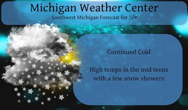
Our winter weather advisory for the lakeshore counties expires at noon as the lake effect machines take a break. The cold air isn’t going away as it seems to want to make up for the months of above-normal temps.
Forecast Discussion:
-- Lingering snow showers this morning near/south of Muskegon --

KGRR radar trends early this morning show scattered lingering
snow showers from near KMKG southward near Lake MI. The vast
majority of our area will have dry and cold wx today but we do
expect some snow showers to linger from KMKG southward through the
morning with isolated additional snow accumulations of an inch or
two possible there.

-- Very cold this week --

A consensus of latest short to medium range guidance and
ensembles continues to suggest that very cold wx will continue
across our area through the rest of the week and weekend. High
temps daily will only reach the teens with mins ranging from the
single digits below zero to the single digits above zero.

Min temps nightly are largely contingent on extent of low cloud
cover and below zero temps are expected any night that we have a
fair amount of clearing. Latest ecmwf ensemble guidance suggests
h8 temps will fall to -20 to -24 C by this weekend. As such high
temps for this weekend will likely only reach the single digits
above zero with potential for mins this weekend to drop to at
least 5 to 10 degrees below zero.

-- No significant snow events expected through the weekend --

A consensus of latest medium range guidance does not show
potential for any significant snow events through the rest of the
week and weekend. A few light mainly lake effect snow showers and
flurries are expected from time to time but no significant snow is
expected. There is some potential for light snow Thursday night
as a strong upper level disturbance moves through from the west.
Of greater concern will be potential for a fairly strong system to
move northeast from the ArkLaTex region early next week that
could potentially bring our area some snow by then.
Great winter and great forecast the rest of this month! Dress warm and get outside and enjoy winter people!! Rock n roll baby!
It was another great day on the ski trails and this is another great snow map!!!
https://www.pivotalweather.com/model.php?m=gfs&p=snku_acc&rh=2021020918&fh=384&r=conus&dpdt=&mc=
Pretty amazing it’s only 15* degrees outside right now whats that 18* degrees below normal great Scotty it’s cold outside!! INDY
NWS: No significant snow events expected all the way through the weekend. I love it!
17 inches of snow on the ground in my area with temps in the teens through next week it’s not going anywhere anytime soon that’s enough snow for me and for most …Back loaded Winter 2021 is fun …..INDY
Always more snow at Indy’s no matter what LOL
The NWS is talking out of both sides of their mouth, very similar to mookie. This quote is directly form their afternoon discussion! Give me a break!
The best windows for
accumulating snow look to be Thursday evening and particularly on
Sunday when a sharp clipper is expected to drop through the area.
Some fun 2021 odds and ends. So far in 2021 the warmest it has gotten is 41. And the warmest so far this month is just 37. For January that high of 41 is well below the 100-year average highest for January of 48. And the highest for February so far of 37 is also well below the average highest in February of 50. The coldest it has been this winter season so far here at Grand Rapids is +2 the last time it has gotten below zero here at Grand Rapids is February 1st, 2019. The last time Grand… Read more »
This just confirms the great winter weather we are having. The streak of not going below Zero will be ending very, very soon!
This just confirms how little snow and cold we’ve had all winter long.
I have had snow on the ground since Christmas day pretty amazing if you ask most ….No January thaws no 50’s or No rain storms like previous years joy to the world!! INDY
Ice fishing has been amazing best in a long time and close to home so peaceful out on the lakes ….INDY
Perfect ice fishing conditions and no change is in sight! It has been a great winter!
Check out the latest GFS 10 day snow map! Incredible!
https://www.instantweathermaps.com/GFS-php/conussfc.php?run=2021020906&time=PER&var=ASNOWI&hour=240
Had to get the snow rake out for our roof we have over 2 foot snow drifts on it I’m trying to think the last time I had to get it out probably 2012 maybe long time ago that’s for sure more amazing snow amounts coming I see thank you for that ..Let it snow let it snow….INDY
Lets review the facts! Snowshoeing yesterday and cross country skiing today! Cold as far as the eye can see and despite the warm weather propaganda by the end of this week/weekend and into next week we have multiple snowstorm chances! This is definitely a back loaded winter and will end up being a long winter! I love it!
Another inch of snow has fell overnight it just keeps snowing and snowing and snowing and snowing let’s keep it going to through April DDDDDD….INDY ….
10″ of snow on the ground. Looks very quiet for the week.
That may have been the best we see all year for the snow lovers. Back into the 30’s and 40’s in the next 10 days or so as we climb into spring!
Wow even above average snowfall at you’re place on the ground amazing plenty of snow and time to get outside and enjoy it back loaded Winter of fun 2021 …INDY
The most snow on the ground so far this winter season at Grand Rapids is 12″ The mean average 30 year average of the deepest snow cover at GRR is 12″ The 100 year mean average deepest snow cover is 11″ so in the department this winter so far has gone down as average.
Slim
17 inches of snow on the ground temps in the teens back loaded Winter of fun and we have more snow on the way we warned you!! ….Get outside and play INDYSNOW!!
The warm weather fanatics will never admit we are having a back loaded winter, even though the facts are clear! The cold and snow will last well into March! Fantastic!