I will be going to Borgess Hospital in Kalamazoo tomorrow morning to have some work done to my heart. Not sure how long I will be in there, but hopefully not more than a couple of days. I will leave this blog in Slim’s capable hands for the duration.
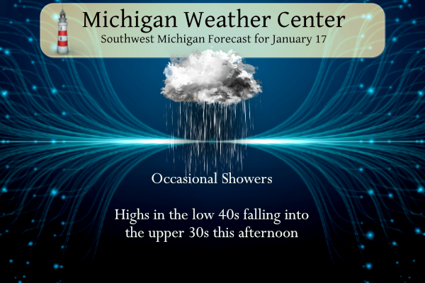
Look for occasional rain showers to continue today ending tonight as light rain and snow showers. After a break in the precipitation on Wednesday, a wintry mix can be expected across Lower Michigan on Wednesday night and Thursday. The track of this system still has some uncertainty but the rain-snow line at this time may be around Grand Rapids to the north.
Kalamazoo Forecast
7-Day Forecast 42.29°N 85.58°W 1 17 kzoLansing Forecast
7-Day Forecast 42.71°N 84.57°W 1 17 lanGrand Rapids Forecast
7-Day Forecast 42.96°N 85.67°W 1 17 grrForecast Discussion
- Spotty Rain Continues Today, Switch to Snow Possible This Evening

Temperatures still sit comfortably above freezing as of 3am with
temps ranging from the 40s to the south and down into the mid 30s to
the north. Meanwhile radar continues to show spotty showers and
drizzle across the area, but given the mild temps the concern for
freezing rain/drizzle is low at this time. While we may still cool a
few degrees within the next few hours, wet bulb temps will hold
above freezing, so the outlook for freezing precip for the rest of
this morning looks minimal.

This low pressure system will move northeast by this evening
resulting in the upper flow shifting northwesterly. Colder air will
filter into the area, and any lingering rain may mix in with snow
late tonight mainly across central and northern lower MI.

- Bigger System Late Wednesday/Thursday Morning

Moisture wanes shortly after midnight as the low pulls further away,
thus any lingering precipitation should end by sunrise Wednesday
morning. Dry conditions will dominate much of the day Wednesday
before our next Southern Plains system arrives late Wednesday
night into early Thursday.

There remains fairly good consistency in model output on the overall
evolution of this system. Subtle differences still exist however,
which lead to a small amount of uncertainty on the track of the
system and thus precipitation amounts and the location of the
rain/snow line. Given the early morning arrival of the system,
temperatures that will be near to slightly above freezing will bring
the possibility for a rain/snow mix at the onset. The greatest
chance for snow accumulations will exist across the northern half of
the CWA, particularly areas north of I-96. Warm advection will
increase Thursday afternoon, leading to a northward shift of the
rain/snow line towards US-10 by mid-afternoon.

The flow shifts northwesterly on Friday as the Southern Plains low
exits east. There is a chance we could see some effects of this
lingering northwest flow into Friday, but certainty is low at the
moment.

- Mostly Dry Weekend

Moisture continues to dwindle across the area into this weekend as
high pressure builds in from our west. Uncertainty increases into
Sunday as models diverge on possible scenarios. The ECMWF remains
fairly dry through this weekend, while the more active GFS suggests
another system moves in from the southwest.
Michael keeping you and your family in my prayers. Wishing you a speedy recovery.
The cpc is looking good for cold and snow next week! Incredible!
The only thing worse than rain in January is freezing rain in January! Bring on the pattern change and tons of snow! I love it!
Rainy and mid 40’s during the coldest time of the year. I love it!
Interesting find by my wife on trying to control lightning:
https://news.yahoo.com/scientists-laser-guide-lightning-bolt-170251839.html?guccounter=1
Wow I did not realize lightning strikes up to 120 times a second worldwide… that is crazy
Prayers for you Michael! Weather takes a back seat when it comes to health and life.
Sending prayers Michael! 🙏 Take the time you need and we will look foreword to your return on here!
Prayers for you Michael and your family! Take your time healing… You left the blog in Slim’s capable hands.
I’m sure we will all be thinking of you Michael 🙏🏻
I wish Michael a speedy recovery. And as Michael stated I will be filling in for the next couple of days.
Slim
Sending prayers up, Michael.
Good morning! The official H/L for yesterday was 41/33 that 41 was just before midnight last night and the temperature has gone up overnight and the current reading at GRR is 46 here in MBY the current reading is 45. There was 0.29” of rain fall yesterday with no snow fall. There was no sunshine. For today the average H/L is 31/18 the record high of 56 was set in 1952 and the record low of -10 was set in 1976. The most snow fall of 4.7” fell in 2009. After today’s rain ends there ls a very brief period… Read more »