Yesterday was cool and wet with a high of 62°, the low was 51°. We had .53 of an inch of rain which brings our total for the month to 1.38 inches in Otsego.
Autumn Leaves . . . it’s that time of year
Now that we are officially in autumn, leaves in many parts of the country are starting to change or will be changing soon. Have you ever wondered “Why do the leaves change color?” . . . or have you ever wondered “Does precipitation play a role in leaf color?”
“The amount and brilliance of the colors that develop in any particular autumn season are related to weather conditions that occur before and during the time the chlorophyll in the leaves is dwindling,” says University of Kentucky agricultural meteorologist Tom Priddy. “Temperature and moisture are the main influences. …The countless combinations of these two highly variable factors assure that no two autumns can be exactly alike.”
And if you are just trying to find out where the leaves are turning during a certain week or in a certain place in the country, the Foliage Report Network: “The Foliage Network” keeps track of leaf colors in the midwestern and eastern half of the country and the US Forest Service keeps you advised on fall colors throughout the US at: “Fall Colors”.
For more info on the study of periodic plant and animal life cycle events that are influenced by environmental changes, especially seasonal variations in temperature and precipitation driven by weather and climate, please visit the National Phenology Network Web site at: “National Phenology Network”.
Around my property, the leaves on a few of the walnut and maple trees have dropped many of their leaves in a brown state due to the dry conditions we had periodically throughout the summer months.
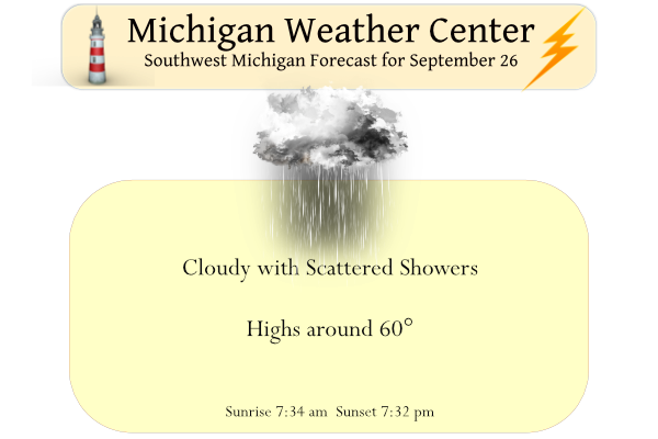
Forecast Discussion
--Rainy weather will continue through the first half of the week--

A large upper level low will continue to dominate the weather
pattern through the first half of the week. This low will be
situated over southern Ontario and will move to the southeast as
it slowly treks eastward.
 Strong northerly flow will keep cold air advecting into the area
through this timeframe. Along with this cold air will be low to
mid level moisture which will allow for clouds to persist over the
region along with periods of showers.

--Storms possible over the Lake Michigan through Tuesday--

Looking at the CAM soundings, while LCL`s will be in the 2 to 3KFT
range, there should be an inversion between 9 to 10KFT. This
should stifle any convection and reduce the probability of
thunderstorms. However, when accounting for the Lake Michigan
water temperatures this drastically changes. Lake Michigan temps
are in the 65 degree range and given the strong flow and decent
low level wind shear, air temps will warm upwards of 65 degrees.
So this warm, moist air, some would say a thermal ridge, over Lake
Michigan should be more than enough to break any mid to low level
inversion and allow for thunderstorms over Lake Michigan today
into tomorrow. Given that the 850mb winds are not expected to be
over 35kts there will be enough but not to much shear for
waterspout formation.

If these storms move onshore, they will experience a conditionally
stable environment and shouldn`t move inland to far. So storms
inland are possible west of the US 131 corridor.

--Improving conditions through the second half of the week--

 As the upper level low moves eastward and tilts positively it
will shift the moisture eastwardly, allowing for breaks in the
clouds and a weakening of the gradient over the region. This will
also allow for the end to any precipitation by Wednesday. High
pressure will build over the region Wednesday into Thursday. This
will allow for warmer, drier air to infiltrate the region.
Temperatures should warm into the 60s through the latter half of
the week and potentially the 70s over the weekend.
 The region should remain dry through this period with the long
range dominated and conditional on what Hurricane Ian does.
I wrote the NWS on the temperature departures and why Grand Rapids departures have been les than several areas in Lower Michigan. I have gotten a response and that will be my post for this Saturday.
Slim
Probably the same thing they told me when I asked? They said they are aware of the differences and there could be many reasons why. But they are confident in the temperatures they are presently recording.
Currently 52* degrees out in my hood is it early November?? Feels great outside not sure why some like mid 90’s and humidity but I will take fresh air over hot air anyday now bring on the snow …. INDY
It is cloudy and 56 here at my house.
Slim
60 here and the Lansing airport today – ten degrees below average.
Solid green around here, other than the stressed trees from the lack of rain that went straight to brown. Looking at the MTU webcam MV has linked below, solid green as far as you can see up there as well.
https://www.mtu.edu/webcams/view/
Lake effect rain showers today soon it will be all snow woo woo … check out the beautiful colors poping around town hitting TC this weekend looks beautiful for a little Fall color tour yeahhh… INDY
It has now clouded up and it is now 57 here at my house.
Slim
As I am no longer following NWS GR data due to always being misleadingly cold relative to their averages, it’s still been a very warm September!
Lansing: +3.0
Detroit: +3.3
Muskegon +3.2
So, are you saying that their equipment is not calibrated right? Or are they lying for some reason? Or was it warmer in the past at Grand Rapids? Or that it has warmed more at other locations? Remember that while the departures have been cooler at Grand Rapids for some time now (compared to some other locations) the mean temperatures are very similar to each other.
Slim
We have some pretty nice weather coming later this week. Let’s hope hurricane Ian doesn’t affect this upcoming pattern
Also the 50s and 60s are not as cold as I thought. It’s actually been pretty nice the past few days besides the cloud cover
50’s and 60’s are not cold and come next March/April they will fell warm.
Slim
I agree. I’ve always said 50’s and 60’s are the perfect temps for me, and far, far, from being cold. Spent the whole morning cutting wood and clearing trees without sweating profusely and needing to drink 3 gallons of water to stay hydrated. Perfect weather!
Yes the 50s and 60s are actually really nice. I’m quite surprised… for some reason I thought it would feel colder. That must be the 40s 😀
The official H/L at Grand Rapids yesterday was 63/51 at GRR there was a reported 0.44” of rain fall and 9% of possible sunshine. Here in MBY I recorded 0.27” of rain fall. The overnight low both here and at GRR was 50 and at this time it is clear and 51 here at my house. For today the average H/L is now down to 70/49 the record high of 92 was set in 2017 (it was the last day of that late September heat wave) and the record low of 30 was set in 1947. The next several days… Read more »
Wow, what a cold snap we are entrenched in! The below normal temp pattern keeps rocking! Bring on winter!
Winter is still a ways off and it more likely than not warm up again.
Slim