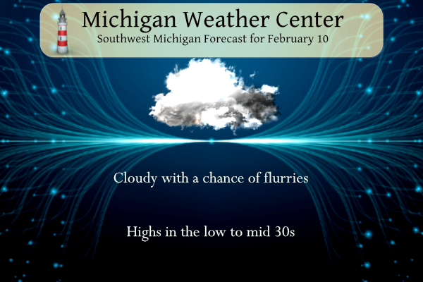
We had about an inch and a half of rain yesterday in Otsego – this is not the ‘official’ total, I won’t get out to the rain gauge until after sunrise. Our high was 47°. Our snow pack is gone once again. We can expect another cloudy day today with a few flurries. The sun will make its triumphant return tomorrow and Sunday with temperatures still above normal around 40°.
Latest ENSO Discussion
ENSO-neutral conditions are expected to begin within the next couple of months and persist through the Northern Hemisphere spring and early summer.
Although a weak La Niña was still apparent during January, below-average sea surface temperatures (SSTs) continued to weaken further across the equatorial Pacific Ocean [Fig. 1]. The latest weekly Niño index values were mostly near -0.5°C, with the exception of Niño-1+2 which was +0.1°C [Fig. 2]. Like the surface, negative subsurface temperature anomalies continued to weaken [Fig. 3], with above-average subsurface temperatures expanding eastward at depth and near the surface of the eastern Pacific Ocean [Fig. 4]. Low-level easterly wind anomalies continued but were confined to the western and central Pacific Ocean. Upper-level westerly wind anomalies were evident over the east-central Pacific. Suppressed convection persisted over the western and central tropical Pacific, while enhanced convection was observed over western Indonesia [Fig. 5]. Overall, the coupled ocean-atmosphere system continued to reflect La Niña.
![[Fig. 1]](https://www.cpc.ncep.noaa.gov/products/analysis_monitoring/enso_advisory/figure01.gif)
![[Fig. 2]](https://www.cpc.ncep.noaa.gov/products/analysis_monitoring/enso_advisory/figure02.gif)
![[Fig. 3]](https://www.cpc.ncep.noaa.gov/products/analysis_monitoring/enso_advisory/figure03.gif)
![[Fig. 4]](https://www.cpc.ncep.noaa.gov/products/analysis_monitoring/enso_advisory/figure04.gif)
![[Fig. 5]](https://www.cpc.ncep.noaa.gov/products/analysis_monitoring/enso_advisory/figure05.gif)
The most recent IRI plume predicts a transition from La Niña to ENSO-neutral in the next couple of months [Fig. 6]. The forecaster consensus is largely in agreement. ENSO-neutral is expected to prevail during the spring and early summer. There are increasing chances of El Niño at longer forecast horizons, though uncertainty remains high because of the spring prediction barrier, which typically is associated with lower forecast accuracy. In summary, ENSO-neutral conditions are expected to begin within the next couple of months and persist through the Northern Hemisphere spring and early summer [Fig. 7].
![[Fig. 6]](https://www.cpc.ncep.noaa.gov/products/analysis_monitoring/enso_advisory/figure06.gif)
![[Fig. 7]](https://www.cpc.ncep.noaa.gov/products/analysis_monitoring/enso_advisory/figure07.gif)
Grand Rapids Forecast
2 10 grrLansing Forecast
2 10 lanKalamazoo Forecast
2 10 kzoForecast Discussion
-- Light snow showers expected today before diminishing --

The more widespread area of mixed rain and snow that came through
last evening has pretty much exited the area as of 08z or 3 am this
morning. That is pretty much the end of the precipitation with the
system that moved through yesterday.

We will keep shower chances in for the area through most of today,
with the focus on the western half of the area. We have the flow
from the W/NW today, and just barely some marginal instability
(delta t`s of around 13C) over the lake with the cooler air flowing
in. We will have a fairly robust short wave that will pass through
the area centered around 18z today, and add some lift to the area.

Forecast soundings indicate that even with the short wave coming
into the region, inversion heights with lake modified parcels are
only expected to be 3-4k ft. It seems that the deep cold air never
really gets down this far, and the cloud depth will be quite
limited. In addition, the DGZ is rather shallow also. This
ultimately makes us think there will be snow showers around, but
nothing that should cause any noticeable impacts.

The snow showers should gradually taper off after 18-20z as the
upper trough moves east of the area, and the ridging aloft builds in
quickly.

-- Quiet and generally mild this weekend through most of Tuesday --

Once the system moves by later today, we will see fairly strong
upper ridging build over the area for Sat and Sun. The ridge and
subsidence will be strong enough, that there is high confidence
amongst the models that clear skies are expected Sat and Sun. The
return flow around the sfc ridge will advect some warmer air over
the area.

Most areas will stay dry also early next week through most of Tue.
The only caveat to this is a fairly strong wave that will move
through on Monday. This could produce a few sprinkles or flurries
out of a mid deck, but that would be the extent of it. There is just
no real low level moisture available for the wave to pick up.

-- Another wet and mild system on Wed then snow potential Thu-Fri --

We have our attention focused on two different systems next week.
One of them will come through Tue night and Wed, and another
potentially Thu.

We will see a long wave trough take control over the Western U.S.,
with a SW flow aimed right toward Lower Michigan. We will see one
fairly strong wave lift NE out of the long wave late Tue and Tue
night. This will draw a nice feed of moisture from the Gulf and up
and over the area. Right now, there is decent agreement that the low
will track west of the state, and warm and mild air will advect in
for our area.

There is no rest for the weary then next week, as the main wave in
the long wave trough rounds the bottom of the trough and lifts
toward the Northeast. This system for next Thu-Fri could be more
interesting, but it is too early to focus on just one solution at
this time. The various models and their ensembles have a better
chance of the main system staying SE of the area, and potentially
phasing with a nrn stream bringing much colder air from Canada. This
has the potential to drop some accumulating snow over the area,
along with colder air. Still a lot of time for the individual
features to be resolved.
Looks like winter is in its dying days. All good with me, not even many days with snow on the ground this winter, I would take this every year!!
Currently it is snowing pretty hard in central Michigan. No Accumulation yet because the ground is warm.
Had a dream last night that I was doing wall to wall severe weather coverage on television with Storm Team 8 tracking a tornado warned storm. Crazy.
Thank God it is still winter and we have accumulating snow and snowstorms still to come! Wow, just wow!
The next “item of interest” is around the 16th/17th. Computer models showing a pretty deep system moving into the Great Lakes region. Right now it looks like a rainy system with heavy snow over Wisconsin. Of course way to far out to know specifics and tracks.
This 10 day outlook is just a thing of beauty!!! Just WOW!!
https://weather.com/weather/tenday/l/b523690bfd952b86fef3627c919dd9855281a8da16b83c10bdd381c64ae12cbc
Wood has nothing but 40’s from Saturday to Thursday now.
I wouldn’t be surprised if we hit 50+ on Tuesday. That’s crazy. The overall trend of this warm winter continues. Constant warmth with short waves of cold.
This winter is now among the lowest on record for the number of days with at least 1” of snow on the ground for GR. Wow!
With just 37 days with 1″ or better on the ground this season is currently in the top 10. Right now GR is at number 8. I have tossed out number 1 with a reported 0 days as there were several days where there should have been 1″ or more on the ground.
Slim
This morning the roads by me are absolutely terrible. Sheets of thin black ice covered by a little snow. Buses were sliding off the road and parking lots are barely walkable. Of course, school wasn’t canceled and I saw buses sliding around.
Yesterday was a record setting day at Grand Rapids, Holland and Kalamazoo. At Grand Rapids it was a record rain fall amount of 1.10” at Holland a rain fall amount of 0.97” and at Kalamazoo a record high of 55. The official H/L at GR yesterday was 43/33 and there was no sunshine. The low overnight was a mild 34 and that is the current temperature. For today the average H/L is 32/19 The record high of 61 was set in 2009 and the record low of -21 was set way back in 1899.
Slim
What, no love for the capital city? 🙂
Lansing also set a record of 1.09″ of rain. The official H/L for Lansing was 49/36, which was good for a +19 departure from normal.
Sorry I didn’t see that. Thanks for the update
Slom
No worries. I got your back.
Thank GOD that was all rain and not snow!!! That would have been an awful mess with that much snow!