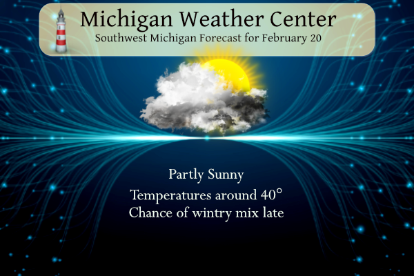
We reached 52° yesterday here in Otsego for another nice winter day. This was our third 50° plus day this month. Partly sunny skies are expected today but temperatures will only reach to near 40° which is still above average for this time of year. A system tonight and Tue will bring light snow to some areas, mainly north of I-96. A more significant system is expected for Wed–Thu, likely bringing accumulating snow and an icy mix of freezing rain and sleet to the area. Hazardous travel is likely in many locations, and power outages are possible.
Grand Rapids Forecast
2 20 grrLansing Forecast
2 20 lanKalamazoo Forecast
1 20 kzoForecast Discussion
-- Clipper Tonight into Tuesday to begin this week --

Models remain consistent on the location and timing of a large
upper level low situated over Hudson Bay. This low brings a
shallow trough through the Upper Midwest. That ripple of energy
will allow for a positively tilted trough to extend from a mid
level low. Warm air out ahead of this system will be supplanted by
colder air in its wake, Monday night into Tuesday. Thus the 40s
of today will be replaced with temperatures at to just above
freezing on Tuesday. Looking at the near term CAMS there is
decent frontogenetic forcing along this boundary with just enough
CAPE behind it to allow for showers tonight into tomorrow
morning. The waffling of temperatures will be a taste of things to
come with precipitation falling as rain across most of the region
before transitioning to snow early Tuesday. While the moisture
allotted this system is not significant, it is more than enough
to allow for an inch or two of snowfall to be possible along and
just to the south of the US 10 corridor. However given the
marginal temperatures and the wet ground, accumulations will have
trouble remaining.

--Continued chance for an Impactful Winter Storm midweek--

For almost a week the models have shown a signal showing a system
that will move into the region like a dagger. This cunning pattern
of an excelling nature will not be like a Promethean heat but
will be more of a callous cold. The long range models do well in
the placement of high pressure systems. Given that the situation
that will drive the weather this week is guided by two of them it
is no wonder it has been so consistent. The third part to this
is the large unrelenting low sitting over northern Canada that is
driving the troughs through the upper levels. NAEFS and ECMWF
anomalies show anomalous moisture from 18Z Wednesday through 12Z
Thursday to the tune of +2 to +4 standard deviations. The key to
this system is determining how far north and when the warm air
will advect else our eyes will be made the fool of the other
senses.

The cold air from the system moving through tonight will allow for
colder surface temperatures north of I -96. That snow will seed
the ground to allow for heavy snowfall along the US 10 corridor
Wednesday evening into Thursday. The soundings currently show a
DGZ around 5Kft with copious moisture throughout. This should
allow for good snowfall rates. As the warmer air treks northward
the snowfall ratios will diminish with a switch to a wintry mix
with sleet potentially being the dominate type.

The question remains on what precipitation will befall us. The
area of most concern for icing will be south of I-96 and
especially along the I-94 corridor. Precipitation should switch to
sleet and freezing rain as temperatures continue to trend warmer
late Wednesday evening into early Thursday morning. Total QPF
remains around an inch through the north with one to 2 inches
possible in the southern tier of counties. Just know that unlike
models "Life is so constructed, that this event does not, cannot,
and will not match expectations". However there is increasing
confidence with the timing and expectations of what we should see.
Headlines should be likely later today.

The evening and morning commutes will be impacted with power
outages possible. The good news, is that the warming trend on
Thursday will bring temperatures above freezing which should help
in limiting the effects of any ice formation.

--Cold air with lake effect to end the work week--

A low pressure system should swig through Thursday night into
Friday which will bring a cold front with cold northwesterly flow
in its wake. This will bring a chance for some lake effect and
drop temperatures back to the 20s.
Those cold temps will be short lived as we warm back up into the
mid to upper 30s this upcoming weekend.
Rumor has it “winter is not over”! Bring that heavy snow line down about 50 lilies or so and GR may get hammered with snow! The RDB will weigh in tomorrow evening! Stay tuned! Incredible!
Or move it up 50 “lilies” or so and we won’t have to deal with freezing rain, power outages, sleet, or snow and just have more Winter time rain.
…WINTER STORM WATCH IN EFFECT FROM TUESDAY EVENING THROUGH
THURSDAY MORNING…
* WHAT…Heavy mixed precipitation possible. Total snow
accumulations of 6 to 10 inches and ice accumulations of a
light glaze possible. Winds could gust as high as 40 mph.
* WHERE…Portions of central and west central Michigan.
* WHEN…From Tuesday evening through Thursday morning.
* IMPACTS…Travel could be very difficult.
Torregrossa’s latest:
https://www.mlive.com/weather/2023/02/initial-thoughts-on-ice-storm-snowstorm-coming-to-michigan.html
Oh did I mention that I’m supposed to pick up my bro from the Flint airport at 5:30 on Wednesday?
I just noticed that it is spelled “wintry mix”, not “wintery mix”. Random fact of the day 😀
20 More days until Spring and we have a major Winter storm on the horizon wow!! INDY
Well, that’s a first! Dropping a Charlotte Bronte quote into the middle of a forecast.
Yes the last two GRR’s have made my literary mind delight.
It was probably written by ChatGPT. hahaha. But in all seriousness, I am hoping for snow, not ice. It appears the significant icing models have shifted south a bit, which is good news for me.
Well it looks like some Winter Storm Watches may be posted later today by the sounds of the discussion. Heaviest icing looks to be between 94 and 96. WPC shows heaviest icing in Northern Kzoo, Calhoun and the next row north.
Well, this is day 6 of my 1st COVID experience. For the most part my COVID so far has been like a odd cold. That is cold like symptoms but just feels different for some reason. While I seem to be feeling better, the overnight was not good to me. I have been having on and off coughing spells with not hint as to when one was going to happen. Well, I had a real bad one that woke me up at 2:30 or so and I had to cough up a lot of what I will call phlegm that… Read more »
The official H/L here in Grand Rapids yesterday was 47/34 there was no rain or snow fall and the sun was out for 418 minutes good for 65%. There was a reported 1” of snow on the ground yesterday at 7 AM. During my coughing spell the low fell to 22 here and now it is 23 with clear skies. For today the average H/L is now up to 35/20 the record high of 63 was in 2018 and the record low of -13 was set in 1966 and again in 2015. The record snow fall amount of 7.1” fell… Read more »
Hopefully you can get your cough under control Slim and glad things weren’t worse for you. I had covid last week and I am feeling great now just the occasional cough leftover.
That’s why I suggested musinex to help with that phlegm. The coughing can be bad!!!
This must be a fairly new meteorologist at the NWS, with some of his Shakespearean lingo leaving me scratching my head… I wish he would just stick to normal egg head lingo that I can understand.
+ 1 million!
I can agree with that. I read it this morning and was left scratching my head to what they were saying in parts of it.
Yea it is hard to read into how confident they are. With all the odd vocabulary, it makes it sound like the storm will be off the charts. But I think that is due to their word choice
I was thinking the same thing. The guy’s name is Joe Ceru. With Bill Marino (the best FD writer IMO), it’s almost as if Joe is trying to compete with Bill’s legacy, or something.
Forget the ice and bring on a big snowstorm!