We have been fattening up several squirrels this winter, so much so that my wife and I have discussed having squirrel dinner. We have seven now feeding at the bird feeders, we started out with three at the beginning of the winter. They sit in the trees in the woods watching me fill the feeders every morning then come pouring out of the woods. I don’t mind feeding the critters but this is getting ridiculous. We enjoy the wildlife in the woods but I think we would like the squirrels better well seasoned in the frying pan as they are getting out of control.
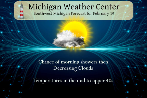
Look for decreasing clouds today. An isolated morning shower is possible this morning. A system on Mon night and Tue will bring light snow to some areas, mainly north of I-96. A more significant system is expected for Wed–Thu, likely bringing accumulating snow and an icy mix of freezing rain and sleet to the area. Travel-related impacts are likely. We are keeping an eye on this system, as it may become interesting. (see forecast discussion below).*
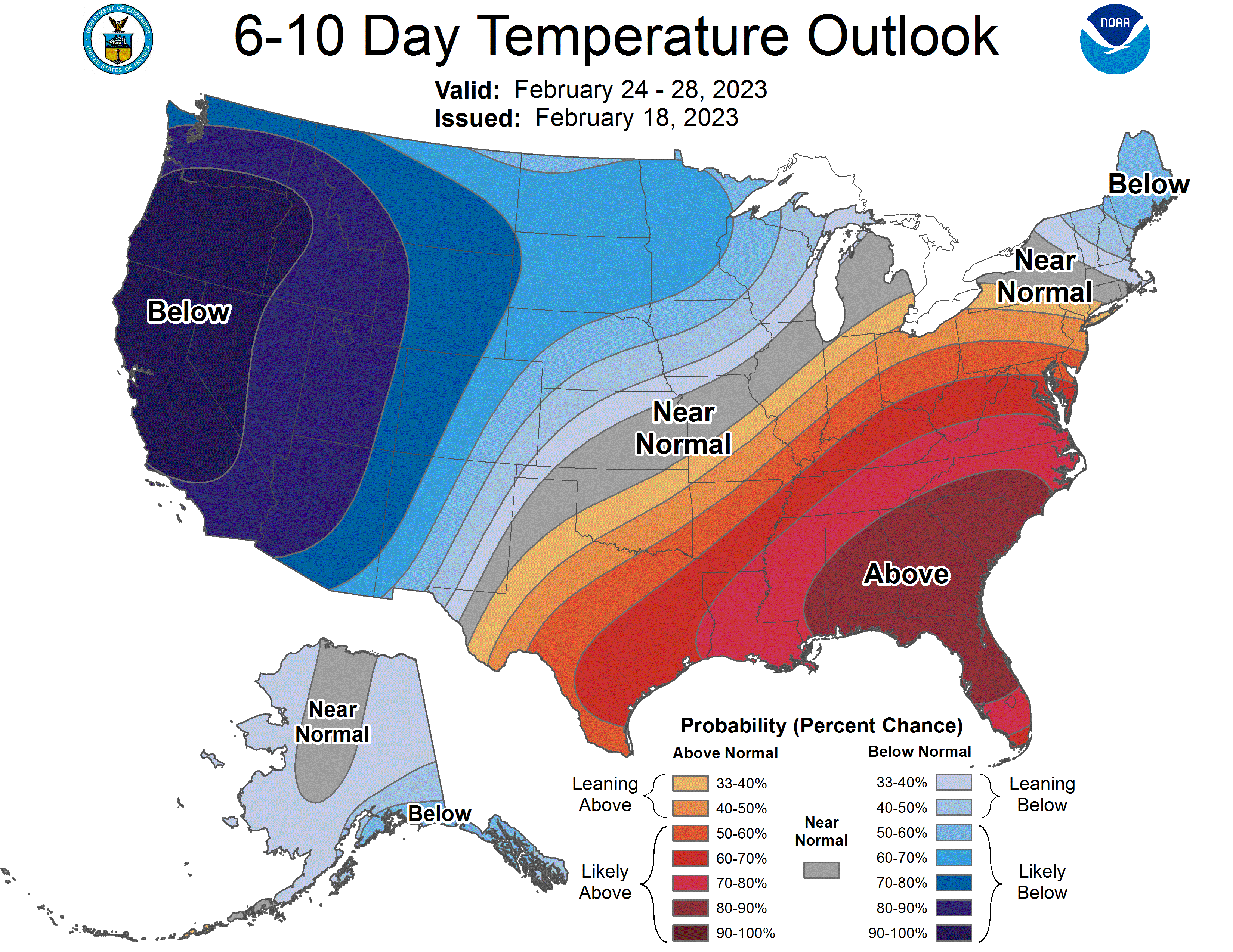
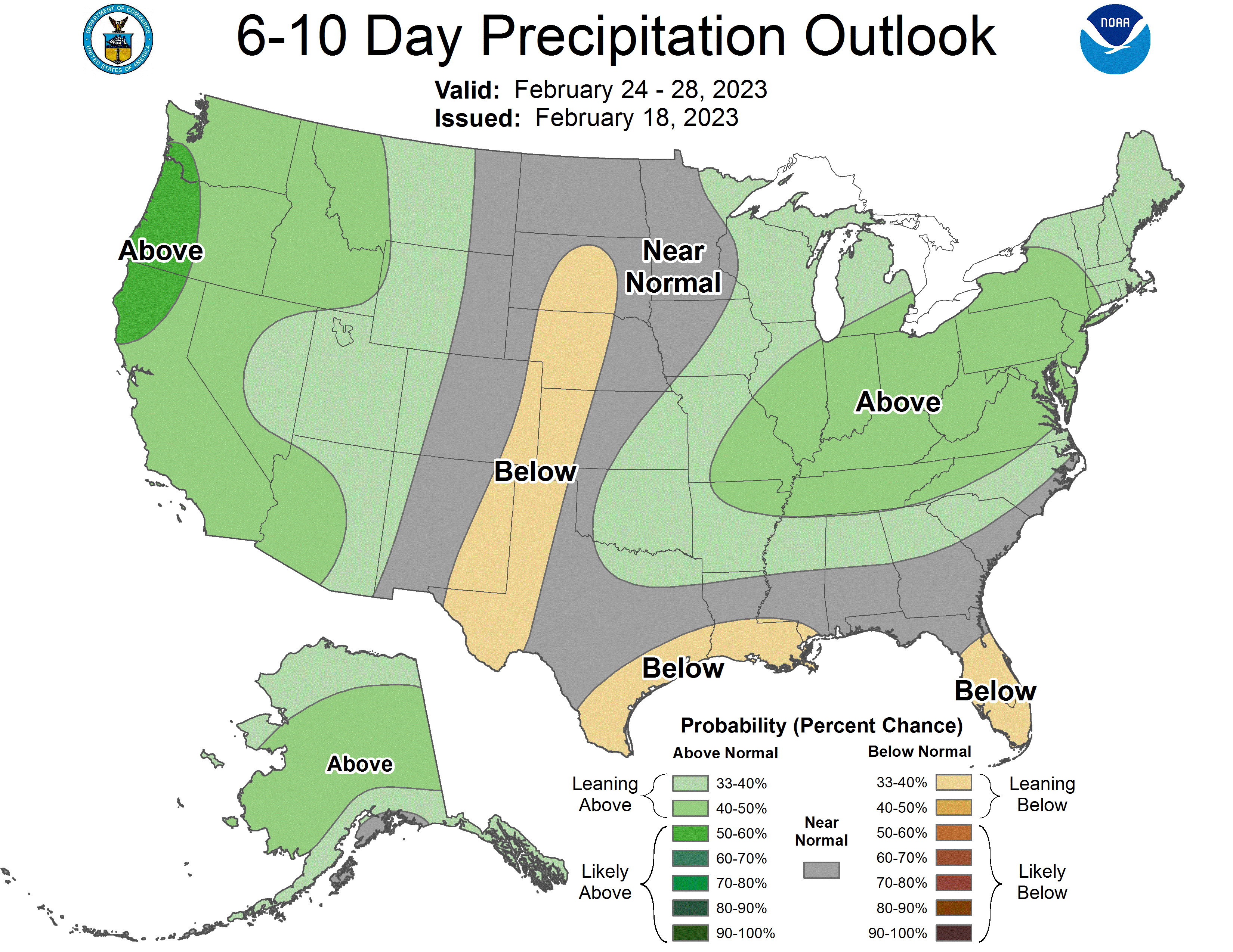
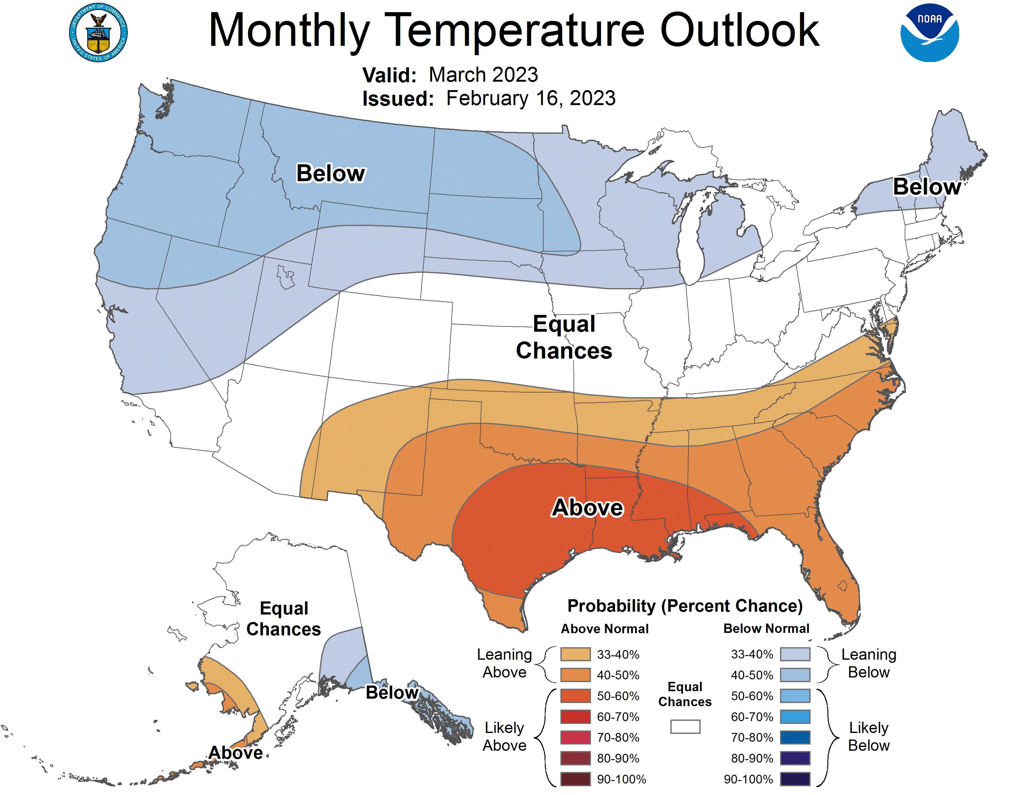
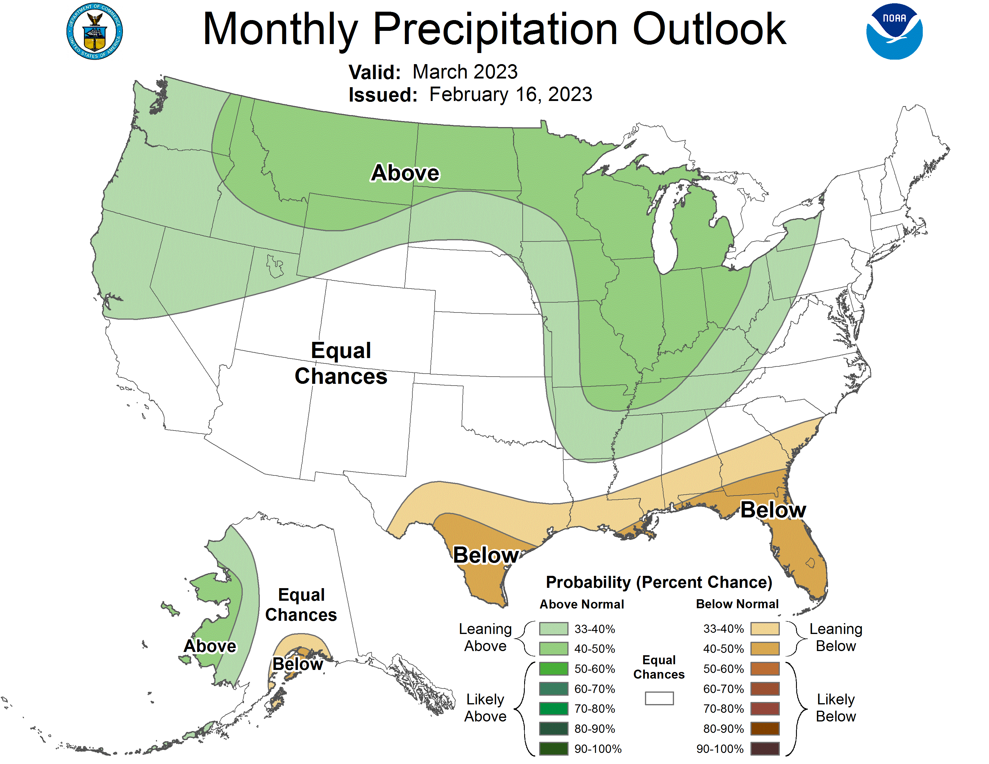
As we close out February we may see equal chances of near to below-normal temperatures and above-normal precipitation across most of the state. The March outlook is for below-normal temperatures and above-normal precipitation.
Grand Rapids Forecast
2 19 grrLansing Forecast
2 19 lanKalamazoo Forecast
2 19 kzoForecast Discussion
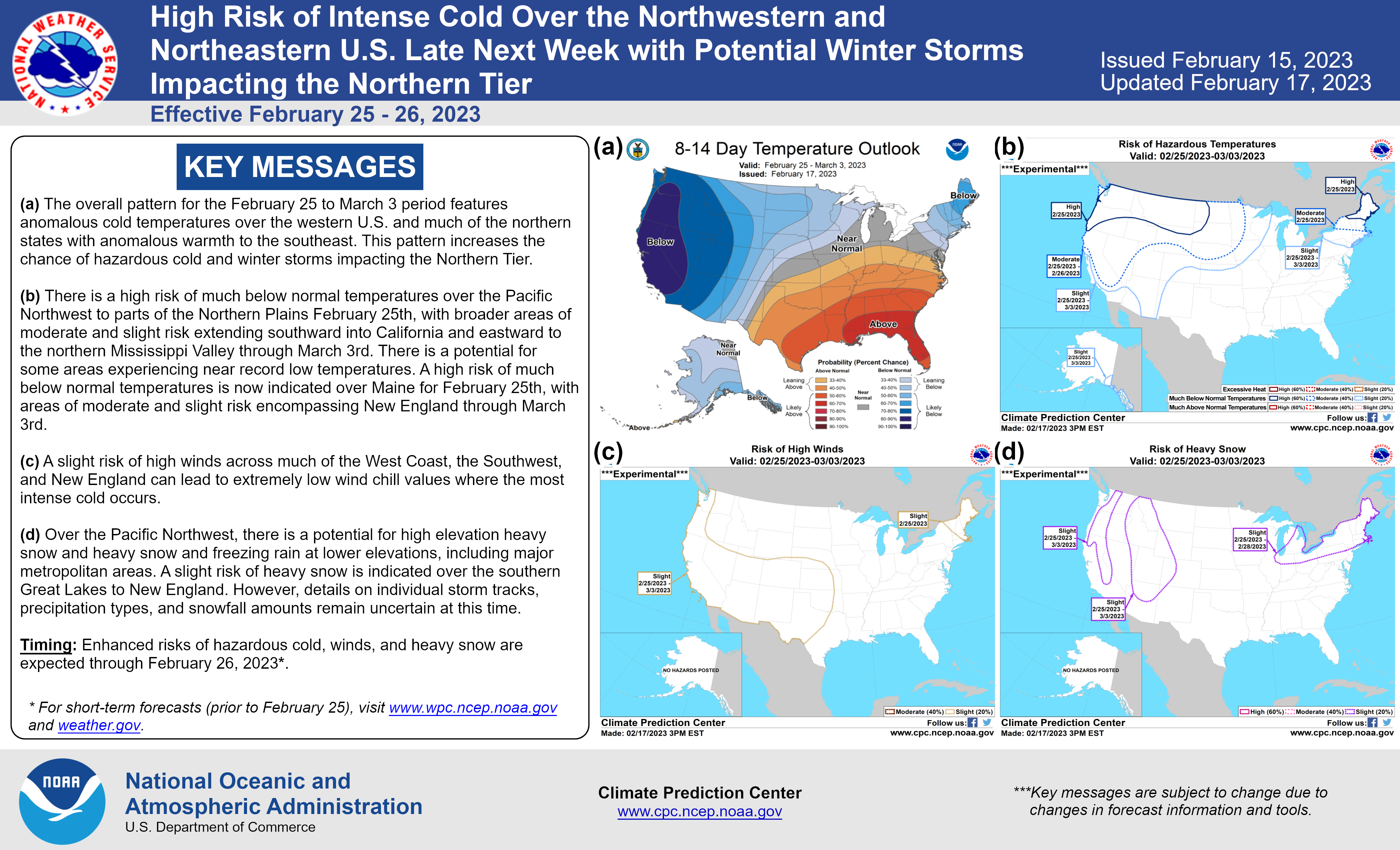
-- Week begins with weak Clipper --

Latest radar shows minor reflectivities moving across Lake
Michigan. This incoming precipitation will continue to propagate
through the state this morning. A weak shallow trough will
continue to spur this precipitation. There will be some gusty
winds this morning due to a Low level jet out ahead of the
approaching trough. This trough is fairly moisture starved so any
precipitation will be light at best. Temperatures are also
marginally at or above freezing so light rain will be the
predominate form of precipitation. Warm air advection will bring
temperatures today into the mid 40s.

A mid to upper level trough moving across the state will bring
northwest flow through Lower Michigan tonight into tomorrow
morning. This will bring blustery northwesterly flow and slowly
cooling temperatures. The models are in fair agreement on the
passage of a 500mb shallow trough that will be associated with a
mid level low at 850mb and a subsequent surface low moving through
Wisconsin and the upper peninsula Monday into Tuesday. The best
moisture for that clipper will remain through northern Michigan
with less than a tenth of QPF expected. Any precipitation will be
snow due to 850mb temperatures in the -5C range. Strong cold air
advection will follow as the low moves eastward.

-- Major Winter Storm Possible Wednesday through Thursday --

*The cold air advection from the passage of Monday`s clipper will
set the stage for the potential for a major winter storm mid week.
That system will not be a much ado about nothing. Snow, sleet,
and freezing rain are expected to shuffle through this mortal coil
bringing travel impacts and some power outages across the area.
This could bring heart ache with impacts that could feel like a
thousand natural shocks to Lower Michigan midweek. This could lead
to travel impacts and some power outages to the area.

 The models and ensembles remain consistent so there is an
increasing confidence in the time, trek and intensity of the
storm. While it may seem like madness, there is a method to it.
The Great Lakes will be stuck between two systems with a clear
baroclinic zone. A large upper level low situated over Hudson Bay
and a large High over the Gulf of Mexico and the Atlantic south of
Florida will trap Michigan.

A deepening low moving through the northwest United States will
provide the impetus of mid and lower level moisture stream.
 The biggest question is not if but where the 850mb temperatures
will advect to. As stated in previous discussions the robust
moisture feed of Gulf air to tap, with PWAT anomalies showing
+3 to +4 Standard deviations according to the latest ECMWF
standardized anomalies. Where the front sets up is one of the
bigger questions going forward. It remains around the I 96
corridor. A few inches of snow are possible north of the front,
with a mix of freezing rain and sleet south of the warm front.

The troubling part of this system will be as the high pressure
over the southern Atlantic meanders to the southwest. That will
allow for gulf moisture to stream into previously mentioned low.
That will bring a steady stream of precipitation that will
continue into Thursday. The southern third of Michigan is
precariously positioned. The incoming surface low is weakened as
it enters the state which will slow its movement and increase the
time the precipitation lingers.

The biggest impacts will range from travel due to freezing rain
and sleet to power outages due to the accumulation of ice from the
freezing rain Wednesday night into Thursday.
 Coupled with any ice accumulation will be the gusty winds that
will accompany this system. A strong gradient capable of causing wind
gusts upwards of 25 to 30 mph possible. These winds coupled with
the freezing rain could increase the potential for power outages.

-- Cold temperatures with Lake Effect into next weekend --

As the upper level low treks eastward the positively tilted trough
will bring arctic air into the region with 850mb temps of -19C
possible by Friday morning. That northwesterly flow and cold air
advection could make lake effect possible. Any lake effect snow
will be short lived and a large upper level ridge builds over the
region late Friday into Saturday. Cold temperatures should
dominate the region next weekend.
I hate Freezing rain 😎
Ditto. Hey Jack, how you been?
Jack good to see you on here. I don’t want the freezing rain either. I am ready for Spring.
NO Ice Storm…please.
I will say the last major ice storm I can remember in West MI was December 2013 right before Christmas. In that event some places went a week without power. I’ll add though we had some cold air that kept the ice on the trees even after the event which lingered the power issues.
It certainly looks like we need to watch next week closely. Still it’s too early to know specifics. Freezing rain forecasts are hard even right before an event let alone still a few days out. It’s doesn’t take much for freezing rain forecasts to become a bust and to get lots of sleet. That being said the ingredients are there. I thought the morning discussion used some interesting choice of words in the discussion. I guess we will know more in the days ahead.
There are two weather related things that really scare me.
Seeing a derecho event on radar that’s headed toward my house and a bad ice storm that knocks out local power for an extended period of time.
Please, no ice storm next week.
The official H/L at Grand Rapids yesterday was 38/35 there was no rain or snow fall and at 7am there was 2” of snow on the ground. There was 593 minutes of sunshine that is good for 93%. With cloudy skies the current temperature here in my yard is 36. There is still around 1.5” of snow on the ground here yet. For today the average H/L is now up to 35/20 the record high of 62 was set in 2017 and the record low of -15 was set in 1978. The record snow fall of 5.0” was set in… Read more »
Yikes, the forecast discussion certainly sounds ominous – especially this far out. This is a time when I hope the mets totally fail with their forecast. I can’t think of anyone that wants a crippling ice storm.
How about that game last night? Both teams played hard, but I don’t think that State could muster the stamina to put in a full 40 minutes. I tip my hat to U-M and their faithful. It was an emotional evening. Well done, Blue. Well done, indeed.
Make someone smile and have a great day.
My brother is heading back to MSU today, they had the last week off. I watched the game last night, definitely appreciate the sportsmanship that UMich presented!