I am adding some more educational materials to the site many are from AMS (American Meteorological Society) sources from their tutorials. I am a member of the AMS and have slowly been trudging my way towards certification.
The document below is an explanation of the CPC climate outlooks:
2011_ClimateOutlooks_General_PublicThere is increasing confidence in model runs we will continue to see above-normal temps into early March, after a brief cool down today temps will go back into the 40s through the weekend.
Forecast Discussion
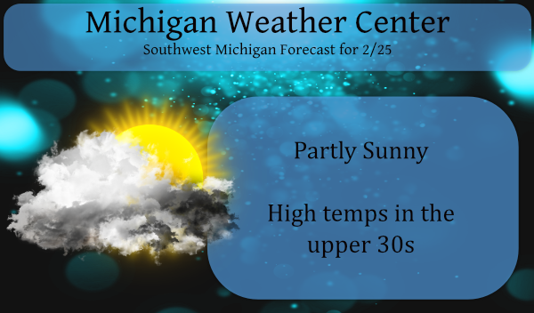
- Small chance for snow and rain showers today

Weak trough tracking through Northern Michigan today will provide a
small chance for snow/rain showers. These should be mainly near and
north of US 10, but we could see a stray shower or sprinkle/flurry
south of there. Low/mid level forcing from this system will be
fighting dry air and subsidence at upper levels, so anything that
does fall will be very light. Weak echos associated with this system
are showing up on radar near Lake Superior, so it is at least worthy
of some small POPs. Most locations in West Michigan will only
experience an increase in clouds as the system passes to the north,
given a boost from daytime heating. Temperatures will be cooler
today, with highs in the mid and upper 30s. These temperatures are
close to normal.

- Quick shot of rain and snow Friday night into Saturday morning

Upper shortwave pivoting through a longer wave trough will lift up
through Michigan Friday night, providing the next chance for
precipitation. Decent but quick shot of lift with this system
(surface trough, mid-level wave, upper diffluence), combined with
deeper moisture advecting in, will provide a widespread chance for
snow and rain. Amounts look fairly light as this event will be
quick, likely only lasting through the second half of the night into
early Saturday morning. Questions surrounding precipitation type
still exist as low-level temperatures hover close to freezing. At
this time, forecast soundings support mostly rain near/south of the
I-96 corridor, and 1-2 inches of slushy snow north of there. Amounts
and precipitation type forecast may need some tweaking over the next
few days though, as it`s a really close call between rain and snow.

- Temperatures warm back above normal Friday through Sunday

Warmer air advecting into the area ahead of the approaching trough
will boost high temperatures back to near 40 on Friday. Weak surface
ridge on Saturday will transition back to southerly flow on Sunday
in advance of another low pressure system. High temperatures should
warm above 40 in most places each of these days, and we could make a
run at upper 40s by Sunday towards Jackson, Lansing, and Battle
Creek. The warm temperatures will favor rain as the main
precipitation type late Sunday and Sunday night as low pressure
passes through the area. A strong cold front Sunday night will then
push temperatures back down into the 30s for highs Monday, and teens
for lows Monday night.

- Increasing confidence in near/above normal temperatures early
March

Long-range temperature guidance from the past several runs of the
GFS and Euro ensembles show strong support for high temperatures
reaching above 40 each day from Wednesday (March 3) through the end
of the following week (March 11-12). There are times these models
even show 50 for Grand Rapids. For reference, normal highs for Grand
Rapids are 39 on March 3rd, and 42 on March 11th. With these
temperatures, we should continue to see a steady melting of our
snowpack, and of ice on lakes and rivers.
The 10 day forecast still looking spectacular!! Front Loaded Springs ROCK!!!
https://weather.com/weather/tenday/l/b4ea0280869baa46799dc75eacef8904785ec43ad2f6fb098355fbc208a55e2c
Friday: 41, Saturday: 44, Sunday: 47… warm up #2 is coming! I love front loaded springs!
I think I heard Bill’s voice break down a little bit when he was reading the 8 day forecast. So sad!! The guy is just wishing the cold would stick around longer, but Mother Nature is not cooperating!!
GR snowpack is down 5″ over the past 2 days. At this rate, snow may be gone soon.
But the parking lot snow piles will hang on for a while.
Slim
So will the ski resorts LOL
While this winter’s total snow fall is only 44.8″ This February will end up as one of the top snowiest February’s in Grand Rapids history. We will end up at least the 6th snowiest and are still in play for the 5th spot. If Grand Rapids fails to reach 50″ that would be the first time that Grand Rapids has not had at least 50″ since the winter of 1986/87 And only the 4th time since 1950.
At this time it is partly cloudy and 31 here.
Slim
The birds singing away this morning now we need Thunderstorms good things are coming it’s called Spring…..INDY
Right on INDY!!
Thanks for posting this, MV.
Looks like most of the snow may be gone by the end of the weekend. Fortunately, we have not had precipitation during this melt. The Red Cedar is just starting to rise now.
P.S. What a gorgeous morning! Loving the sunshine and the earlier sunrise.