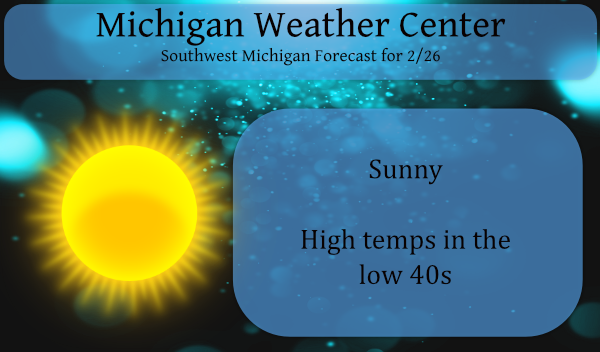
Plenty of sunshine is expected today. This will help boost temperatures to the low 40s for most locations. A light mix of rain, snow, and freezing rain will move through the area late tonight. Impacts to travel will be brief, especially as temperatures warm above freezing Saturday morning.
Here is another item in my educational series that discusses the differences between weather and climate:
WeatherAndClimateForecast Discussion
- Freezing fog concerns this morning, then sunshine

High pressure situated near the Indiana/Ohio border is providing
clear skies and light winds across the area. This will allow areas
of freezing fog to form through mid morning, some dense. Most
locations will only see patches of freezing fog, with the highest
confidence in shallow, transient patches developing closer to the
low center near/south of the I-94 corridor. Further north,
specifically near/north of Muskegon and west of US-131, warm moist
southwest flow off the lake may allow a more widespread area of
freezing fog to fill in under a shallow inversion. This will be the
area we need to watch the most as we head through the morning. Where
freezing fog does form, ice may deposit on roads and create slick
spots. Any fog will dissipate in the mid-morning as southerly winds
increase ahead of an approaching trough. Plenty of sunshine will be
seen this afternoon and early this evening before we start to feel
the impacts from this trough, however. After another cold start to
the day, temperatures will warm to the upper 30s to low 40s.

- Light mix of precipitation late tonight into Saturday morning

Longwave trough now developing from the Western U.S. to the Midwest
will bring a few shots of precipitation to our area through early
next week. The first will be late tonight into Saturday morning as
the first chunk of energy embedded within the trough crosses Lower
Michigan.

We are not expecting significant amounts of precipitation from this
system, as it will cross quickly over the area. Dry air in place
through this evening should be overcome fairly quickly as 30-40 knot
low-level jet punches up into the area after midnight. Strong warm
air advection tied to this feature will also cause a period of
warming temperatures at the surface overnight, especially for areas
near/south of I-96. This will help change precipitation type there
to rain after an initial burst of snow or even light sleet/freezing
rain. Locations north of I-96 will be colder as precipitation
arrives, and will have the best chance for slushy snow accumulations
(around an inch or less) before a changeover to a mix of
rain/snow/freezing just before sunrise. Precipitation is expected to
taper off by around 7 AM as forcing pushes east and drier air moves
in. Temperatures even north of I-96 will warm to above freezing by
mid-morning, reducing the time frozen precipitation can have an
impact on travel.

- Mixed precipitation again Saturday night and Sunday, turning windy

Next upper wave will affect the area Saturday night through Sunday.
Models have trended stronger with the shortwave from 24 hours ago,
and now show a pretty decent deepening of the surface wave as it
crosses northern Michigan. This system will again pass quickly
through the area, and with a lack of deep layer moisture,
rain/snow/freezing rain amounts look light. Light precipitation
should begin Saturday night within an area of isentropic ascent and
strong warm air advection preceding the low. Rain is currently
expected for areas north of I-96, while precipitation north of I-96
looks to start as snow, then possibly mix with freezing rain or
sleet before changing to all rain Sunday morning. Models are not in
the best agreement with the timing of a strong cold front on Sunday,
which affects when the high temperature for the day will be reached.
This is not to say that we cannot reach highs in the mid 40s to near
50 in the late morning or early afternoon though. Forecast soundings
show very strong warm air advection and great mixing, which could
support this. Windy conditions are also expected to develop
near/behind the front, with latest GFS forecast soundings showing we
could mix into 40 mph gusts across the area. Will wait for a better
idea on frontal timing before we get too detailed with the wind gust
forecast though.
Check out that low temp on
March 1st! Incredible cold!
Lol!!!! What about the hi temps all week!! Lol!!!
I am heading up to snow country for another great weekend of skiing! Absolutely incredible!
Hey Mookie, check this out!! Tons of Warmth and Melting on the way!!
Look at all the warmth they are calling for. Amazing!
A temporary Feb thaw generates a “short winter” frame of mind? Makes one look forward to how deep and bleak March and April should be, during a “back loaded” winter. It tends to bring reality into focus, by crushing foolish optimism.
Absolutly a great comment! This happens every late winter! The warm weather nuts become totally delusional! Their delusions will be crushed again!
Sunday I am posting an article about the new climate ‘normals’ set to be released in May…
I am eager to see that!
I would expect that the “new” average temperatures will be warmer and at Grand Rapids I would not be too surprised to see the annual total snow fall to up a bit.
Slim
It will be interesting to read.
Has anyone heard from Rocky? Is he trying to rescue as many snowmen as possible before everything melts? Is he on vacation in Alaska?
I recall he said we had lots more snow and cold upcoming, but I don’t see any…
I think he is in an igloo where wifi isn’t readily available 🙂
I think him and Bill Steffen are mourning the abrupt end to the 3 week winter we had. Or he’s halfway into his trip to Barrow Alaska in his never ending search for snow!
After a cold overnight low of 15 here the temperature is now up to 30 with clear skies. The official overnight low at GRR looks to have been 18. There was no snow or rain yesterday, the February snow fall remains at 29.6″ and for the season it remains 44.8″ As of yesterday at 7 AM the official snow depth is down to 6″ here in my yard there is around 5″ on the ground but there are spots of bare ground showing and of course there are the snow piles that will take some time to melt. For the… Read more »
44.5″ so far at the Lansing airport. Like I mentioned previously, we received about six inches more on this side of town during the big storm. I hope that we end up with more than GR for the season. That’s something you don’t see very often.
Maybe 50* this weekend it’s been forever since we had 50* degrees in my area I lost count on how many days ago I’m ready I have some 3 inch NY strips I’m throwing on the grill Sunday it’s going to be a great weekend ahead and how about them wolverines baby yes go blue shuuu happy sunny Friday MV’s best …INDY
It was 53 on December 23rd so it has been 66 days since the last time it has been 50 or better at Grand Rapids. The high was 74 on November 10th and it has so it has now been 109 days since it has gotten to 60 and or 70 or above. The last time it has reached 80 or above was on September 26th so it has been 156 days since it has reached 80 or better. I hope covers that for everyone.
Slim
Wow many many days ago not sure where I love short winters come in to play with the facts lol…INDY
Probably from the fact we had the least amount of snow in recorded history through mid January, and we never had a sustained snow pack till the last week of January. Throw in the massive meltdown we are having this week = 3 week Winter.
Sunny and mild with melting snow and ice! What could be a better way to end this short winter?
Along with the posted articles and page updates I have been updating the Michigan Weather Forecast Page with new maps and data on the tabbed Weather Center app. This will help bring more weather data for your viewing pleasure.
👍
Thanks for all the information that is provided
Slim
Thanks for all you do.