I remember the days when watching the weather meant being outside looking at the skies. Radios were a more prominent fixture at home rather than TV mainly due to broadcasting in black and white and having two or three channels available. Folk would be outside on their front porches along with most of the neighbors discussing the weather, sports, and any gossip which seemed pertinent for the day. Herds of children roamed the sidewalks playing whatever they deemed possible with their imagination as their canvas.
Things have changed as one can tell by the vacant sidewalks and porches when driving through town these days. An occasional runner or dog walker can be seen as the day cools and makes those things more tolerable for both man and beast. Extensive weather reports can be seen on TV by knowledgeable meteorologists along with a wide variety of channels and shows in every genre conceivable. I often wonder if we are overly entertained and our imagination dulled by electronic media.
This time of year the crickets and other nocturnal insects sing at night as one sits outside, fireflies flash their lights in the yard and all things are grand in nature. Looking in the skies we can watch the clouds drift by perhaps seeing an occasion meteor or even the ISS cruising overhead. When storms are imminent we can see distant flashes of lightning and hear rumbles of thunder. There are a lot of things to enjoy outside when the weather is fair.
As we start the second half of August and the last couple weeks of Met summer we are looking at above-normal temps and slightly above-normal precipitation. I suspect we will continue this trend through mid-fall (October).
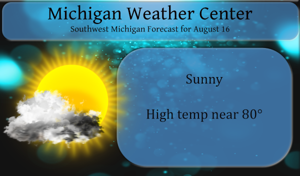
We will have a repeat today of this weekend’s weather with sunny skies and comfortable temps and humidity levels, which means another mild day is ahead with highs in the upper 70s to low 80s. Dew points in 50 to low 60s will mean RH’s around 50%. This will feel comfortable for most of the area. The highest humidity will be in the Jackson area which will be slightly humid.
Forecast Discussion
- Risk for isolated thunderstorms this week

Forcing remains weak for storms through Friday. PWAT values
increase as moisture moves in from the south. Values are shown to
rise to around 1.5 inches by Wednesday and then decrease somewhat
at the axis of deeper moisture shifts Thursday into Friday.
The instability generally takes on a diurnally driven
pattern...which is when we will feature the highest potential for
storms. We likely will not see any storms today or perhaps
Tuesday...but on Wednesday there is a better chance. Bulk deep
layer shear is shown to remain weak...thus little risk for
organized convection will exist.

Over the weekend a stronger wave of low pressure moves in from the
west. This feature draws up higher PWAT values from the south.
Guidance has been showing values approaching 2 inches. Aloft the
wave takes on a negative tilt as it lifts northeast through the
Western Great Lakes region. Thus the best lift and dynamics
generally stay to the northwest of the CWA. Mid level height do
not drop off very much into Sunday. An associated surface cold
front does pass through though which should touch off scattered
thunderstorms mainly Saturday into Saturday night.

- Fog risk tonight

Low level moisture will be higher later tonight into early
Tuesday. With the clouds thinning out...we may radiate enough to
set up a risk for locally dense fog. The main area for this is
down towards southeast parts of the CWA...Jackson. Will need to
monitor trends though for the remainder of the region.

- Warming trend this week

The flow will be veering into Wednesday from the east to the
southwest. As the winds turn southwest...warmer air will advect
in. Temps at 850 mb are shown to climb into the teens by
Wednesday and stay there into the start of the weekend. This
should support above normal surface temperatures with max values
rising into the mid 80s.
It has been beautiful outside!! I wish it could always be like this. All weekend and today we ate dinner on the deck. No humidity! Nice change. Do you think it could be like this to December? 🙂
The past three days have been fantastic. I wish the whole year was like that. The local forecast has 84 or 85 for the next seven days. All in all, it’s been a very nice summer so far.
No kidding! The past couple mornings going in to work at 4am has been just perfect. To bad the humidity starts pouring back in for the rest of the week.
This is a post I seen in a Grand Rapids neighborhood site I thought I would post it to show some insight into how other people might view west Michigan. Does Consumers just suck, or…? We just moved here, so I am attempting to withhold judgment and be fair but that storm didn’t seem “all that” but caused an EIGHT HOUR outage? I’m not starting off impressed with Consumers. Back in Nashville, even the greedy corporate Satan that was NES typically hammered things out in 2hrs or less. Is Consumers understaffed? Under-skilled? Just not concerned or in a hurry? Was… Read more »
That’s weird. I just read that exact post on the face place yesterday. Seems like it might have been Holland Informed or one of those groups.
That is weird. I wonder if that is some kind of fake post trying to get back at Consumers??
slim
What a beautiful below average Summer day on tap let’s keep it going through September….INDY
Yes the below normal trend is rocking!
One of the changes that I like now it the wealth of information at our fingertips. Not just in the forecast but in past records. We can not look up past weather events from all parts of the US and to a lesser extent other parts of the world. While the use of weather models is a useful tool some people find the model that fits there wish cast and that is what they go with. That is how we get some people thinking that there will be 20″ of snow in the next storm when in truth there are… Read more »